File:Entwurf einer Karte von Ost-Afrika zwischen Chartum und dem Rothen Meere bis Sauakim und Massana 2.png
Jump to navigation
Jump to search

Size of this preview: 729 × 600 pixels. Other resolutions: 292 × 240 pixels | 584 × 480 pixels | 934 × 768 pixels | 1,245 × 1,024 pixels | 2,490 × 2,048 pixels | 6,895 × 5,672 pixels.
Original file (6,895 × 5,672 pixels, file size: 51.94 MB, MIME type: image/png)
Captions
Captions
Add a one-line explanation of what this file represents
Summary
[edit]
| Description |
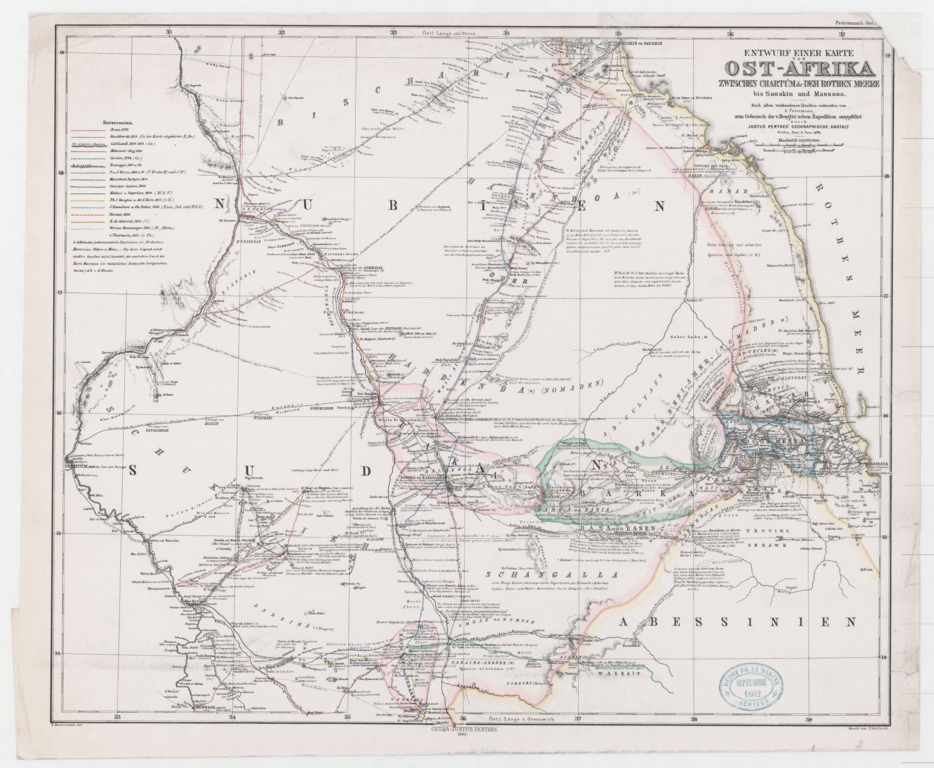
Deutsch: Entwurf einer Karte von Ost Afrika zwischen Chartum & dem Rothen Meere bis Sauakin und Massaua ; Nach allen vorhandenen Quellen entworfen von A. Petermann zum Gebrauch der v. Heuglin'schen Expedition ausgeführt durch Justus Perthes Geographische Anstalt... B. Hassenstein del |
| Date | |
| Source | Gallica |
| Author | August Heinrich Petermann (1822-1878) & Bruno Hassenstein (1839-1902) |
Licensing
[edit]
The author died in 1902, so this work is in the public domain in its country of origin and other countries and areas where the copyright term is the author's life plus 100 years or fewer. | |
| This file has been identified as being free of known restrictions under copyright law, including all related and neighboring rights. | |
File history
Click on a date/time to view the file as it appeared at that time.
| Date/Time | Thumbnail | Dimensions | User | Comment | |
|---|---|---|---|---|---|
| current | 09:00, 30 January 2022 | | 6,895 × 5,672 (51.94 MB) | Kristián Czerny (talk | contribs) | Uploaded a work by August Heinrich Petermann (1822-1878) from Gallica with UploadWizard |
You cannot overwrite this file.
File usage on Commons
There are no pages that use this file.
File usage on other wikis
The following other wikis use this file:
- Usage on de.wikipedia.org