File:Entering the Grand Harbour; Valletta, Malta.jpg
Jump to navigation
Jump to search
Size of this preview: 800 × 533 pixels. Other resolutions: 320 × 213 pixels | 640 × 427 pixels | 1,024 × 683 pixels | 1,280 × 853 pixels | 2,560 × 1,707 pixels | 3,456 × 2,304 pixels.
Original file (3,456 × 2,304 pixels, file size: 2.45 MB, MIME type: image/jpeg)
Captions
Captions
Add a one-line explanation of what this file represents
| Description |
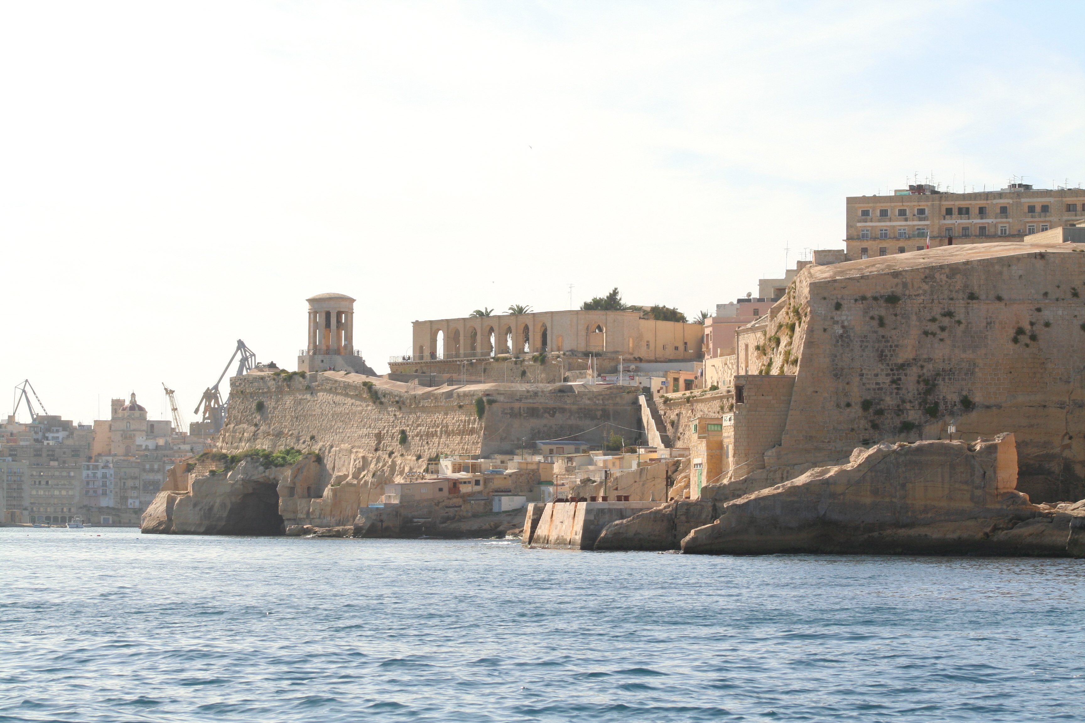
The following is the author's description of the photograph quoted directly from the photograph's Flickr page. "The harbour mouth faces north east and is bounded to the north by St Elmo's Point and further sheltered by an isolated breakwater and is bounded to the south by Ricasoli Point. Its north west shore is formed by the Scebarras peninsula, which is largely covered by the city of Valletta and its suburb Floriana. This peninsula also divides Grand Harbour from a second parallel natural harbour, Marsamxett Harbour. The main waterway of Grand Harbour continues inland almost to Marsa. The south eastern shore of the harbour is formed by a number of inlets and headlands, principally Rinella Creek, Kalkara Creek, Dockyard Creek, and French Creek, which are covered by Kalkara and the Three Cities: Cospicua, Vittoriosa, and Senglea. Grand Harbour was the base for the Knights of St John for 268 years, and after their departure became a strategic base for the British for a further 170 years. It was the site in the late 16th century of a devastating tornado that killed 600 people and destroyed a shipping armada. The area was the scene of much of the fighting in the First Siege of Malta when the Turks attempted to eject the Knights of St John. The whole area was savagely bombed during the Second Siege of Malta during World War II, as the docks and military installations around the port were legitimate targets for Axis bombers. However collateral damage wrecked much of Valletta and The Three Cities, and caused large numbers of civilian casualties. The harbours and docks are still active but with the departure of the British Military the harbour lost much of its military significance. A considerable part of Malta's commercial shipping is now handled by the new free port at Kalafrana, so the harbour is much quieter than it was in the first half of the 20th century. " |
||
| Date | |||
| Source |
originally posted to Flickr as Entering the Grand Harbour; Valletta, Malta
|
||
| Author | John Haslam | ||
| Permission (Reusing this file) |
This file is licensed under the Creative Commons Attribution 2.0 Generic license.
|
| Camera location | | View this and other nearby images on: OpenStreetMap |
|---|
File history
Click on a date/time to view the file as it appeared at that time.
| Date/Time | Thumbnail | Dimensions | User | Comment | |
|---|---|---|---|---|---|
| current | 09:36, 16 October 2009 | | 3,456 × 2,304 (2.45 MB) | Geo Swan (talk | contribs) | {{Information |Description=The following is the author's description of the photograph quoted directly from the photograph's Flickr page.<br/>"The harbour mouth faces north east and is bounded to the north by St Elmo's Point and further sheltered by an is |
You cannot overwrite this file.
File usage on Commons
The following page uses this file:
File usage on other wikis
The following other wikis use this file:
- Usage on gag.wikipedia.org