File:Entenmoos Raised-Transition Mire 02.jpg
Jump to navigation
Jump to search
Size of this preview: 800 × 292 pixels. Other resolutions: 320 × 117 pixels | 640 × 233 pixels | 1,024 × 373 pixels | 1,280 × 467 pixels | 2,560 × 934 pixels | 6,554 × 2,390 pixels.
Original file (6,554 × 2,390 pixels, file size: 5.76 MB, MIME type: image/jpeg)
Captions
Captions
Add a one-line explanation of what this file represents
Summary
[edit]| Description |
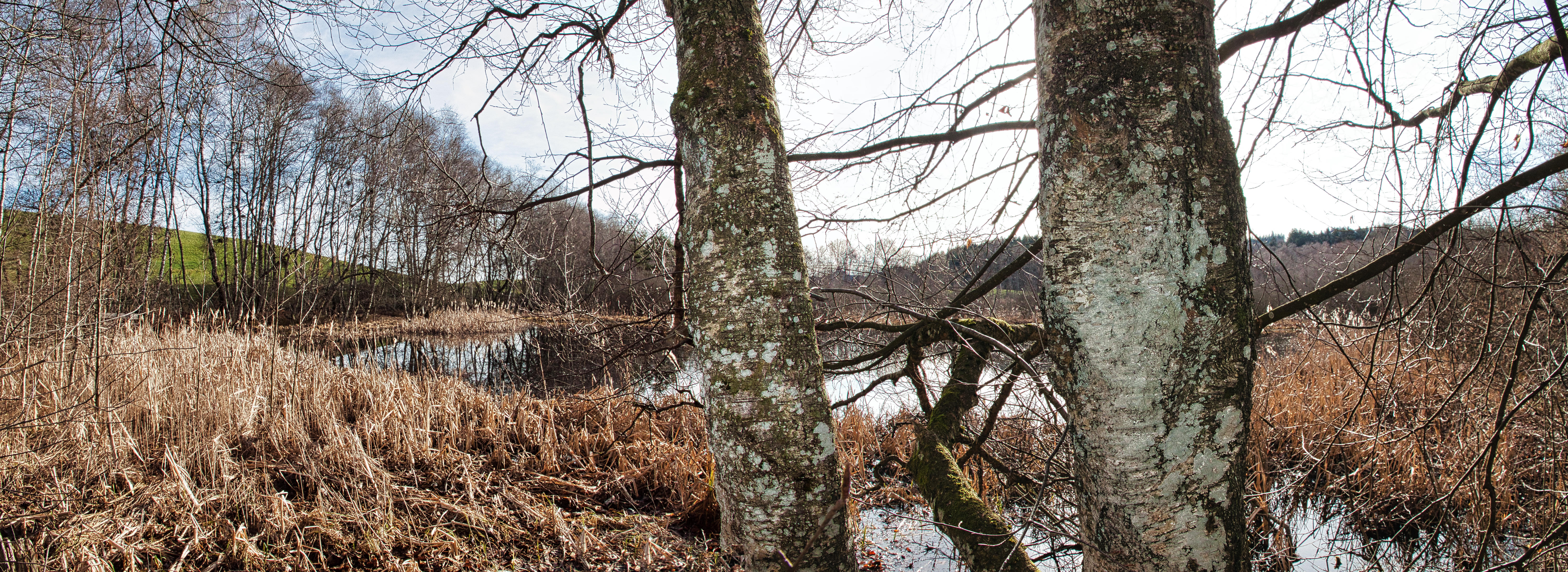
Deutsch: Blick auf eine offene Wasserfläche im Entenmoos, das im Bundesinventar der Hoch- und Übergangsmoore und im Bundesinventar der Amphibienlaichgebiete verzeichnet ist. Dieses Schutzgebiet erstreckt sich über knapp 9 ha (davon 1,42 ha Hochmoor) auf dem Gebiet der Gemeinde Rechthalten im Kanton Freiburg, Schweiz. Français : Vue d'une étendue d'eau ouverte dans le Entenmoos, inscrit à l'inventaire fédéral des hauts-marais et marais de transition et à l'inventaire fédéral des sites de reproduction de batraciens. Cette zone protégée s'étend sur près de 9 ha (dont 1,42 ha de haut-marais) sur le territoire de la commune de Rechthalten dans le canton de Fribourg, en Suisse. English: View of an open water area in the Entenmoos, which is listed in the Federal Inventory of Raised and Transitional Mires and in the Federal Inventory of Amphibian Spawning Areas. This protected area extends over just under 9 ha (including 1.42 ha of raised mire) on the territory of the municipality of Rechthalten in the canton of Fribourg, Switzerland. |
||||
| Protected |
|
||||
| Date | |||||
| Source | Own work | ||||
| Author | Martin Thurnherr | ||||
| Permission (Reusing this file) |
|
||||
| Panorama |
|


Licensing
[edit]
I, the copyright holder of this work, hereby publish it under the following license:
This file is licensed under the Creative Commons Attribution-Share Alike 4.0 International license.
- You are free:
- to share – to copy, distribute and transmit the work
- to remix – to adapt the work
- Under the following conditions:
- attribution – You must give appropriate credit, provide a link to the license, and indicate if changes were made. You may do so in any reasonable manner, but not in any way that suggests the licensor endorses you or your use.
- share alike – If you remix, transform, or build upon the material, you must distribute your contributions under the same or compatible license as the original.
File history
Click on a date/time to view the file as it appeared at that time.
| Date/Time | Thumbnail | Dimensions | User | Comment | |
|---|---|---|---|---|---|
| current | 20:52, 17 March 2023 | 6,554 × 2,390 (5.76 MB) | Matutinho (talk | contribs) | {{Information |Description=Blick auf eine offene Wasserfläche im Entenmoos, das im Bundesinventar der Hoch- und Übergangsmoore und im Bundesinventar der Amphibienlaichgebiete verzeichnet ist. Dieses Schutzgebiet erstreckt sich über knapp 9 ha (davon 1,42 ha Hochmoor) auf dem Gebiet der Gemeinde Rechthalten im Kanton Freiburg, Schweiz. |Source={... |
You cannot overwrite this file.
File usage on Commons
The following page uses this file:
File usage on other wikis
The following other wikis use this file:
- Usage on de.wikipedia.org
- Usage on www.wikidata.org