File:Engelsbrücke Dämmerung.JPG
Jump to navigation
Jump to search
Size of this preview: 800 × 600 pixels. Other resolutions: 320 × 240 pixels | 640 × 480 pixels | 1,024 × 768 pixels | 1,280 × 960 pixels | 2,560 × 1,920 pixels.
Original file (2,560 × 1,920 pixels, file size: 2.38 MB, MIME type: image/jpeg)
Captions
Captions
Add a one-line explanation of what this file represents
Summary
[edit]
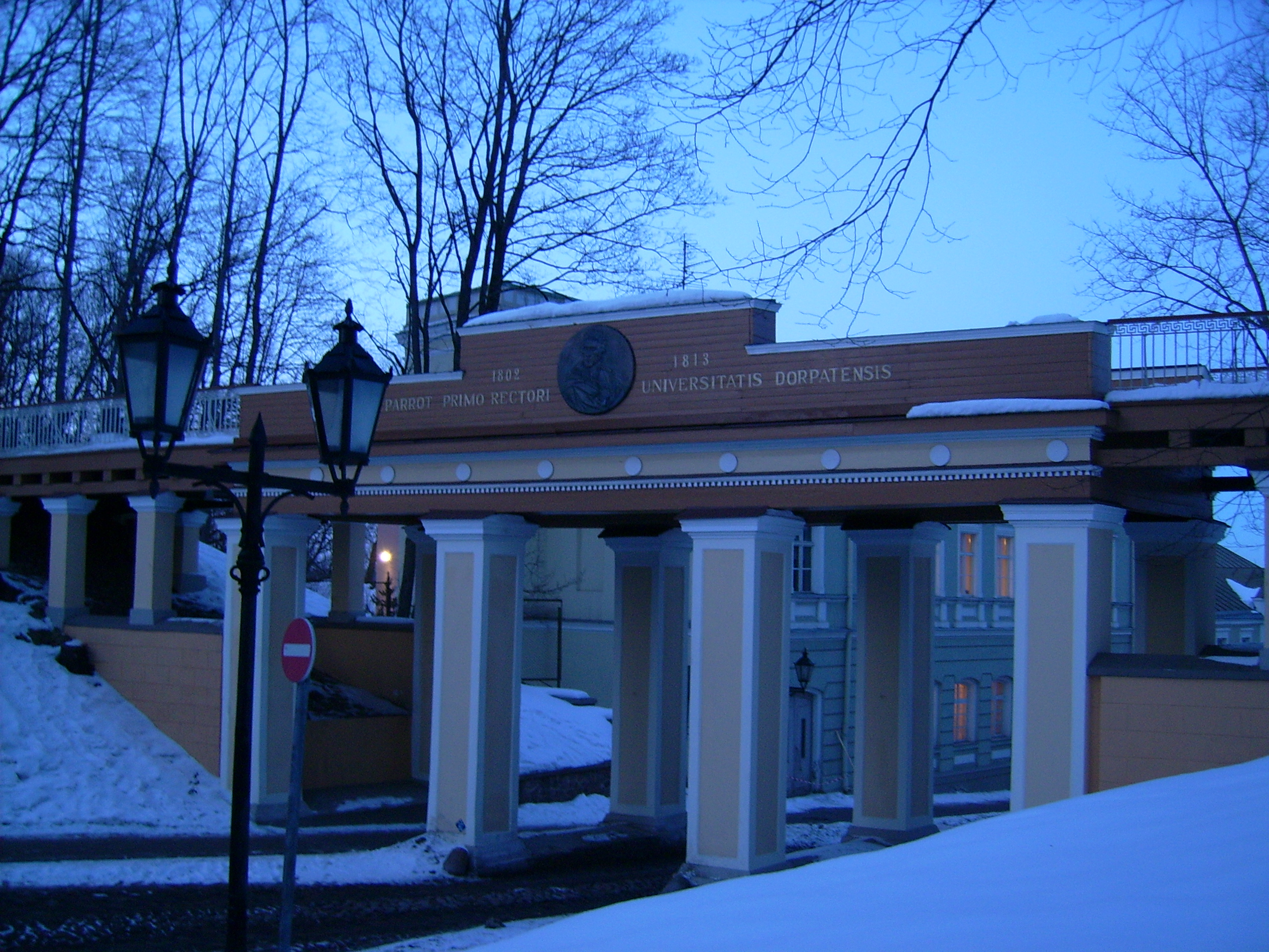
Tartu Angel's bridge at dusk
author: User:Axt
date: 2006
| Camera location | | View this and other nearby images on: OpenStreetMap |
|---|
Licensing
[edit]
| I, the copyright holder of this work, release this work into the public domain. This applies worldwide. In some countries this may not be legally possible; if so: I grant anyone the right to use this work for any purpose, without any conditions, unless such conditions are required by law. |
File history
Click on a date/time to view the file as it appeared at that time.
| Date/Time | Thumbnail | Dimensions | User | Comment | |
|---|---|---|---|---|---|
| current | 17:37, 19 February 2013 | | 2,560 × 1,920 (2.38 MB) | Frukt~commonswiki (talk | contribs) | Reverted to version as of 10:47, 14 April 2006. The edit had completely discarded the dusk ambience. |
| 07:26, 29 December 2009 |  | 2,560 × 1,920 (2.27 MB) | Quibik (talk | contribs) | Adjusted levels and as a result removed the blue tint. Sharpened. | |
| 10:47, 14 April 2006 |  | 2,560 × 1,920 (2.38 MB) | Axt (talk | contribs) | Tartu Angel's bridge at dawn author: user:Likedeeler date: 2006 |
You cannot overwrite this file.
File usage on Commons
There are no pages that use this file.
File usage on other wikis
The following other wikis use this file:
- Usage on az.wikipedia.org
- Usage on ba.wikipedia.org
- Usage on cy.wikipedia.org
- Usage on eo.wikipedia.org
- Usage on eu.wikipedia.org
- Usage on fiu-vro.wikipedia.org
- Usage on it.wikipedia.org
- Usage on ja.wikipedia.org
- Usage on mk.wikipedia.org
- Usage on pt.wikipedia.org
- Usage on sq.wikipedia.org