File:Enceladus June 2008 PIA08417.jpg
Jump to navigation
Jump to search

Size of this preview: 800 × 422 pixels. Other resolutions: 320 × 169 pixels | 640 × 338 pixels | 1,024 × 540 pixels | 1,280 × 676 pixels | 3,793 × 2,002 pixels.
Original file (3,793 × 2,002 pixels, file size: 1.25 MB, MIME type: image/jpeg)
Captions
Captions
Add a one-line explanation of what this file represents
Summary
[edit]
| Description |
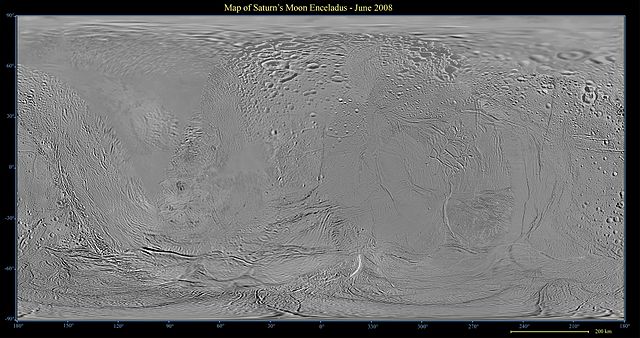
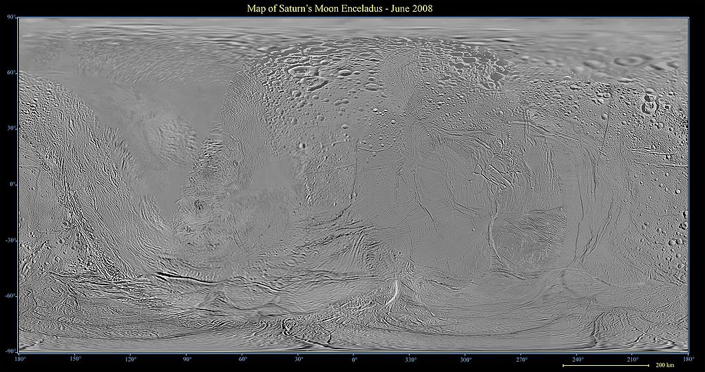
English: This global map of Saturn's moon Enceladus was created using images taken during Cassini spacecraft flybys, with Voyager images filling in the gaps in Cassini's coverage.
The map is an equidistant (simple cylindrical) projection and has a scale of 440 meters (1,444 feet) per pixel at the equator. The mean radius of Enceladus used for projection of this map is 252 kilometers (157 miles). This mosaic map is an update to the version released in December 2006 (see PIA08342). The mosaic was shifted by 3.5 degrees to the west, compared to the previous version, to be consistent with the International Astronomical Union longitude definition for Enceladus. |
| Date | |
| Source | http://photojournal.jpl.nasa.gov/catalog/PIA08417 |
| Author | NASA/JPL/Space Science Institute |
| Other versions | Derivative works of this file: Enceladus June 2008 PIA08417 moon only.jpg |
Licensing
[edit]
| This file is in the public domain in the United States because it was solely created by NASA. NASA copyright policy states that "NASA material is not protected by copyright unless noted". (See Template:PD-USGov, NASA copyright policy page or JPL Image Use Policy.) | ||
 |
Warnings:
|
File history
Click on a date/time to view the file as it appeared at that time.
| Date/Time | Thumbnail | Dimensions | User | Comment | |
|---|---|---|---|---|---|
| current | 19:58, 6 August 2008 | | 3,793 × 2,002 (1.25 MB) | Bryan Derksen (talk | contribs) | {{Information |Description={{en|1=This global map of Saturn's moon Enceladus was created using images taken during Cassini spacecraft flybys, with Voyager images filling in the gaps in Cassini's coverage. The map is an equidistant (simple cylindrical) pr |
You cannot overwrite this file.
File usage on Commons
The following 2 pages use this file:
File usage on other wikis
The following other wikis use this file:
- Usage on el.wikipedia.org
- Usage on vi.wikipedia.org