File:Emigrant Lake, Emigrant Wilderness, California (21546574656).jpg

Original file (4,000 × 3,000 pixels, file size: 4.77 MB, MIME type: image/jpeg)
Captions
Captions
Summary
[edit].jpg&action=edit§ion=1)
| Description |
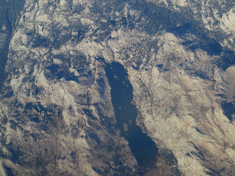
The Emigrant Wilderness of Stanislaus National Forest is a wilderness area in the Sierra Nevada. It is bordered by Yosemite National Park on the south, the Toiyabe National Forest and the Hoover Wilderness on the east, and State Route 108 over Sonora Pass on the north. It is an elongated area that extends northeast about 25 miles (40 km) in length and up to 15 miles (24 km) in width. Watersheds drain to the Stanislaus and Tuolumne Rivers. This area is entirely within Tuolumne County, California and is approximately 140 miles (230 km) east of San Francisco, California and 50 miles (80 km) south of Lake Tahoe. The Emigrant Wilderness is a glaciated landscape of scenic beauty. The northeastern third of the Wilderness is dominated by volcanic ridges and peaks; the remaining areas consist of many sparsely vegetated, granitic ridges interspersed with numerous lakes and meadows. To see that contrast, compare the red volcanic rock in the image of Emigrant Meadow (below Right) with the granite in the other images. Elevations range from below 5,000 feet (1,500 m) near Cherry Reservoir to 11,570 feet (3,527 m) at Leavitt Peak, but the elevation range of most of the popular areas is 7,500 to 9,000 feet (2,300 to 2,700 m). Precipitation averages 50 inches (1,300 mm) annually, 80% of it in the form of snow. Snowpacks typically linger into June, sometimes later following very wet winters. Summers are generally dry and mild, but afternoon thundershowers occur periodically and nighttime temperatures could dip below freezing anytime. Since 1975, 18 small dams in the Emigrant Wilderness have been the source of an unresolved political debate. Some support proposals to maintain the dams while others feel the dams should be allowed to decay in keeping with the Wilderness Act. A decision by the Stanislaus National Forest to compromise and leave some dams to naturally deteriorate while allowing maintenance of others was overturned in court in 2006, reigniting some of the controversy. The Forest Service chose not to appeal and the dams will gradually disappear. From Sonora Pass in the north, the Pacific Crest Trail follows a scenic route at the east edge of the Emigrant Wilderness along the high ridge past Leavitt Peak, turns further east from Kennedy Canyon to Bond Pass, and then heads south down Jack Main Canyon. Many other trails crisscross the Emigrant Wilderness, from Leavitt Meadow on the East side, Kennedy Meadow on the West side, and other trailheads. Highlights include cliffs in the Granite Dome area and lakes such as Emigrant Lake, Huckleberry Lake, and Lake Lertoria. en.wikipedia.org/wiki/Emigrant_Wilderness en.wikipedia.org/wiki/Wikipedia:Text_of_Creative_Commons_... |
| Date | |
| Source | Emigrant Lake, Emigrant Wilderness, California |
| Author | Ken Lund from Reno, Nevada, USA |
| Camera location | | View this and other nearby images on: OpenStreetMap |
|---|
.jpg¶ms=038.206886_N_-119.622373_E_globe:Earth_type:camera_source:Flickr_&language=en)
Licensing
[edit].jpg&action=edit§ion=2)
- You are free:
- to share – to copy, distribute and transmit the work
- to remix – to adapt the work
- Under the following conditions:
- attribution – You must give appropriate credit, provide a link to the license, and indicate if changes were made. You may do so in any reasonable manner, but not in any way that suggests the licensor endorses you or your use.
- share alike – If you remix, transform, or build upon the material, you must distribute your contributions under the same or compatible license as the original.
| This image was originally posted to Flickr by Ken Lund at https://flickr.com/photos/75683070@N00/21546574656. It was reviewed on 4 December 2015 by FlickreviewR and was confirmed to be licensed under the terms of the cc-by-sa-2.0. |
File history
Click on a date/time to view the file as it appeared at that time.
| Date/Time | Thumbnail | Dimensions | User | Comment | |
|---|---|---|---|---|---|
| current | 04:52, 4 December 2015 | | 4,000 × 3,000 (4.77 MB) | INeverCry (talk | contribs) | Transferred from Flickr via Flickr2Commons |
You cannot overwrite this file.
File usage on Commons
There are no pages that use this file.
.jpg&oldid=907399599)