File:Ellora Caves an Engineering Marvel.jpg
Jump to navigation
Jump to search
Size of this preview: 337 × 599 pixels. Other resolutions: 135 × 240 pixels | 270 × 480 pixels | 432 × 768 pixels | 576 × 1,024 pixels | 1,369 × 2,433 pixels.
Original file (1,369 × 2,433 pixels, file size: 391 KB, MIME type: image/jpeg)
Captions
Captions
Add a one-line explanation of what this file represents
Summary
[edit]
| Description |
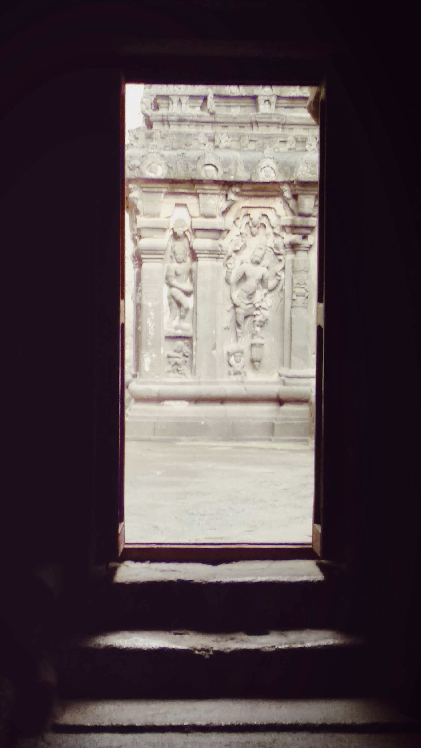
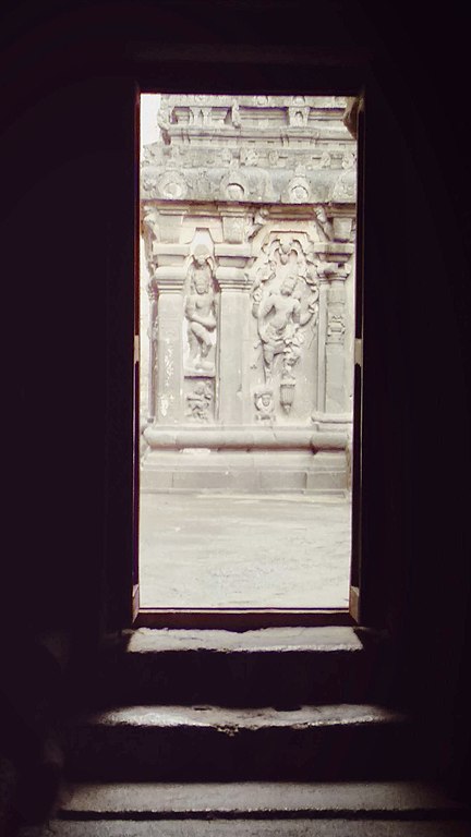
English: The temple is in the rock-cut caves of Ellora carved out of a single rock of the Charanandri hills at Ellora village. According to experts, the artists carved out a singular stone at a point and hollowed it out into the Kailasa Temple. The artists designed the Kailasha Temple to resemble the abode of God Shiva, Mount Kailash. When monitored closely, the experts found out that initially, artists plastered the entire temple with white color so that it can look like Mount Kailash. Its pyramidal structure also resembles the mountain. One of the most mysterious facts about Kailash Temple is that no one knows about the origins, the builders, and the constructors of the temple. The entire construction does not reveal any date or depict a name indicating that the carving dates back hundreds and thousands of years. Another unimaginable and mysterious facts of Kailash Temple is its top to bottom carving. Even today, it is simply impossible to carve such a perfect construction from top to bottom so elaborately using just chisels and Hammers. Many believe that the construction belongs to outer space. It is because it is simply impossible to construct the biggest monolithic constructions thousands of years ago without any technology.
|
||||||
| Date | |||||||
| Source | Own work | ||||||
| Author | Sarathlibra |
| Camera location | | View this and other nearby images on: OpenStreetMap |
|---|
Licensing
[edit]
I, the copyright holder of this work, hereby publish it under the following license:
This file is licensed under the Creative Commons Attribution-Share Alike 4.0 International license.
- You are free:
- to share – to copy, distribute and transmit the work
- to remix – to adapt the work
- Under the following conditions:
- attribution – You must give appropriate credit, provide a link to the license, and indicate if changes were made. You may do so in any reasonable manner, but not in any way that suggests the licensor endorses you or your use.
- share alike – If you remix, transform, or build upon the material, you must distribute your contributions under the same or compatible license as the original.

|
This image was uploaded as part of Wiki Loves Monuments 2021.
|
 |
File history
Click on a date/time to view the file as it appeared at that time.
| Date/Time | Thumbnail | Dimensions | User | Comment | |
|---|---|---|---|---|---|
| current | 10:24, 2 September 2021 | | 1,369 × 2,433 (391 KB) | Sarathlibra (talk | contribs) | Uploaded own work with UploadWizard |
You cannot overwrite this file.
File usage on Commons
There are no pages that use this file.