File:El Pozo de la Salud y Casa Rosa, El Hierro, Canarias, España.JPG

Original file (4,896 × 3,672 pixels, file size: 7.15 MB, MIME type: image/jpeg)
Captions
Captions
Summary
[edit]
| Description |
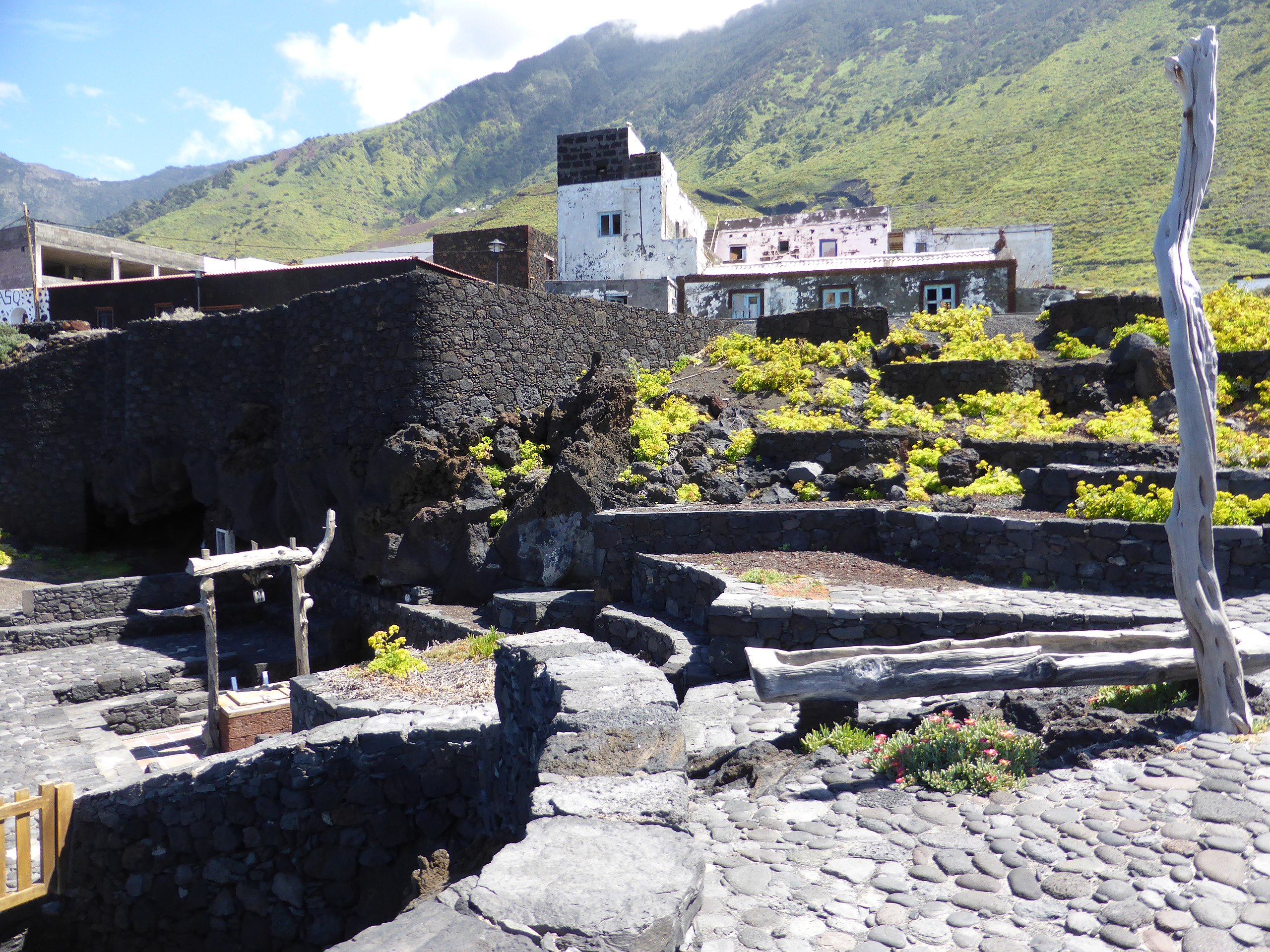
Español: El Pozo de la Salud (antiguamente "Pozo de Sabinosa") es conocido por sus antiguas aguas minero-medicinales. Fue perforado entre los años 1702 y 1704. Abajo, a la izquierda, vemos el brocal del pozo, recubierto modernamente. Más arriba se divisa "Casa Rosa", antiguo lugar de hospedaje.
English: The Well of Health (formerly "Well of Sabinosa") is known for its ancient mineral-medicinal waters. It was drilled between 1702 and 1704. Below, on the left, we see the well's curb, modern coated. Higher up you can see "Casa Rosa", an old lodging place. |
| Date |
|
| Source |
Own work |
| Author |
CARLOS TEIXIDOR CADENAS |
Deutsch: Der Brunnen der Gesundheit (früher „Brunnen von Sabinosa“) ist bekannt für sein uraltes mineralisches Heilwasser. Er wurde zwischen 1702 und 1704 gebohrt. Unten links sehen wir den Bordstein des Brunnens, modern beschichtet. Weiter oben sieht man "Casa Rosa", eine alte Herberge.}}
Français: Le Puits de Santé (anciennement "Puits de Sabinosa") est connu pour ses anciennes eaux minérales et médicinales. Il a été foré entre 1702 et 1704. En bas, à gauche, on voit la bordure du puits, enduit moderne. Plus haut, vous pouvez voir "Casa Rosa", un ancien gîte.}}
|date=2014-04-17 15:56:58 |source=Own work |author=CARLOS TEIXIDOR CADENAS |permission= |other_versions= }}
| Camera location | | View this and other nearby images on: OpenStreetMap |
|---|
Licensing
[edit]
- You are free:
- to share – to copy, distribute and transmit the work
- to remix – to adapt the work
- Under the following conditions:
- attribution – You must give appropriate credit, provide a link to the license, and indicate if changes were made. You may do so in any reasonable manner, but not in any way that suggests the licensor endorses you or your use.
- share alike – If you remix, transform, or build upon the material, you must distribute your contributions under the same or compatible license as the original.
File history
Click on a date/time to view the file as it appeared at that time.
| Date/Time | Thumbnail | Dimensions | User | Comment | |
|---|---|---|---|---|---|
| current | 00:24, 19 April 2014 | | 4,896 × 3,672 (7.15 MB) | CARLOS TEIXIDOR CADENAS (talk | contribs) | User created page with UploadWizard |
You cannot overwrite this file.
File usage on Commons
There are no pages that use this file.
File usage on other wikis
The following other wikis use this file:
- Usage on ast.wikipedia.org
- Usage on es.wikipedia.org
- Usage on hu.wikipedia.org
- Usage on nl.wikipedia.org