File:El Malpais NCA (9302481924).jpg

Original file (5,760 × 3,840 pixels, file size: 10.4 MB, MIME type: image/jpeg)
Captions
Captions
Summary
[edit].jpg&action=edit§ion=1)
| Description |
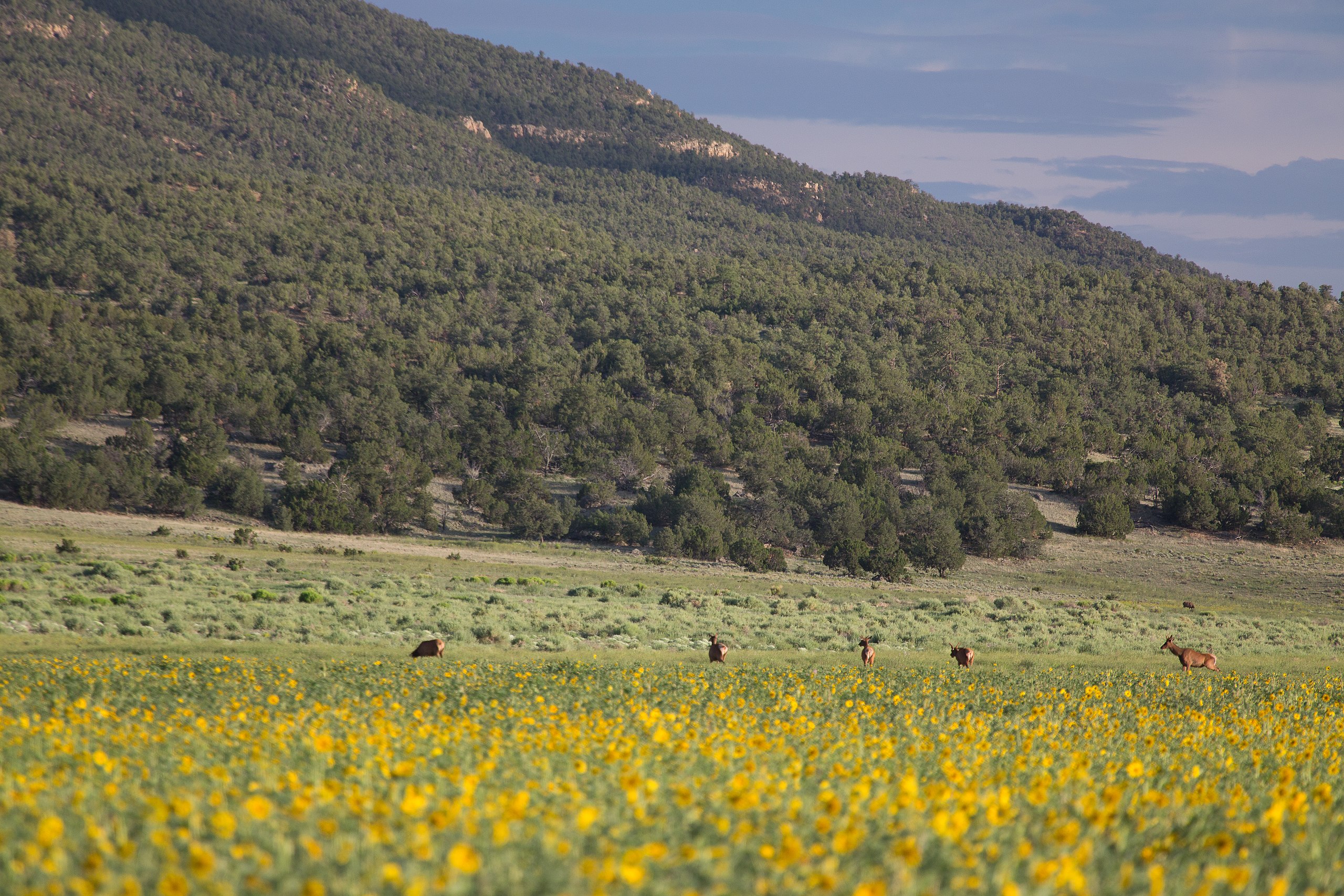
El Malpais translates to "the badlands" in Spanish and is pronounced Mal-(rhymes with wall)-pie-ees. El Malpais NCA was established to protect nationally significant geological, archaeological, ecological, cultural, scenic, scientific, and wilderness resources surrounding the Grants Lava Flows. In addition to the two wilderness areas, the NCA includes dramatic sandstone cliffs, canyons, La Ventana Natural Arch, the Chain of Craters Back Country Byway and the Narrows Picnic Area. There are many opportunities for photography, hiking, camping and wildlife viewing within this unique NCA. For more than 10,000 years people have interacted with the El Malpais landscape. Historic and prehistoric sites provide connections to past times. More than mere artifacts, these cultural resources are kept alive by the spiritual and physical presence of contemporary Indian groups, including the Puebloan peoples of Acoma, Laguna and Zuni, and the Ramah Navajo. These tribes continue their ancestral uses of El Malpais including gathering plant materials, paying respect, and renewing ties. For more information visit: www.blm.gov/nm/st/en/prog/recreation/rio_puerco/el_malpai... Photo: Bob Wick, BLM California |
| Date | |
| Source | El Malpais NCA |
| Author | Bureau of Land Management |
Licensing
[edit].jpg&action=edit§ion=2)
- You are free:
- to share – to copy, distribute and transmit the work
- to remix – to adapt the work
- Under the following conditions:
- attribution – You must give appropriate credit, provide a link to the license, and indicate if changes were made. You may do so in any reasonable manner, but not in any way that suggests the licensor endorses you or your use.
| This image was originally posted to Flickr by mypubliclands at https://flickr.com/photos/91981596@N06/9302481924. It was reviewed on 4 August 2015 by FlickreviewR and was confirmed to be licensed under the terms of the cc-by-2.0. |
| This image is a work of a Bureau of Land Management* employee, taken or made as part of that person's official duties. As a work of the U.S. federal government, the image is in the public domain in the United States. *or predecessor organization |
File history
Click on a date/time to view the file as it appeared at that time.
| Date/Time | Thumbnail | Dimensions | User | Comment | |
|---|---|---|---|---|---|
| current | 20:43, 4 August 2015 | | 5,760 × 3,840 (10.4 MB) | Wilfredor (talk | contribs) | Transferred from Flickr via Flickr2Commons |
You cannot overwrite this file.
File usage on Commons
There are no pages that use this file.
.jpg&oldid=895658466)