File:Eisenbach, Zürner-Karte 1758.jpg

Original file (1,923 × 748 pixels, file size: 952 KB, MIME type: image/jpeg)
Captions
Captions
Summary
[edit]
| Description |
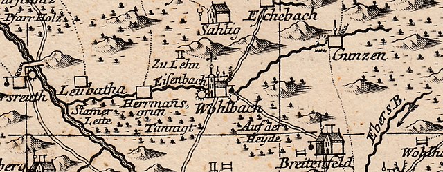
Deutsch: Kartenausschnitt: Eisenbach bei Gunzen und Leubetha (sächsisches Vogtland, Kurfürstentum Sachsen) |
| Date | 1758, Amsterdam |
| Source |
Accurate Geogr. Delineation Des Zu Dem Churfürstenth. Sachsen Gehörigen Voigtlaendischen Creisses Und Derer Darinnen Befindlichen Aemmter Plauen, Pausa U. Voigtsberg, Ingleichen Der Reichsfreyen Zettwitzischen Herrschaft Ascha: Nebst Andern Angrenzenden Gegenden. Kupferstichkarte, Maßstab etwa 1:120 000 |
| Author | Pieter Schenk (Druck), Tobias Conrad Lotter (Stich), Adam Friedrich Zürner |
| Other versions | other copy (SLUB, Dresden) |
|
This work is in the public domain in its country of origin and other countries and areas where the copyright term is the author's life plus 70 years or fewer.
| |
| This file has been identified as being free of known restrictions under copyright law, including all related and neighboring rights. | |
This media file is in the public domain in the United States. This applies to U.S. works where the copyright has expired, often because its first publication occurred prior to January 1, 1929, and if not then due to lack of notice or renewal. See this page for further explanation.
|
 | |
 |
This image might not be in the public domain outside of the United States; this especially applies in the countries and areas that do not apply the rule of the shorter term for US works, such as Canada, Mainland China (not Hong Kong or Macao), Germany, Mexico, and Switzerland. The creator and year of publication are essential information and must be provided. See Wikipedia:Public domain and Wikipedia:Copyrights for more details.
|
File history
Click on a date/time to view the file as it appeared at that time.
| Date/Time | Thumbnail | Dimensions | User | Comment | |
|---|---|---|---|---|---|
| current | 18:29, 28 November 2022 | 1,923 × 748 (952 KB) | Lysippos (talk | contribs) | {{Information |Description={{de|Kartenausschnitt: Eisenbach bei Gunzen und Leubetha (sächsisches Vogtland, Kurfürstentum Sachsen)}} |Source=''Accurate Geogr. Delineation Des Zu Dem Churfürstenth. Sachsen Gehörigen Voigtlaendischen Creisses Und Derer Darinnen Befindlichen Aemmter Plauen, Pausa U. Voigtsberg, Ingleichen Der Reichsfreyen Zettwitzischen Herrschaft Ascha: Nebst Andern Angrenzenden Gegenden''.<br />Kupferstichkarte, Maßstab etwa 1:120 000 |Date='''1758''', Amsterdam |Author=[[:de:P... |
You cannot overwrite this file.
File usage on Commons
The following page uses this file:
File usage on other wikis
The following other wikis use this file:
- Usage on de.wikipedia.org