File:Einzugsgebietskarte Orke.png
Jump to navigation
Jump to search
Size of this preview: 711 × 600 pixels. Other resolutions: 285 × 240 pixels | 569 × 480 pixels | 910 × 768 pixels | 1,214 × 1,024 pixels | 2,427 × 2,048 pixels | 4,973 × 4,196 pixels.
Original file (4,973 × 4,196 pixels, file size: 38.06 MB, MIME type: image/png)
Captions
Captions
Add a one-line explanation of what this file represents
Summary
[edit]
| Description |
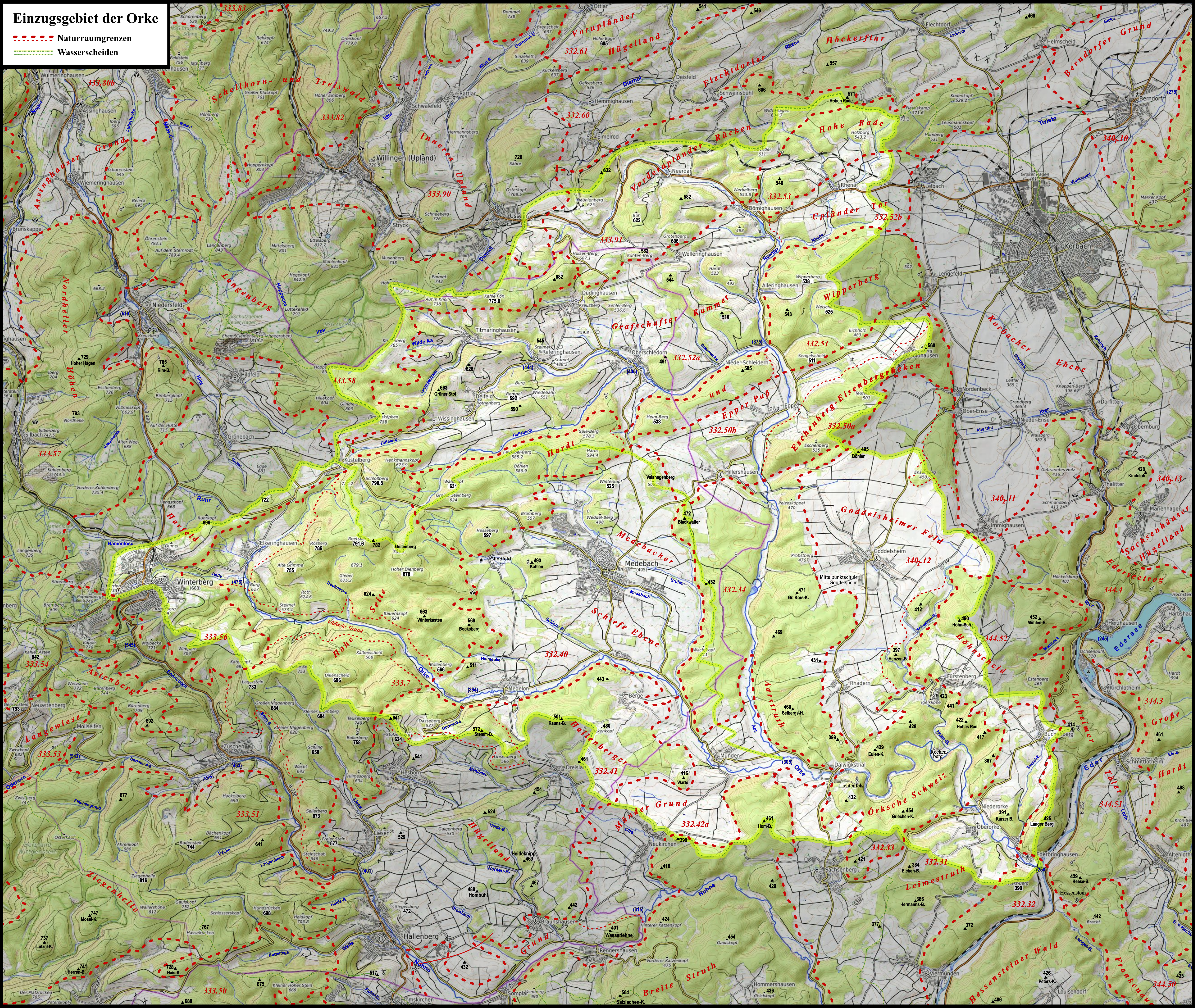
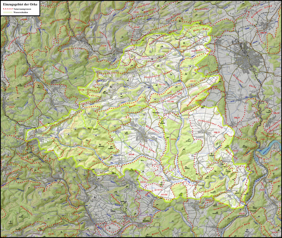
Deutsch: Karte des Einzugsgebiets der Orke mit Orke und Wilder Aa als Hauptflüssen nebst Trennscheide. Beide entspringen im Rothaargebirge, von dem aus die Orke in die Medebacher Bucht fließt und die Aar in die Grafschafter Kammer; nach der Vereinigung fließt die Orke in andere Teile des Ostsauerländer Gebirgsrandes, insbesondere die Örksche Schweiz (Waldeckische Schweiz). Mit Naturräumen; im Westen Winterberg, im Nordosten Korbach und etwas südwestlich des Zentrums Medebach |
| Date | |
| Source | Own work / Martin Bürgener: Die naturräumlichen Einheiten auuf Blatt 111 Arolsen, Bundesanstalt für Landeskinde 1963 (→ map) |
| Author | Elop, Background: OpenTopoMap, Sammeln und Montage der OTM-Kacheln: Morty |
Licensing
[edit]
I, the copyright holder of this work, hereby publish it under the following license:
This file is licensed under the Creative Commons Attribution-Share Alike 3.0 Unported license.
- You are free:
- to share – to copy, distribute and transmit the work
- to remix – to adapt the work
- Under the following conditions:
- attribution – You must give appropriate credit, provide a link to the license, and indicate if changes were made. You may do so in any reasonable manner, but not in any way that suggests the licensor endorses you or your use.
- share alike – If you remix, transform, or build upon the material, you must distribute your contributions under the same or compatible license as the original.
File history
Click on a date/time to view the file as it appeared at that time.
| Date/Time | Thumbnail | Dimensions | User | Comment | |
|---|---|---|---|---|---|
| current | 08:37, 5 June 2020 | | 4,973 × 4,196 (38.06 MB) | Elop (talk | contribs) | Update |
| 14:44, 30 May 2020 |  | 4,973 × 4,196 (38.05 MB) | Elop (talk | contribs) | == {{int:filedesc}} == {{Information |Description ={{de|1= Karte des Einzugsgebiets der de:Orke mit Orke und Wilder Aa als Hauptflüssen nebst Trennscheide. Beide entspringen im Rothaargebirge, von dem aus die Orke in die Medebacher Bucht fließt und die Aar in die de:Grafschafter Kammer; nach der Vereinigung fließt die Orke in andere Teile des Ostsauerländer Gebirgsrandes, insbeso... |
You cannot overwrite this file.
File usage on Commons
There are no pages that use this file.
File usage on other wikis
The following other wikis use this file:
- Usage on arz.wikipedia.org
- Usage on de.wikipedia.org
- Usage on zh.wikipedia.org