File:Eiker.svg
Jump to navigation
Jump to search

Size of this PNG preview of this SVG file: 400 × 400 pixels. Other resolutions: 240 × 240 pixels | 480 × 480 pixels | 768 × 768 pixels | 1,024 × 1,024 pixels | 2,048 × 2,048 pixels.
Original file (SVG file, nominally 400 × 400 pixels, file size: 233 KB)
Captions
Captions
Add a one-line explanation of what this file represents
Summary
[edit]
| Description |
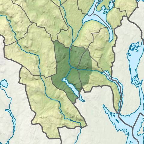
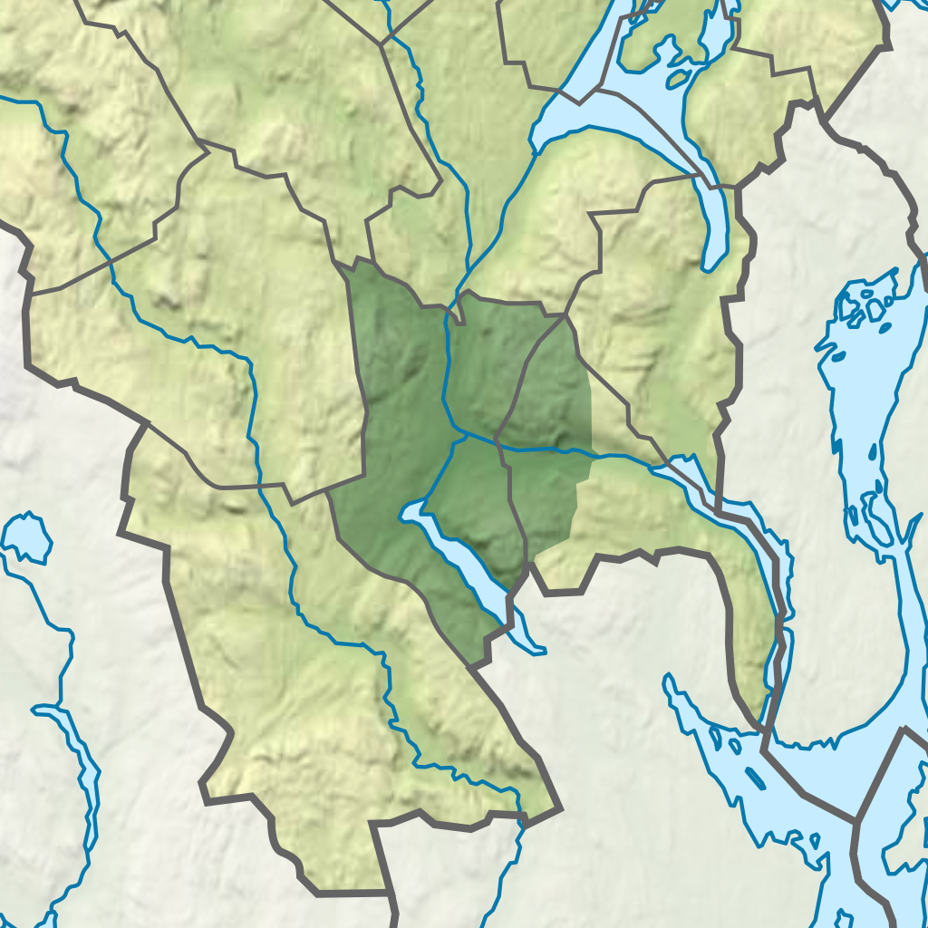
Norsk bokmål: I 1885 ble Eiker herred delt i to herreder: Øvre og Nedre Eiker.[1] Ettersom kommunegrensene gjenspeiler de tidligere herredsgrensene utgjøre Øvre Eiker kommune og tidligere Nedre Eiker kommune landskapet kjent som Eiker. |
| Date | |
| Source | This vector image includes elements that have been taken or adapted from this file: |
| Author | Derivative work: User:Worldlydev. Original work: User:NordNordWest. |
Licensing
[edit]
This file is licensed under the Creative Commons Attribution-Share Alike 3.0 Germany license.
- You are free:
- to share – to copy, distribute and transmit the work
- to remix – to adapt the work
- Under the following conditions:
- attribution – You must give appropriate credit, provide a link to the license, and indicate if changes were made. You may do so in any reasonable manner, but not in any way that suggests the licensor endorses you or your use.
- share alike – If you remix, transform, or build upon the material, you must distribute your contributions under the same or compatible license as the original.

- ↑ Nasjonalbiblioteket. www.nb.no. Retrieved on 2021-01-13.
File history
Click on a date/time to view the file as it appeared at that time.
| Date/Time | Thumbnail | Dimensions | User | Comment | |
|---|---|---|---|---|---|
| current | 20:28, 12 July 2024 | | 400 × 400 (233 KB) | Worldlydev (talk | contribs) | Updated per 01.01.2024, and changed the base map |
| 14:38, 13 January 2021 |  | 400 × 400 (1.05 MB) | Worldlydev (talk | contribs) | Klippet til 400x400 | |
| 14:25, 13 January 2021 |  | 1,049 × 1,022 (505 KB) | Worldlydev (talk | contribs) | Gulere gulfarge for fylket samt grønn landskapsfarge for Eiker | |
| 14:11, 13 January 2021 |  | 1,049 × 1,022 (504 KB) | Worldlydev (talk | contribs) | Uploaded a work by *Derivative work: User:Worldlydev *Original work: User:NordNordWest from {{AttribSVG|Norway_Viken_adm_location_map.svg|NordNordWest}} with UploadWizard |
You cannot overwrite this file.
File usage on Commons
The following page uses this file:
File usage on other wikis
The following other wikis use this file: