File:Ei-map-it.svg
Jump to navigation
Jump to search

Size of this PNG preview of this SVG file: 517 × 599 pixels. Other resolutions: 207 × 240 pixels | 414 × 480 pixels | 662 × 768 pixels | 883 × 1,024 pixels | 1,766 × 2,048 pixels | 652 × 756 pixels.
Original file (SVG file, nominally 652 × 756 pixels, file size: 109 KB)
Captions
Captions
Add a one-line explanation of what this file represents
Summary
[edit]| Description |
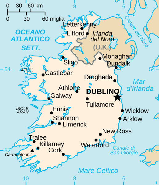
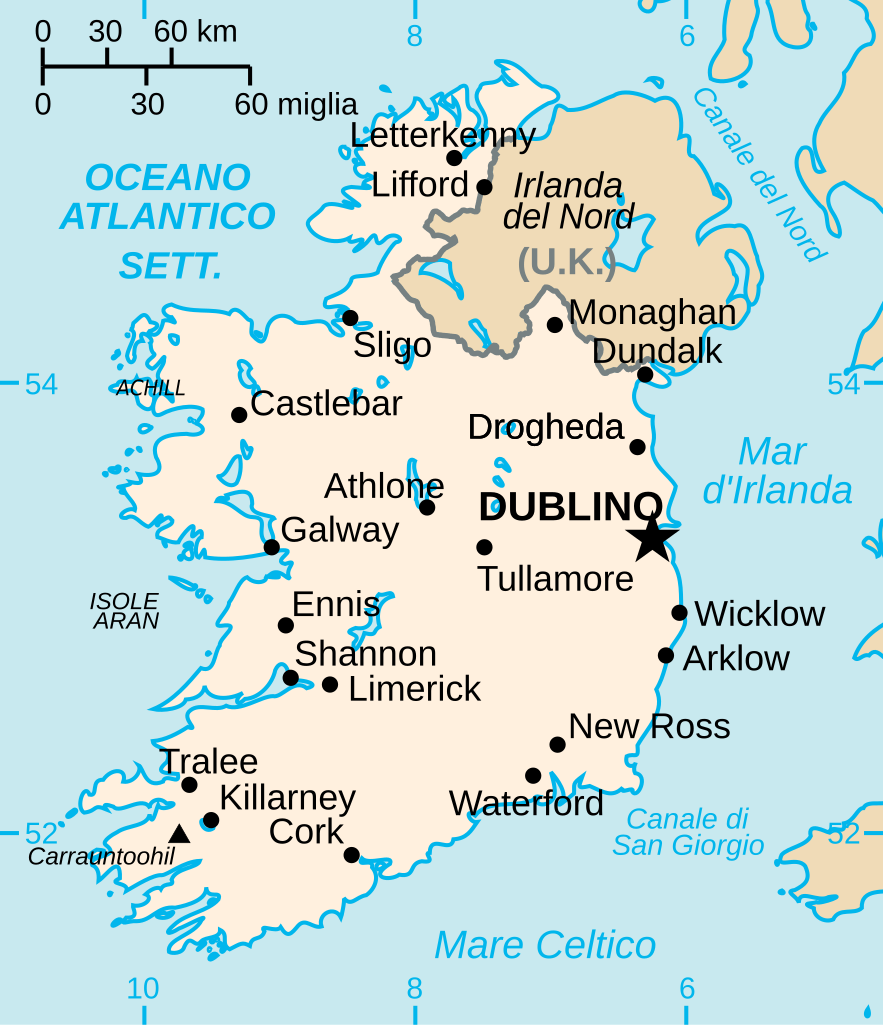
English: Translated version of Ei-map.svg in italian, with some cities added. Original is a Vector version of CIA WorldBook map of the Republic of Ireland. Mercator projection. Vector information is from the CIA World DataBank II, and hence in the public domain. |
| Source | Own work based on: Ei-map.svg |
| Author | CIA World Factbook |
| Other versions |
[]
|
| SVG development |


.svg)


Licensing
[edit]
| I, the copyright holder of this work, release this work into the public domain. This applies worldwide. In some countries this may not be legally possible; if so: I grant anyone the right to use this work for any purpose, without any conditions, unless such conditions are required by law. |
File history
Click on a date/time to view the file as it appeared at that time.
| Date/Time | Thumbnail | Dimensions | User | Comment | |
|---|---|---|---|---|---|
| current | 11:47, 8 January 2007 | | 652 × 756 (109 KB) | Kanchelskis (talk | contribs) | == Summary == Translated version of image:Ei-map.svg in italian Original is a Vector version of CIA WorldBook map of the Republic of Ireland. Mercator projection. Vector information is from the CIA World DataBank II, and hence in the public domain. |
You cannot overwrite this file.
File usage on Commons
The following 6 pages use this file:
File usage on other wikis
The following other wikis use this file:
- Usage on en.wiktionary.org
- Usage on it.wikipedia.org
- Usage on roa-tara.wikipedia.org
- Usage on zh.wiktionary.org