File:Eglise Saint-Orens de Laas 01.jpg
Original file (4,128 × 3,096 pixels, file size: 5.03 MB, MIME type: image/jpeg)
Captions
Captions
Summary
[edit]
| Description |
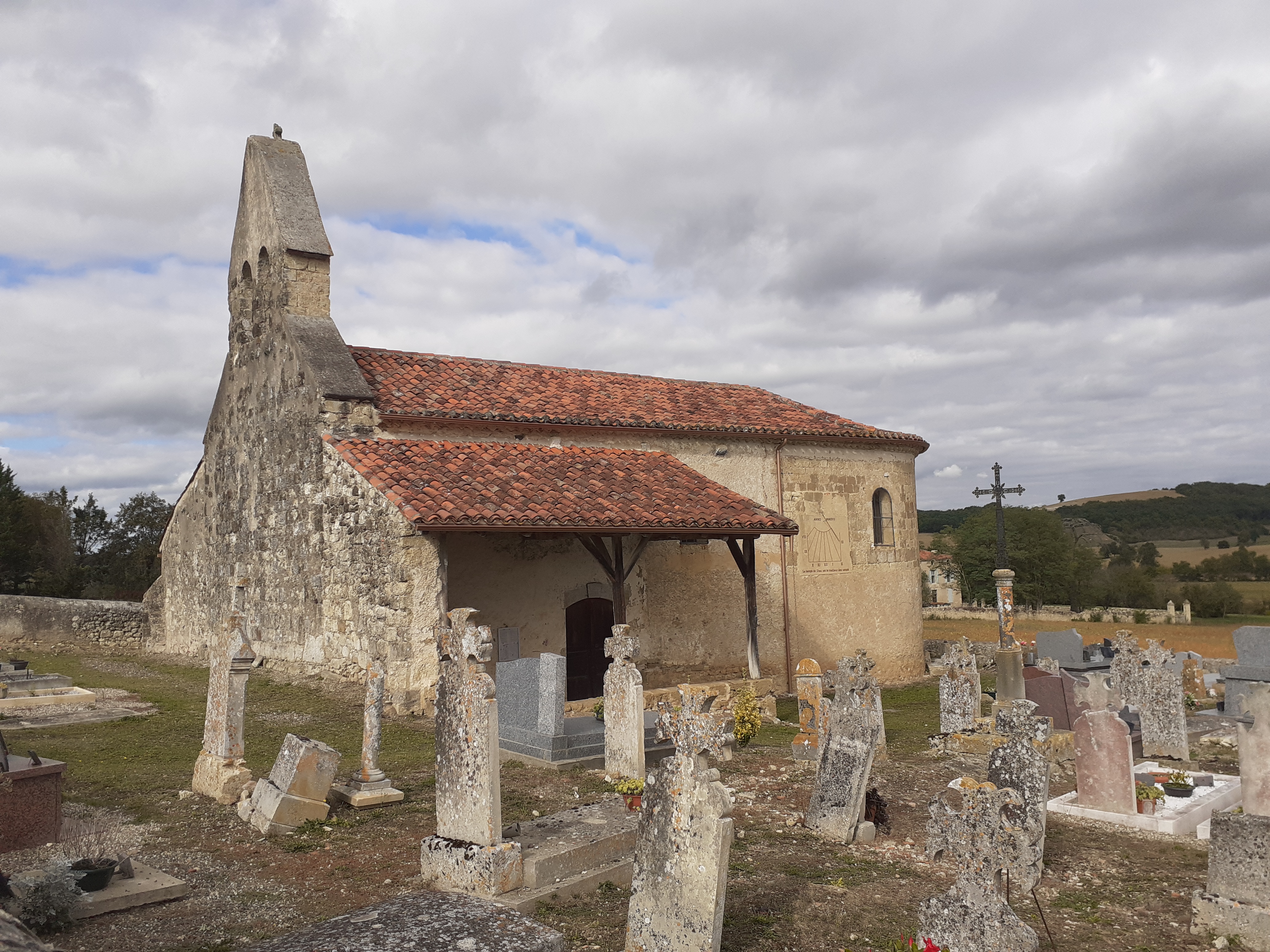
Français : L’église Saint-Orens de Laas est située à 2,6 kms au sud du village de Caillavet, sur la route départementale 34. Elle est dans l’enceinte du cimetière. Elle est typique de l’architecture religieuse rurale de la région d’Auch. Elle est de style roman, mais la chapelle nord est gothique. Le portail porte la date de 1783. La façade sud porte un cadran solaire peint, restauré en 2019.
Saint Orens qui a donné son nom à cette église a vécu dans cette région au 5ème siècle. Né en Espagne, à Huesca, il était un grand pénitent mais aussi un poète. Il a été nommé évêque d’Auch en 410. Il avait refusé dans un premier temps, mais il fut convaincu lorsque ayant prié le Saint Esprit le bâton qu’il tenait en main se couvrit de fleurs. L’église Saint-Orens de Laas est inscrite aux Monuments Historiques comme patrimoine architectural.English: Saint-Orens de Laas Church is located 2.6 km south of the village of Caillavet, on departmental road 34. It is within the cemetery. It is typical of the rural religious architecture of the Auch region. It is Romanesque in style, but the north chapel is Gothic. The portal bears the date of 1783. The south facade bears a painted sundial, restored in 2019.
Saint Orens who gave its name to this church lived in this region in the 5th century. Born in Spain, in Huesca, he was a great penitent but also a poet. He was appointed bishop of Auch in 410. He had refused at first, but he was convinced when, having prayed to the Holy Spirit, the wooden stick he was holding was covered with flowers. The Saint-Orens de Laas church is listed as an historic monument as an architectural heritage.
|
|
| Date | ||
| Source | Own work | |
| Author | DomiSalle |
| Camera location | | View this and other nearby images on: OpenStreetMap |
|---|
Licensing
[edit]
- You are free:
- to share – to copy, distribute and transmit the work
- to remix – to adapt the work
- Under the following conditions:
- attribution – You must give appropriate credit, provide a link to the license, and indicate if changes were made. You may do so in any reasonable manner, but not in any way that suggests the licensor endorses you or your use.
- share alike – If you remix, transform, or build upon the material, you must distribute your contributions under the same or compatible license as the original.

|
This image was uploaded as part of Wiki Loves Monuments 2021.
|
File history
Click on a date/time to view the file as it appeared at that time.
| Date/Time | Thumbnail | Dimensions | User | Comment | |
|---|---|---|---|---|---|
| current | 20:21, 30 September 2021 | | 4,128 × 3,096 (5.03 MB) | DomiSalle (talk | contribs) | Uploaded own work with UploadWizard |
You cannot overwrite this file.
File usage on Commons
The following page uses this file:
File usage on other wikis
The following other wikis use this file:
- Usage on ca.wikipedia.org
- Usage on fr.wikipedia.org
- Usage on oc.wikipedia.org
- Usage on www.wikidata.org