File:Een-luchtfoto-van-het-vliegveld-Keent-B82-Grave.jpg
Jump to navigation
Jump to search

Size of this preview: 600 × 600 pixels. Other resolutions: 240 × 240 pixels | 480 × 480 pixels | 768 × 768 pixels | 1,024 × 1,024 pixels | 2,126 × 2,126 pixels.
Original file (2,126 × 2,126 pixels, file size: 463 KB, MIME type: image/jpeg)
Captions
Captions
Add a one-line explanation of what this file represents
Summary
[edit]
| Description |
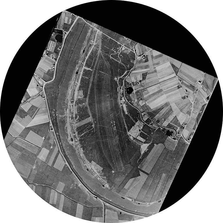
Nederlands: Een luchtfoto van vliegveld Keent (B82 Grave)
Nederlands: An airial photo of Keent Airfield (B82 Grave) |
| Date | between circa 1944 and circa 1945 |
| Source | https://www.defensie.nl/onderwerpen/vliegvelden-tijdens-de-tweede-wereldoorlog/vliegveldenoverzicht/grave/luchtfotos |
| Author | NIMH |
| Permission (Reusing this file) |
| Camera location | | View this and other nearby images on: OpenStreetMap |
|---|
Licensing
[edit]
| This file is made available under the Creative Commons CC0 1.0 Universal Public Domain Dedication. | |
| The person who associated a work with this deed has dedicated the work to the public domain by waiving all of their rights to the work worldwide under copyright law, including all related and neighboring rights, to the extent allowed by law. You can copy, modify, distribute and perform the work, even for commercial purposes, all without asking permission.
|
File history
Click on a date/time to view the file as it appeared at that time.
| Date/Time | Thumbnail | Dimensions | User | Comment | |
|---|---|---|---|---|---|
| current | 18:54, 21 April 2018 | | 2,126 × 2,126 (463 KB) | Take Mirrenberg (talk | contribs) | User created page with UploadWizard |
You cannot overwrite this file.
File usage on Commons
The following page uses this file:
File usage on other wikis
The following other wikis use this file:
- Usage on nl.wikipedia.org
- Usage on www.wikidata.org