File:Edifício Copan (3408011258).jpg

Original file (2,448 × 3,264 pixels, file size: 4.8 MB, MIME type: image/jpeg)
Captions
Captions
Summary
[edit].jpg&action=edit§ion=1)
| Description |
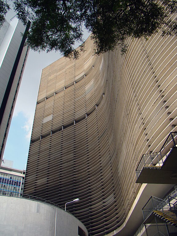
O Copan é um dos mais importantes e emblemáticos edifícios da cidade de São Paulo, Brasil. Projetado por Oscar Niemeyer, localiza-se num dos pontos mais movimentados do centro da capital paulista. É bastante conhecido por sua geometria sinuosa, que lembra uma onda, e pelos números superlativos de suas estatísticas. Tem 140 metros de altura, 37 andares e cerca de cinco mil residentes, considerada a maior estrutura de concreto armado do Brasil.Possui 1.160 apartamentos distribuídos em seis blocos e também o Edifício Copan é mais populoso que 457 municípios do país, além de área comercial no térreo com 72 lojas e uma igreja evangélica, sendo considerado o maior edifício residencial da América Latina.
|
| Date | |
| Source | Edifício Copan |
| Author | Rodrigo Soldon from Rio de Janeiro, Brazil |
| Camera location | | View this and other nearby images on: OpenStreetMap |
|---|
.jpg¶ms=-23.551229_N_-046.632549_E_globe:Earth_type:camera_source:Flickr_&language=en)
Licensing
[edit].jpg&action=edit§ion=2)
- You are free:
- to share – to copy, distribute and transmit the work
- to remix – to adapt the work
- Under the following conditions:
- attribution – You must give appropriate credit, provide a link to the license, and indicate if changes were made. You may do so in any reasonable manner, but not in any way that suggests the licensor endorses you or your use.
| This image was originally posted to Flickr by Rodrigo_Soldon at https://flickr.com/photos/8865243@N02/3408011258. It was reviewed on 7 January 2023 by FlickreviewR 2 and was confirmed to be licensed under the terms of the cc-by-2.0. |
File history
Click on a date/time to view the file as it appeared at that time.
| Date/Time | Thumbnail | Dimensions | User | Comment | |
|---|---|---|---|---|---|
| current | 06:55, 7 January 2023 | | 2,448 × 3,264 (4.8 MB) | RodRabelo7 (talk | contribs) | Transferred from Flickr via #flickr2commons |
You cannot overwrite this file.
File usage on Commons
There are no pages that use this file.
.jpg&oldid=723548841)