File:Eastern Himalaya Mtns 28to32N 92to98E Topo Rainbow Zebra 1530.jpg
Jump to navigation
Jump to search

Size of this preview: 800 × 533 pixels. Other resolutions: 320 × 213 pixels | 640 × 427 pixels | 1,024 × 683 pixels | 1,280 × 853 pixels | 2,560 × 1,707 pixels | 7,200 × 4,800 pixels.
Original file (7,200 × 4,800 pixels, file size: 33.33 MB, MIME type: image/jpeg)
Captions
Captions
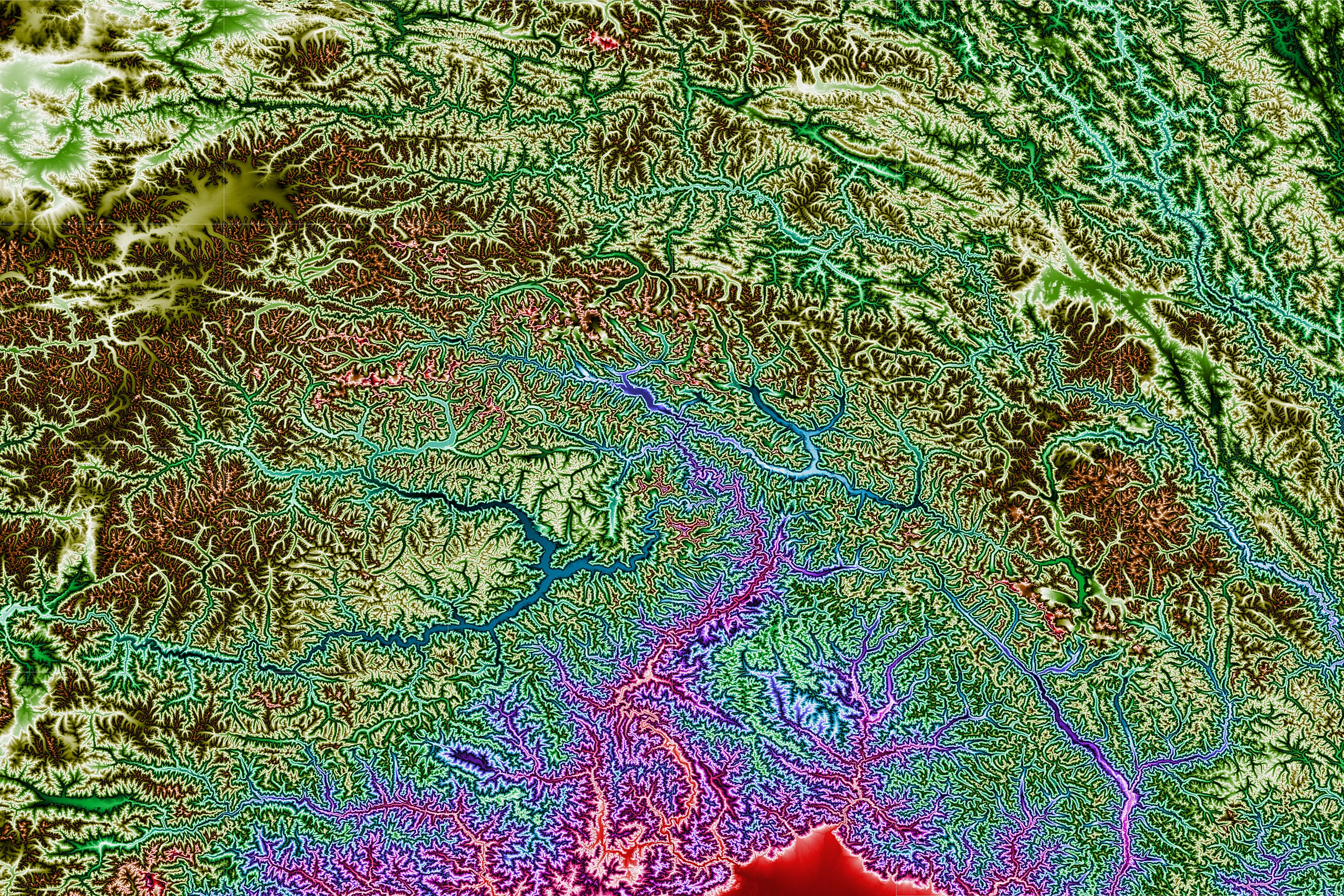
Topographic map of the eastern end of the Himalaya Mountains.
Summary
[edit]
| Description |
English: This topographic map shows the eastern end of the Himalaya Mountains from 28 to 32 degrees north latitude and from 92 to 98 degrees east longitude. Produced with Map Render 3D from GHz Limited. Then used IrfanView to stitch together multiple maps. |
| Date | |
| Source | http://www.viewfinderpanoramas.org/dem3.html |
| Author | Jonathan de Ferranti |
Licensing
[edit]
| This file is in the public domain in the United States because it was solely created by NASA. NASA copyright policy states that "NASA material is not protected by copyright unless noted". (See Template:PD-USGov, NASA copyright policy page or JPL Image Use Policy.) | ||
 |
Warnings:
|
File history
Click on a date/time to view the file as it appeared at that time.
| Date/Time | Thumbnail | Dimensions | User | Comment | |
|---|---|---|---|---|---|
| current | 23:16, 12 December 2019 | | 7,200 × 4,800 (33.33 MB) | Rainbow Zebra 13 (talk | contribs) | Improved the stitching together of the map tiles by using IrfanView instead of Image Composite Editor. |
| 01:16, 31 May 2015 |  | 7,141 × 4,764 (36.01 MB) | Rainbow Zebra 13 (talk | contribs) | User created page with UploadWizard |
You cannot overwrite this file.
File usage on Commons
There are no pages that use this file.