File:Easter Island and Sala y Gomez 1870 map nla.obj-231561562-1.jpg
Jump to navigation
Jump to search
Size of this preview: 800 × 583 pixels. Other resolutions: 320 × 233 pixels | 640 × 467 pixels | 1,024 × 747 pixels | 1,280 × 933 pixels | 2,560 × 1,867 pixels | 5,000 × 3,646 pixels.
Original file (5,000 × 3,646 pixels, file size: 8.04 MB, MIME type: image/jpeg)
Captions
Captions
Add a one-line explanation of what this file represents
Summary
[edit]
| Description |
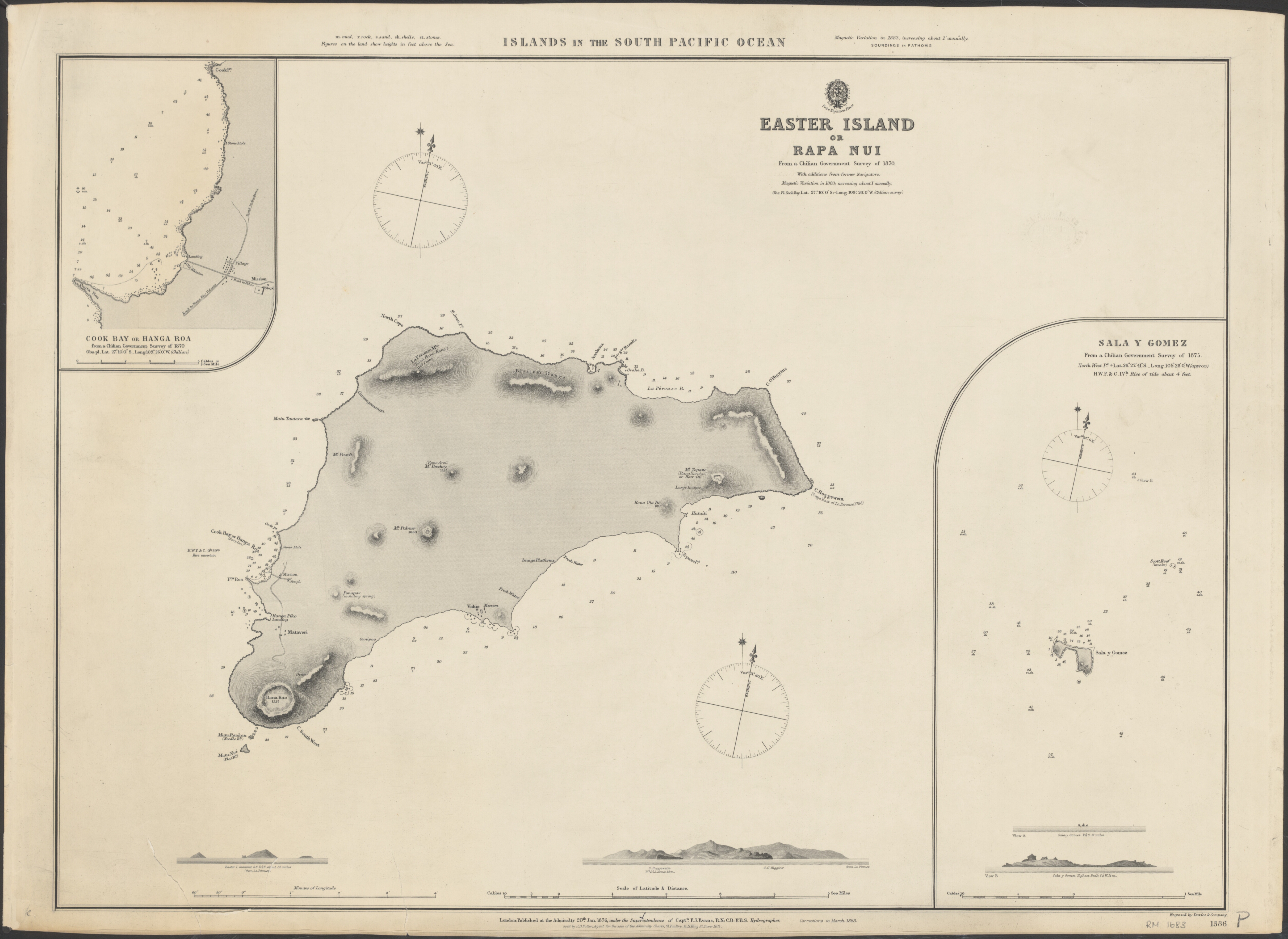
English: Map of Easter Island and Sala y Gómez |
| Date | |
| Source | http://trove.nla.gov.au/work/30368868?q&versionId=36856464 |
| Author |
Great Britain. Hydrographic Department Potter, J. D. (John D.)
Evans, F. J. (Frederick John), 1815-1885.
Davies & Company. |
Licensing
[edit]
|
This work is in the public domain in its country of origin and other countries and areas where the copyright term is the author's life plus 70 years or fewer. This work is in the public domain in the United States because it was published (or registered with the U.S. Copyright Office) before January 1, 1929. | |
| This file has been identified as being free of known restrictions under copyright law, including all related and neighboring rights. | |
File history
Click on a date/time to view the file as it appeared at that time.
| Date/Time | Thumbnail | Dimensions | User | Comment | |
|---|---|---|---|---|---|
| current | 14:11, 5 October 2016 | | 5,000 × 3,646 (8.04 MB) | Ratzer (talk | contribs) | User created page with UploadWizard |
You cannot overwrite this file.
File usage on Commons
There are no pages that use this file.
File usage on other wikis
The following other wikis use this file:
- Usage on de.wikipedia.org
- Usage on es.wikipedia.org