File:East Prussia 1923-1939 map-zh-hans.svg
Jump to navigation
Jump to search

Size of this PNG preview of this SVG file: 651 × 600 pixels. Other resolutions: 261 × 240 pixels | 521 × 480 pixels | 834 × 768 pixels | 1,111 × 1,024 pixels | 2,223 × 2,048 pixels | 865 × 797 pixels.
Original file (SVG file, nominally 865 × 797 pixels, file size: 122 KB)
Captions
Captions
Add a one-line explanation of what this file represents
Summary
[edit]| Description |
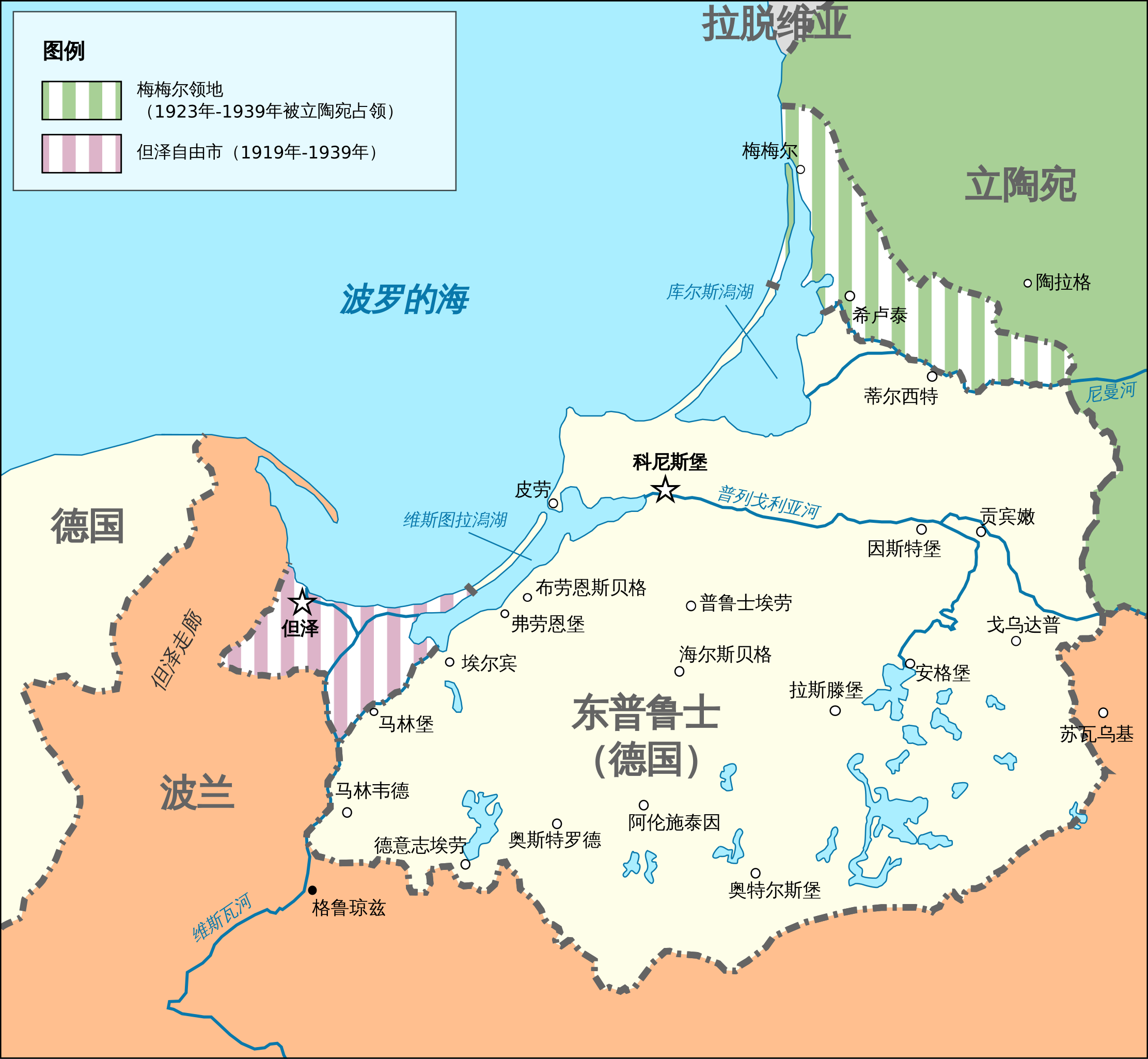
中文(简体):1923年至1939年期间德国的东普鲁士省地图 |
| Date | |
| Source |
This file was derived from: East Prussia 1923-1939 map-fr.svg |
| Author |
|
| Other versions |
[]
|


Licensing
[edit]
I, the copyright holder of this work, hereby publish it under the following license:
This file is licensed under the Creative Commons Attribution-Share Alike 4.0 International license.
- You are free:
- to share – to copy, distribute and transmit the work
- to remix – to adapt the work
- Under the following conditions:
- attribution – You must give appropriate credit, provide a link to the license, and indicate if changes were made. You may do so in any reasonable manner, but not in any way that suggests the licensor endorses you or your use.
- share alike – If you remix, transform, or build upon the material, you must distribute your contributions under the same or compatible license as the original.
File history
Click on a date/time to view the file as it appeared at that time.
| Date/Time | Thumbnail | Dimensions | User | Comment | |
|---|---|---|---|---|---|
| current | 07:56, 3 May 2024 | | 865 × 797 (122 KB) | BlackShadowG (talk | contribs) | Uploaded own work with UploadWizard |
You cannot overwrite this file.
File usage on Commons
The following 11 pages use this file:
- User:Magog the Ogre/Multilingual legend/2024 May 1-4
- File:East Prussia 1923-1939.png
- File:East Prussia 1923-1939.svg
- File:East Prussia 1923-1939 map-el.svg
- File:East Prussia 1923-1939 map-es.svg
- File:East Prussia 1923-1939 map-fr.svg
- File:East Prussia 1923-1939 map-nl.svg
- File:East Prussia 1923-1939 map-zh-hans.svg
- File:East Prussia 1923-1939 map hu.svg
- File:East Prussia 1939.JPG
- Template:Other versions/East Prussia 1923-1939
File usage on other wikis
The following other wikis use this file:
- Usage on zh.wikipedia.org