File:East Huntington Bridge Across Ohio River, Proctorville, Ohio and Huntington, West Virginia (14518338333).jpg
Original file (4,000 × 3,000 pixels, file size: 10.43 MB, MIME type: image/jpeg)
Captions
Captions
Summary
[edit].jpg&action=edit§ion=1)
| Description |
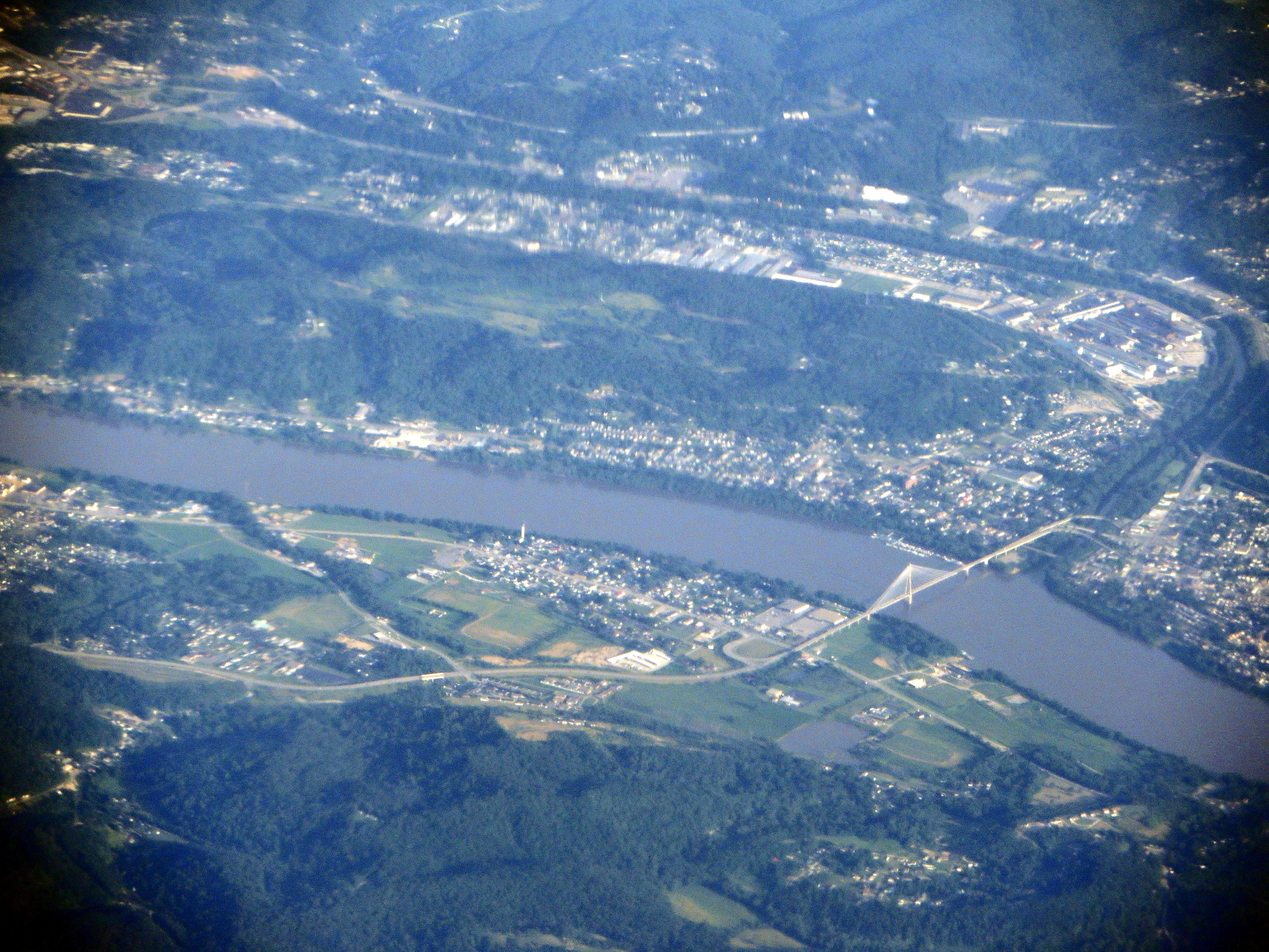
The East Huntington Bridge (officially the Frank Gatski Memorial Bridge, also called the East End Bridge or the 31st Street Bridge) is a 900-foot (270 m) cable-stayed bridge crossing the Ohio River at Huntington, West Virginia. It carries WV 106 on the West Virginia approach and OH 775 on the Ohio approach. The history of the span dates to the early 1970s when possible routings for a future Ohio River span were being discussed. To conform to the Huntington city comprehensive plan, the alignment preferred by the city was one that connected to Interstate 64 outside of the city boundaries. Many favored a plan about one mile north of the city along WV 2. Work began on the bridge in 1983 and was completed in August 1985 at a cost of $38 million. The designer of the bridge was Arvid Grant and Associated of Olympia, Washington and was the first bridge of its type in West Virginia. It was only the second of its kind in the United States since it utilized concrete instead of steel for its construction. It was built as a FHWA demonstration project. The Ohio River span and approach ramps on both sides of the river completed was what was known as Phase I. Future plans involved tolling the bridge and connecting it to U.S. Route 60 four blocks east. The bridge was renamed for Marshall University's first member of the Pro Football Hall of Fame, Frank "Gunner" Gatski, during halftime of the Marshall-UTEP Football game on November 18, 2006. en.wikipedia.org/wiki/East_Huntington_Bridge en.wikipedia.org/wiki/Wikipedia:Text_of_Creative_Commons_... |
| Date | |
| Source | East Huntington Bridge Across Ohio River, Proctorville, Ohio and Huntington, West Virginia |
| Author | Ken Lund from Reno, Nevada, USA |
| Camera location | | View this and other nearby images on: OpenStreetMap |
|---|
.jpg¶ms=038.433278_N_-082.389800_E_globe:Earth_type:camera_source:Flickr_&language=en)
Licensing
[edit].jpg&action=edit§ion=2)
- You are free:
- to share – to copy, distribute and transmit the work
- to remix – to adapt the work
- Under the following conditions:
- attribution – You must give appropriate credit, provide a link to the license, and indicate if changes were made. You may do so in any reasonable manner, but not in any way that suggests the licensor endorses you or your use.
- share alike – If you remix, transform, or build upon the material, you must distribute your contributions under the same or compatible license as the original.
| This image was originally posted to Flickr by Ken Lund at https://flickr.com/photos/75683070@N00/14518338333. It was reviewed on 4 December 2015 by FlickreviewR and was confirmed to be licensed under the terms of the cc-by-sa-2.0. |
File history
Click on a date/time to view the file as it appeared at that time.
| Date/Time | Thumbnail | Dimensions | User | Comment | |
|---|---|---|---|---|---|
| current | 01:41, 4 December 2015 | | 4,000 × 3,000 (10.43 MB) | INeverCry (talk | contribs) | Transferred from Flickr via Flickr2Commons |
You cannot overwrite this file.
File usage on Commons
There are no pages that use this file.
.jpg&oldid=896482857)