File:East Howe, bottom of Puck's Dell - geograph.org.uk - 1340501.jpg
(Redirected from File:East Howe, bottom of Pucks Dell - geograph.org.uk - 1340501.jpg)
Size of this preview: 450 × 600 pixels. Other resolutions: 180 × 240 pixels | 480 × 640 pixels.
Original file (480 × 640 pixels, file size: 114 KB, MIME type: image/jpeg)
Captions
Captions
Add a one-line explanation of what this file represents
Summary
[edit]
| Description |
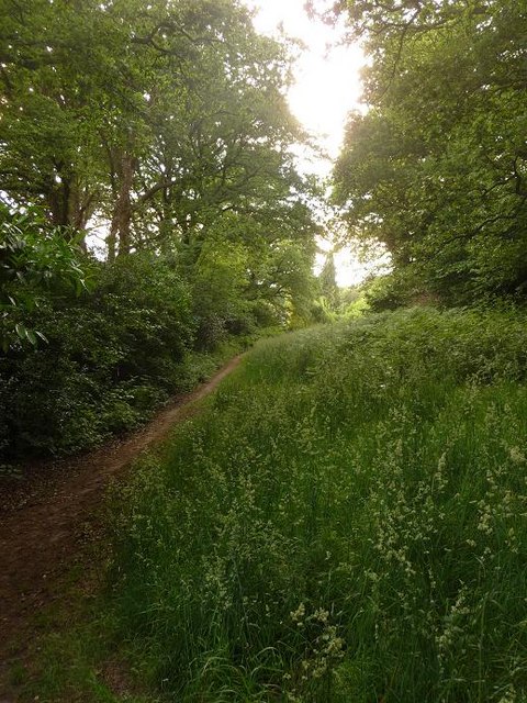
English: East Howe: bottom of Puck's Dell Looking along the path that runs along the bottom of 1340491, with back gardens of Elgar and Howeth Roads backing on to the left. This is the darkest part of the Dell, under the cover of large oak trees; on the northern side the grassland is in open air (see 1340493). |
| Date | |
| Source | From geograph.org.uk |
| Author | Chris Downer |
| Attribution (required by the license) | Chris Downer / East Howe: bottom of Puck’s Dell / |
| Camera location | | View this and other nearby images on: OpenStreetMap |
|---|
_heading:292.00&language=en)
| Object location | | View this and other nearby images on: OpenStreetMap |
|---|
_heading:292.00&language=en)
Licensing
[edit]

|
This image was taken from the Geograph project collection. See this photograph's page on the Geograph website for the photographer's contact details. The copyright on this image is owned by Chris Downer and is licensed for reuse under the Creative Commons Attribution-ShareAlike 2.0 license.
|
This file is licensed under the Creative Commons Attribution-Share Alike 2.0 Generic license.
Attribution: Chris Downer
- You are free:
- to share – to copy, distribute and transmit the work
- to remix – to adapt the work
- Under the following conditions:
- attribution – You must give appropriate credit, provide a link to the license, and indicate if changes were made. You may do so in any reasonable manner, but not in any way that suggests the licensor endorses you or your use.
- share alike – If you remix, transform, or build upon the material, you must distribute your contributions under the same or compatible license as the original.
File history
Click on a date/time to view the file as it appeared at that time.
| Date/Time | Thumbnail | Dimensions | User | Comment | |
|---|---|---|---|---|---|
| current | 04:24, 28 February 2011 | | 480 × 640 (114 KB) | GeographBot (talk | contribs) | == {{int:filedesc}} == {{Information |description={{en|1=East Howe: bottom of Pucks Dell Looking along the path that runs along the bottom of 1340491, with back gardens of Elgar and Howeth Roads backing on to the left. This is the darkest part of th |
You cannot overwrite this file.
File usage on Commons
The following page uses this file: