File:Earthquake off Samoa Generates Tsunami (After).jpg
Jump to navigation
Jump to search
Size of this preview: 600 × 600 pixels. Other resolutions: 240 × 240 pixels | 480 × 480 pixels | 768 × 768 pixels | 1,024 × 1,024 pixels | 1,800 × 1,800 pixels.
Original file (1,800 × 1,800 pixels, file size: 880 KB, MIME type: image/jpeg)
Captions
Captions
Add a one-line explanation of what this file represents
Summary
[edit].jpg&action=edit§ion=1)
| Description |
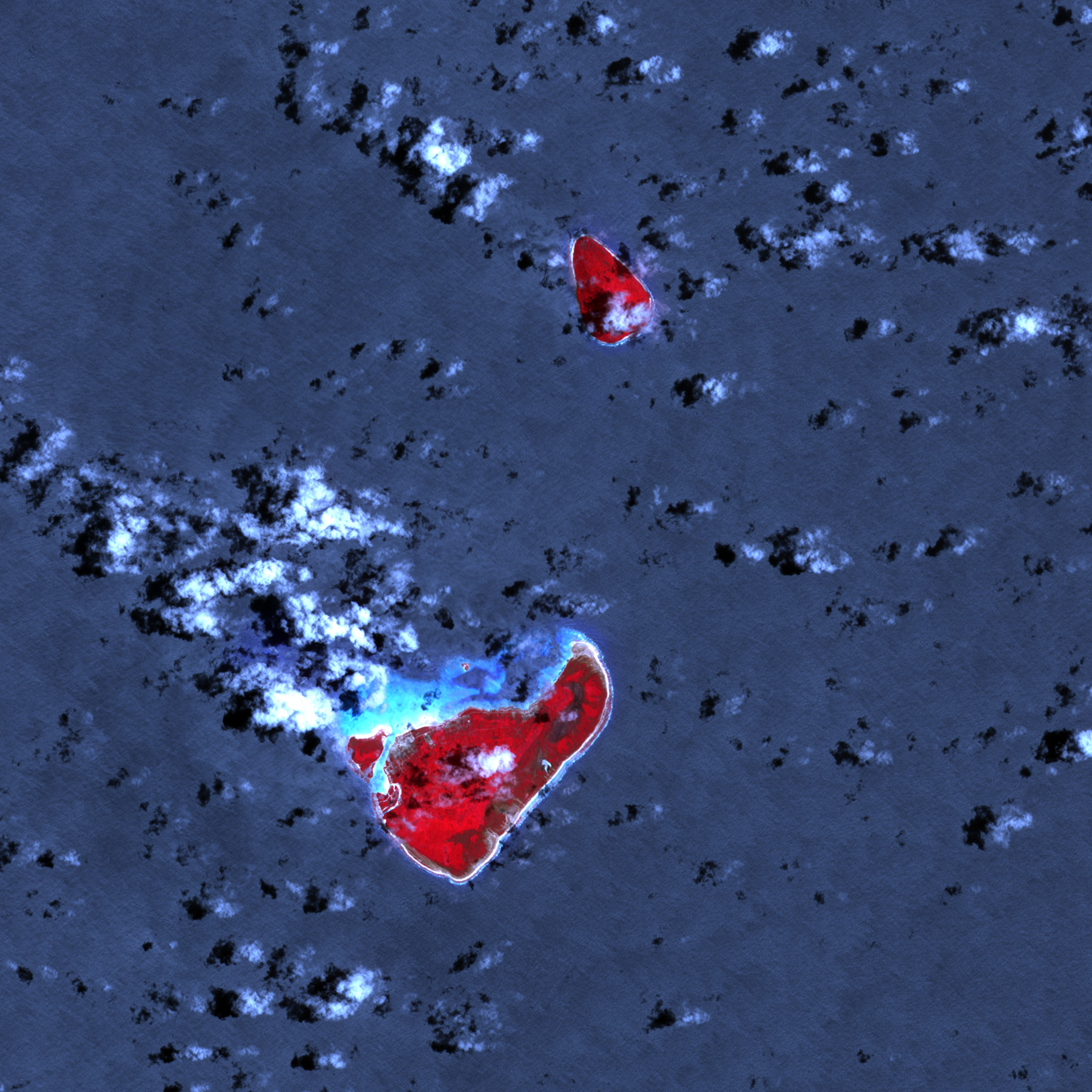
English: In the wake of a magnitude 8.0 earthquake, tsunami waves rolled onto the Tongan island of Niuatoputapu. The New Zealand Herald reported that waves up to 6 meters high hit the island. The north-east shoreline (facing the earthquake epicentre) received the most damage, followed by the towns of Hihifo and Felehau. Nine residents were killed. In this image vegetation is red, while bare ground is pale blue-grey. The dark red area along the eastern side of the island likely indicates damaged or inundated vegetation. Clouds and breaking waves are white or cyan. |
| Date | |
| Source | NASA Earth Observatory |
| Author | Robert Simmon |
Image acquired using data from the NASA/GSFC/METI/ERSDAC/JAROS, and U.S./Japan ASTER Science Team. Instrument: Terra - ASTER.
Licensing
[edit].jpg&action=edit§ion=2)
| This file is in the public domain in the United States because it was solely created by NASA. NASA copyright policy states that "NASA material is not protected by copyright unless noted". (See Template:PD-USGov, NASA copyright policy page or JPL Image Use Policy.) | ||
 |
Warnings:
|
File history
Click on a date/time to view the file as it appeared at that time.
| Date/Time | Thumbnail | Dimensions | User | Comment | |
|---|---|---|---|---|---|
| current | 11:04, 23 October 2009 | | 1,800 × 1,800 (880 KB) | Originalwana (talk | contribs) | {{Information |Description={{en|1=In the wake of a magnitude 8.0 earthquake, tsunami waves rolled onto the Tongan island of Niuatoputapu. The New Zealand Herald reported that waves up to 6 meters hig |
You cannot overwrite this file.
File usage on Commons
There are no pages that use this file.
File usage on other wikis
The following other wikis use this file:
- Usage on en.wikipedia.org
- Usage on fr.wikipedia.org
.jpg&oldid=463740503)