File:Earthmap1000x500.jpg
Jump to navigation
Jump to search

Size of this preview: 800 × 400 pixels. Other resolutions: 320 × 160 pixels | 640 × 320 pixels | 1,000 × 500 pixels.
Original file (1,000 × 500 pixels, file size: 336 KB, MIME type: image/jpeg)
Captions
Captions
Add a one-line explanation of what this file represents
Summary
[edit]
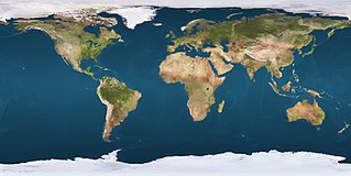
| Description | Earth map - resolution 1000 x 500 pixels |
| Date | upload 25. Oct. 2005 |
| Source | http://gw.marketingden.com/planets/images/earthmaps/earthmap1k.jpg (archived) |
| Author | jimht at shaw dot ca |
| Permission (Reusing this file) |
http://gw.marketingden.com/planets/earth.html (archived) |
| Other versions |
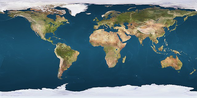
Derivative works of this file: Image:Whole world - land and oceans.jpg (basic hires version) |
| 360° | View in 360° panoramic viewer
|
|---|
English: This particular image version allows identification and marking of any pixel by its decimalized longitude and latitude parameters applying the following formulas:
- pixel from top edge = (90 - latitude) / 0,36
- pixel from left hand side = (180 + longitude) / 0,36
Licensing
[edit]

|
The copyright holder of this work allows anyone to use it for any purpose including unrestricted redistribution, commercial use, and modification.
Usage notes:
|
File history
Click on a date/time to view the file as it appeared at that time.
| Date/Time | Thumbnail | Dimensions | User | Comment | |
|---|---|---|---|---|---|
| current | 07:48, 25 October 2005 | | 1,000 × 500 (336 KB) | Schwalbe (talk | contribs) | {{Information| |Description = Earth map - resolution 1000 x 500 pixels |Source = http://gw.marketingden.com/planets/images/earthmaps/earthmap1k.jpg |Date = upload 25. Oct. 2005 |Author = jimht at shaw dot ca |Permission = http://gw.marketingden.com/plane |
You cannot overwrite this file.
File usage on Commons
The following 10 pages use this file:
- User:F1jmm
- Commons:Files used on RegiowikiAT/4
- File:Cambridge azimuthal equidistant.png
- File:Conson at 201007122000HKT.png
- File:Earth orthographic projection Earthmap1000x500.jpg
- File:Mecca azimuthal equidistant.png
- File:Qibla observation by shadows map.svg
- File:Valeriepieris circle azimuthal equal area.png
- File:Valeriepieris circle azimuthal equidistant.png
- File:World Ocean Current.ja.jpg
File usage on other wikis
The following other wikis use this file:
- Usage on af.wikipedia.org
- Usage on ar.wikipedia.org
- Usage on ast.wikipedia.org
- Usage on as.wikipedia.org
- Usage on azb.wikipedia.org
- Usage on ban.wikipedia.org
- Usage on be-tarask.wikipedia.org
- Usage on bh.wikipedia.org
- टेम्पलेट:Infobox historic site
- टेम्पलेट:Infobox historic site/doc
- टेम्पलेट:Infobox dam
- टेम्पलेट:Infobox dam/doc
- टेम्पलेट:Infobox bridge
- टेम्पलेट:Infobox bridge/doc
- टेम्पलेट:GeoTemplate
- टेम्पलेट:Infobox glacier
- टेम्पलेट:Infobox glacier/doc
- टेम्पलेट:Infobox aqueduct
- टेम्पलेट:Infobox aqueduct/doc
- टेम्पलेट:Infobox oil refinery
- टेम्पलेट:Infobox oil refinery/doc
- टेम्पलेट:Infobox hut
- टेम्पलेट:Infobox hut/doc
- टेम्पलेट:Infobox residential college
- लॉस एंजिलिस
- टेम्पलेट:Infobox residential college/doc
- Usage on bn.wikipedia.org
- Usage on br.wikipedia.org
- Usage on bs.wikipedia.org
- Usage on cs.wikipedia.org
- Usage on de.wikipedia.org
- Usage on dty.wikipedia.org
- Usage on en.wikipedia.org
- Usage on eo.wikipedia.org
- Usage on es.wikipedia.org
- Usage on fa.wikipedia.org
View more global usage of this file.