File:Earnslaw basin and waterfalls towards Mt Earnslaw Pikirakatahi.jpg
Jump to navigation
Jump to search
Size of this preview: 800 × 471 pixels. Other resolutions: 320 × 188 pixels | 640 × 376 pixels | 1,024 × 602 pixels | 1,280 × 753 pixels | 2,560 × 1,506 pixels | 4,896 × 2,880 pixels.
Original file (4,896 × 2,880 pixels, file size: 5.77 MB, MIME type: image/jpeg)
Captions
Captions
Add a one-line explanation of what this file represents
Summary
[edit]
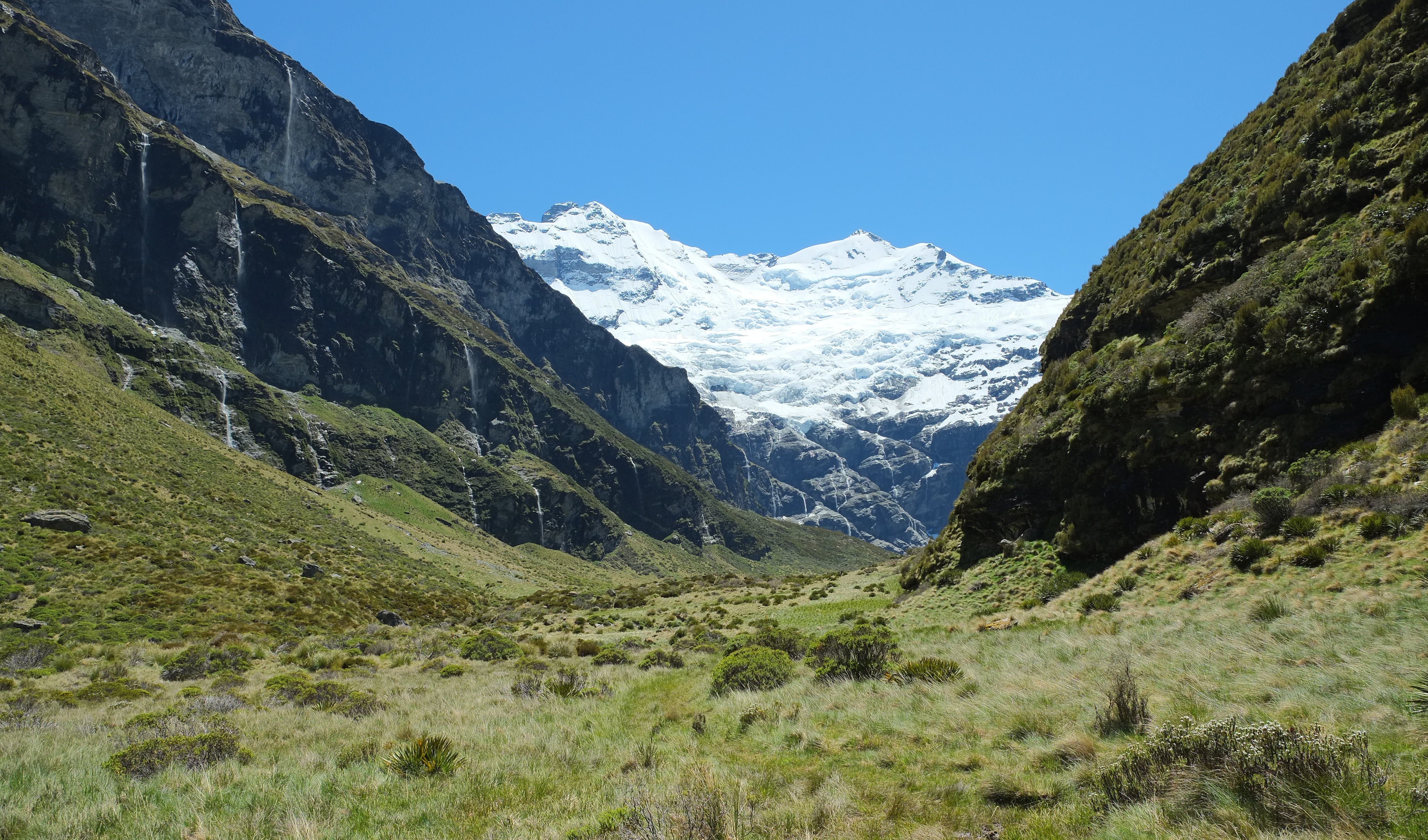
| Description | Earnslaw basin and waterfalls towards Mount Earnslaw / Pikirakatahi and Earnslaw Glacier |
| Date | |
| Source | Own work |
| Author | Pseudopanax at English Wikipedia |
| Camera location | | View this and other nearby images on: OpenStreetMap |
|---|
Licensing
[edit]
| I, the copyright holder of this work, release this work into the public domain. This applies worldwide. In some countries this may not be legally possible; if so: I grant anyone the right to use this work for any purpose, without any conditions, unless such conditions are required by law. |
File history
Click on a date/time to view the file as it appeared at that time.
| Date/Time | Thumbnail | Dimensions | User | Comment | |
|---|---|---|---|---|---|
| current | 02:06, 8 August 2022 | | 4,896 × 2,880 (5.77 MB) | Pseudopanax (talk | contribs) | == {{int:filedesc}} == {{Information |Description=Earnslaw basin and waterfalls towards Mount Earnslaw / Pikirakatahi and Earnslaw Glacier |Source={{Own}} |Date=2021-11-30 |Author={{user at project|Pseudopanax|wikipedia|en}} }} {{location|44|39|56|S|168|24|17|E}} == {{int:license-header}} == {{PD-self}} Category:Mount Earnslaw / Pikirakatahi Category:Earnslaw Glacier Category:U-shaped valleys in New Zealand Category:Waterfalls of Otago Region |
You cannot overwrite this file.
File usage on Commons
There are no pages that use this file.