File:Early medieval hooked tag (FindID 1024894).jpg
Original file (6,053 × 3,034 pixels, file size: 2.64 MB, MIME type: image/jpeg)
Captions
Captions
Summary
[edit].jpg&action=edit§ion=1)
| Early medieval hooked tag | |||
|---|---|---|---|
| Photographer |
The Portable Antiquities Scheme, Lucy Shipley, 2021-04-07 10:38:34 |
||
| Title |
Early medieval hooked tag |
||
| Description |
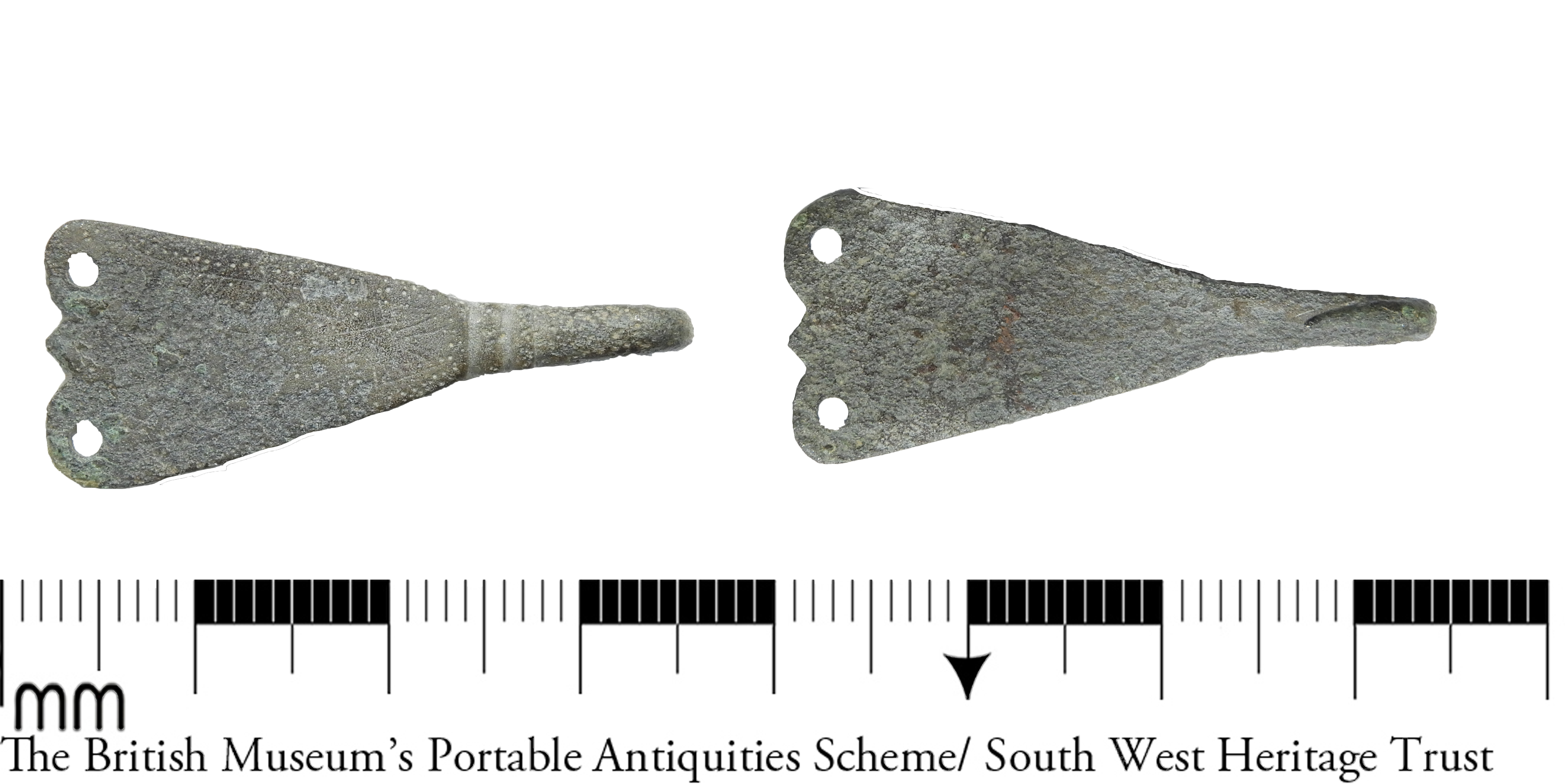
English: A complete copper alloy hooked tag, dating to the Early Medieval period, c. AD 700-1100.
The object is flattened in section, and sub-triangular in profile,with a sharply pointed hook curving 180 degrees beneath the main triangular plate. The plate itself, which is more clearly an isoscoles triangle in shape, has a flared terminal, with two rounded foils and a central smaller knop defining it. In each rounded foil is a circular attachment hole. At the apex of the triangle are two grooves,with ribs between them, forming a collar before the tail of the hook. This form of object is defined by its delicacy and small size, which has been used to argue that their function did not incorporate significant strain, and that they were more likely used to connect different elements of dress, such as leg wrappings, trousers, or to secure textile purses or bags (Read 2008: 5-6). Measurements: 32.3mm length, 9.9mm width, 1.2mm thickness, weight 2.02g. |
||
| Depicted place | (County of findspot) Somerset | ||
| Date | between 700 and 1100 | ||
| Accession number |
FindIdentifier: 1024894 |
||
| Credit line |
|
||
| Source |
https://finds.org.uk/database/ajax/download/id/1140596 Catalog: https://finds.org.uk/database/images/image/id/1140596/recordtype/artefacts archive copy at the Wayback Machine Artefact: https://finds.org.uk/database/artefacts/record/id/1024894 |
||
| Permission (Reusing this file) |
Attribution License | ||
| Object location | | View this and other nearby images on: OpenStreetMap |
|---|
.jpg¶ms=050.953100_N_-003.061190_E_globe:Earth_class:object_type:object__&language=en)
Licensing
[edit].jpg&action=edit§ion=2)
- You are free:
- to share – to copy, distribute and transmit the work
- to remix – to adapt the work
- Under the following conditions:
- attribution – You must give appropriate credit, provide a link to the license, and indicate if changes were made. You may do so in any reasonable manner, but not in any way that suggests the licensor endorses you or your use.
File history
Click on a date/time to view the file as it appeared at that time.
| Date/Time | Thumbnail | Dimensions | User | Comment | |
|---|---|---|---|---|---|
| current | 11:38, 15 April 2021 | | 6,053 × 3,034 (2.64 MB) | Fæ (talk | contribs) | Portable Antiquities Scheme, DEV (slurp), FindID: 1024894-1140596, early medieval, page 13, batch count 262 |
You cannot overwrite this file.
File usage on Commons
The following page uses this file:
.jpg)
.jpg&oldid=579161048)