File:Eaa3724 005 0002517 00001 k3.jpg
Jump to navigation
Jump to search
Size of this preview: 800 × 512 pixels. Other resolutions: 320 × 205 pixels | 640 × 410 pixels | 1,024 × 655 pixels | 1,280 × 819 pixels | 2,480 × 1,587 pixels.
Original file (2,480 × 1,587 pixels, file size: 2.34 MB, MIME type: image/jpeg)
Captions
Captions
Add a one-line explanation of what this file represents
Other Parts of the map

1/4

2/4

4/4
Summary
[edit]
| Description |
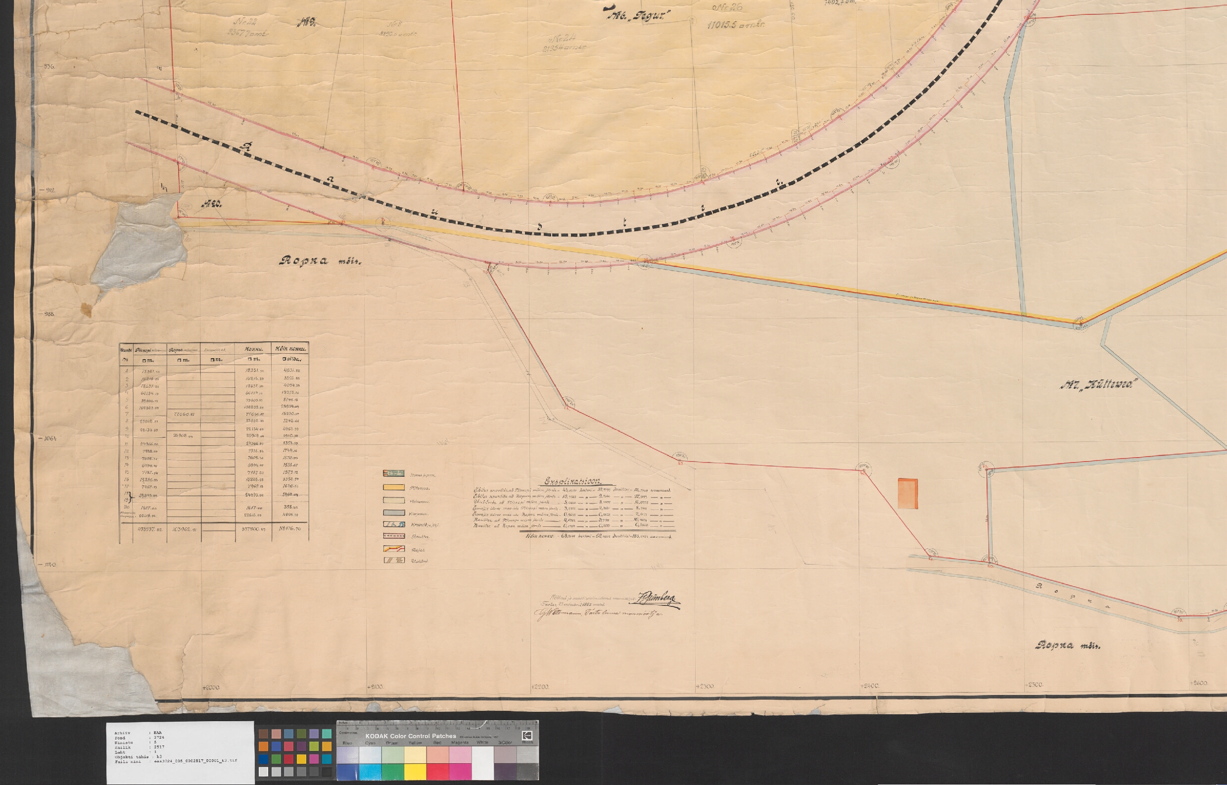
English: A map from Estonian National Archives with Reference code: EAA.3724.5.2517 sheet 1; 3/4 Eesti: Kaart Eesti Rahvusarhiivist Lähtekoodiga: EAA.3724.5.2517 leht 1; 3/4 |
| Date | |
| Source | http://www.ra.ee/kaardid/index.php/et/map/view?id=6382 |
| Author | Julius Grünberg |
| Language | Estonian |
| Map type | City Plan |
| Map sheet | Single sheet map |
| Map reproduction | Printed |
| Title | Eesti: Tartu linna Ropka linnaosa kaart |
| Map scale | 1:600 |
| Accession number | EAA.3724.5.2517 sheet 1 |
| Dimensions | height: 143 cm (56.2 in); width: 220 cm (86.6 in) |
| Medium | print on paper |
Licensing
[edit]
|
This work is in the public domain in its country of origin and other countries and areas where the copyright term is the author's life plus 70 years or fewer. | |
| This file has been identified as being free of known restrictions under copyright law, including all related and neighboring rights. | |
File history
Click on a date/time to view the file as it appeared at that time.
| Date/Time | Thumbnail | Dimensions | User | Comment | |
|---|---|---|---|---|---|
| current | 14:47, 1 December 2014 | | 2,480 × 1,587 (2.34 MB) | JLoide (talk | contribs) | User created page with UploadWizard |
You cannot overwrite this file.
File usage on Commons
The following 4 pages use this file: