File:Eaa3724 004 0001320 00001 k.jpg
Jump to navigation
Jump to search
Size of this preview: 507 × 599 pixels. Other resolutions: 203 × 240 pixels | 406 × 480 pixels | 650 × 768 pixels | 866 × 1,024 pixels | 1,748 × 2,066 pixels.
Original file (1,748 × 2,066 pixels, file size: 2.77 MB, MIME type: image/jpeg)
Captions
Captions
Add a one-line explanation of what this file represents
Summary
[edit]
| Description |
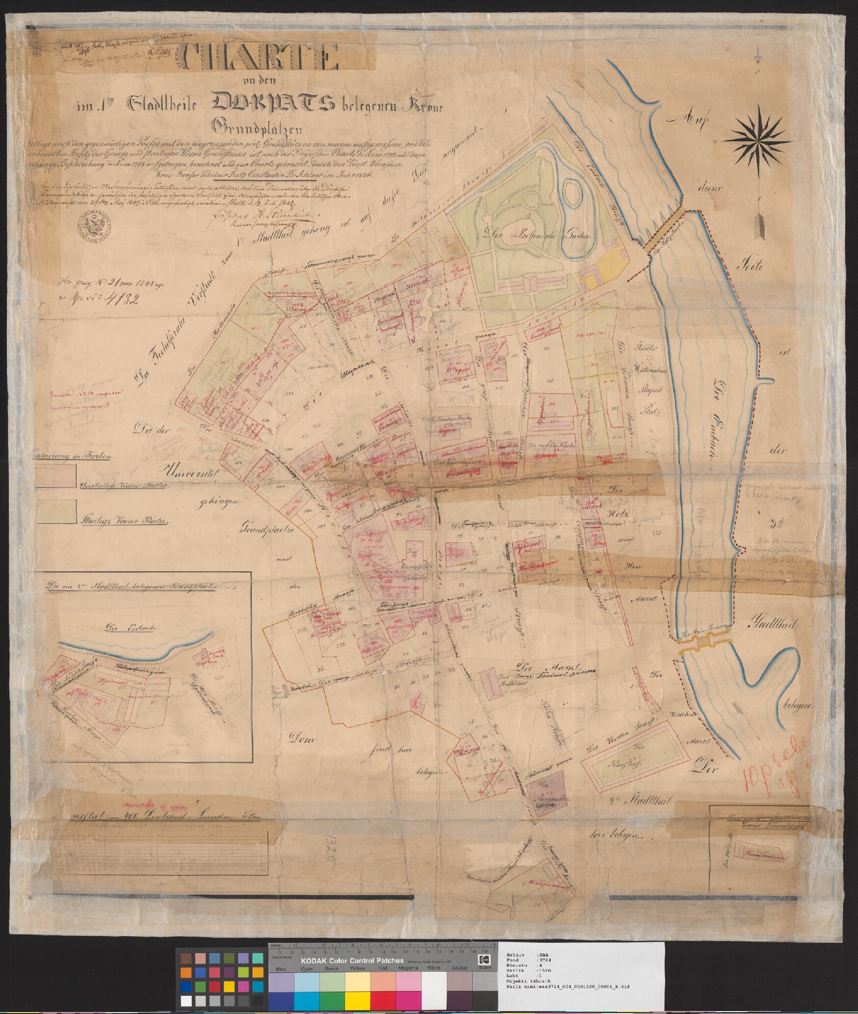
English: A map from Estonian National Archives with Reference code: EAA.3724.4.1320 sheet 1 Eesti: Kaart Eesti Rahvusarhiivist Lähtekoodiga: EAA.3724.4.1320 leht 1 |
| Date | |
| Source | http://www.ra.ee/kaardid/index.php/en/map/view?id=2499 |
| Author | Constantin Benjamin Anders; Dreyer |
| Language | German |
| Map type | City Plan |
| Map sheet | Single sheet map |
| Map reproduction | Printed |
| Title | Deutsch: Charte von den im 1ten Stadttheile Dorpats belegenen Krone Grundplätzen |
| Accession number | EAA.3724.4.1320 sheet 1 |
| Dimensions | height: 82 cm (32.2 in); width: 75 cm (29.5 in) |
| Medium | print on paper |
Licensing
[edit]
|
This work is in the public domain in its country of origin and other countries and areas where the copyright term is the author's life plus 70 years or fewer. | |
| This file has been identified as being free of known restrictions under copyright law, including all related and neighboring rights. | |
File history
Click on a date/time to view the file as it appeared at that time.
| Date/Time | Thumbnail | Dimensions | User | Comment | |
|---|---|---|---|---|---|
| current | 17:35, 4 September 2014 | | 1,748 × 2,066 (2.77 MB) | JLoide (talk | contribs) | User created page with UploadWizard |
You cannot overwrite this file.
File usage on Commons
The following page uses this file: