File:EWerkBesigheimFlorianKauffeld-02.jpg
Jump to navigation
Jump to search

Size of this preview: 800 × 533 pixels. Other resolutions: 320 × 213 pixels | 640 × 427 pixels | 1,024 × 683 pixels | 1,280 × 853 pixels | 2,048 × 1,365 pixels.
Original file (2,048 × 1,365 pixels, file size: 1.25 MB, MIME type: image/jpeg)
Captions
Captions
Add a one-line explanation of what this file represents
Summary
[edit]
| Description |
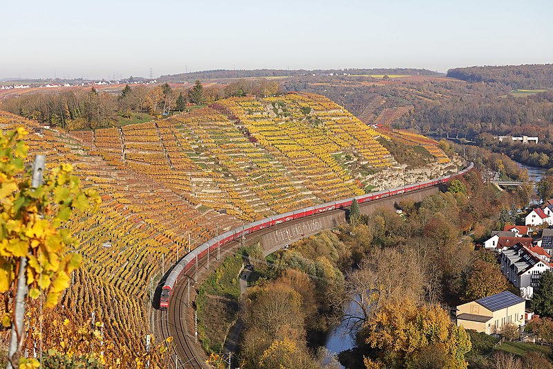
Deutsch: Blick von der Besigheimer Weinkanzel. Rechts unten das Enzkraftwerk Besigheim, von dort aus sichtbar die Stromleitung den Weinberg hinauf Richtung Löchgau |
| Date | |
| Source | Florian Kauffeld |
| Author | Florian Kauffeld |
| Permission (Reusing this file) |
| Camera location | | View this and other nearby images on: OpenStreetMap |
|---|
Licensing
[edit]
This file is licensed under the Creative Commons Attribution-Share Alike 4.0 International license.
Attribution: Florian Kauffeld
- You are free:
- to share – to copy, distribute and transmit the work
- to remix – to adapt the work
- Under the following conditions:
- attribution – You must give appropriate credit, provide a link to the license, and indicate if changes were made. You may do so in any reasonable manner, but not in any way that suggests the licensor endorses you or your use.
- share alike – If you remix, transform, or build upon the material, you must distribute your contributions under the same or compatible license as the original.
File history
Click on a date/time to view the file as it appeared at that time.
| Date/Time | Thumbnail | Dimensions | User | Comment | |
|---|---|---|---|---|---|
| current | 08:07, 13 November 2020 | | 2,048 × 1,365 (1.25 MB) | Mussklprozz (talk | contribs) | Uploaded a work by Florian Kauffeld from Florian Kauffeld with UploadWizard |
You cannot overwrite this file.
File usage on Commons
There are no pages that use this file.