File:EST-1935 Bl 59.png
Jump to navigation
Jump to search

Size of this preview: 744 × 599 pixels. Other resolutions: 298 × 240 pixels | 596 × 480 pixels | 953 × 768 pixels | 1,271 × 1,024 pixels | 2,542 × 2,048 pixels | 3,165 × 2,550 pixels.
Original file (3,165 × 2,550 pixels, file size: 2.56 MB, MIME type: image/png)
Captions
Captions
Add a one-line explanation of what this file represents
Summary
[edit]
| Description |
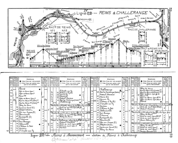
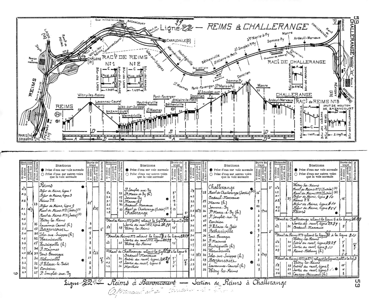
Deutsch: Gleisbild, Streckenprofil und Kilometertabelle Bahnstrecke Bazancourt–Challerange |
| Date | 10:25, 15 December 2019 (UTC) |
| Source | http://users.fini.net/~bersano/francais-french/carnet_de_profils_plans_de_gare/profils_EST-1935.pdf |
| Author | Chemin de fer de l’Est/ SNCF |
Licensing
[edit]
This work is in the public domain in France for one of the following reasons:
|
 |
File history
Click on a date/time to view the file as it appeared at that time.
| Date/Time | Thumbnail | Dimensions | User | Comment | |
|---|---|---|---|---|---|
| current | 10:27, 18 December 2019 | | 3,165 × 2,550 (2.56 MB) | Lantus (talk | contribs) | {{Information |description ={{en|1=x}} |date =z |source =x |author =y }} |
You cannot overwrite this file.
File usage on Commons
There are no pages that use this file.
File usage on other wikis
The following other wikis use this file:
- Usage on de.wikipedia.org