File:ESP 018043 1500 (44892712431).jpg
Jump to navigation
Jump to search

Size of this preview: 800 × 422 pixels. Other resolutions: 320 × 169 pixels | 640 × 338 pixels | 1,024 × 540 pixels | 1,280 × 675 pixels | 2,560 × 1,350 pixels | 4,096 × 2,160 pixels.
Original file (4,096 × 2,160 pixels, file size: 1.12 MB, MIME type: image/jpeg)
Captions
Captions
Add a one-line explanation of what this file represents
Summary
[edit].jpg&action=edit§ion=1)
| Description |
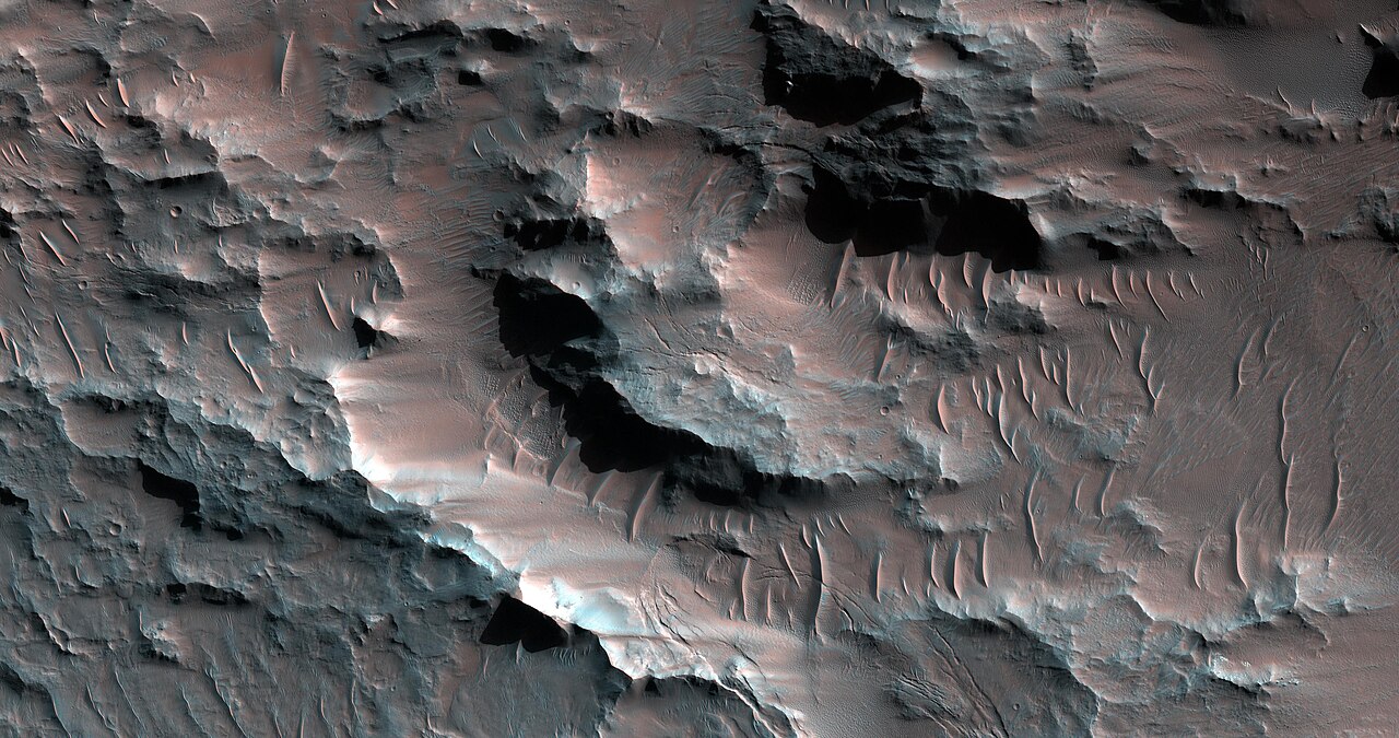
Possible Clay-Rich Terrain at the Mouth of Nirgal Vallis — Nirgal Vallis is a long river channel, whose western half is a branched system, but the eastern half is a tightly sinuous, deeply entrenched valley. We know that water once flowed here and the presence of clays helps to confirm that. But how much and for how long? NASA/JPL/University of Arizona (256 km above the surface; less than 1 km top to bottom and north is to the right) Source: www.uahirise.org/ESP_018043_1500 |
| Date | |
| Source | ESP_018043_1500 |
| Author | UAHiRISE (NASA) |
Licensing
[edit].jpg&action=edit§ion=2)
| This file is in the public domain in the United States because it was solely created by NASA. NASA copyright policy states that "NASA material is not protected by copyright unless noted". (See Template:PD-USGov, NASA copyright policy page or JPL Image Use Policy.) | ||
 |
Warnings:
|
File history
Click on a date/time to view the file as it appeared at that time.
| Date/Time | Thumbnail | Dimensions | User | Comment | |
|---|---|---|---|---|---|
| current | 10:19, 16 May 2019 | | 4,096 × 2,160 (1.12 MB) | Meisam (talk | contribs) | Transferred from Flickr via #flickr2commons |
You cannot overwrite this file.
File usage on Commons
The following page uses this file:
.jpg&oldid=910734367)