File:EF3 damage west of Tibbie, Alabama 2022 (3).jpg
Jump to navigation
Jump to search
Size of this preview: 800 × 600 pixels. Other resolutions: 320 × 240 pixels | 640 × 480 pixels | 1,024 × 768 pixels | 1,280 × 960 pixels | 2,560 × 1,920 pixels | 3,264 × 2,448 pixels.
Original file (3,264 × 2,448 pixels, file size: 2.36 MB, MIME type: image/jpeg)
Captions
Captions
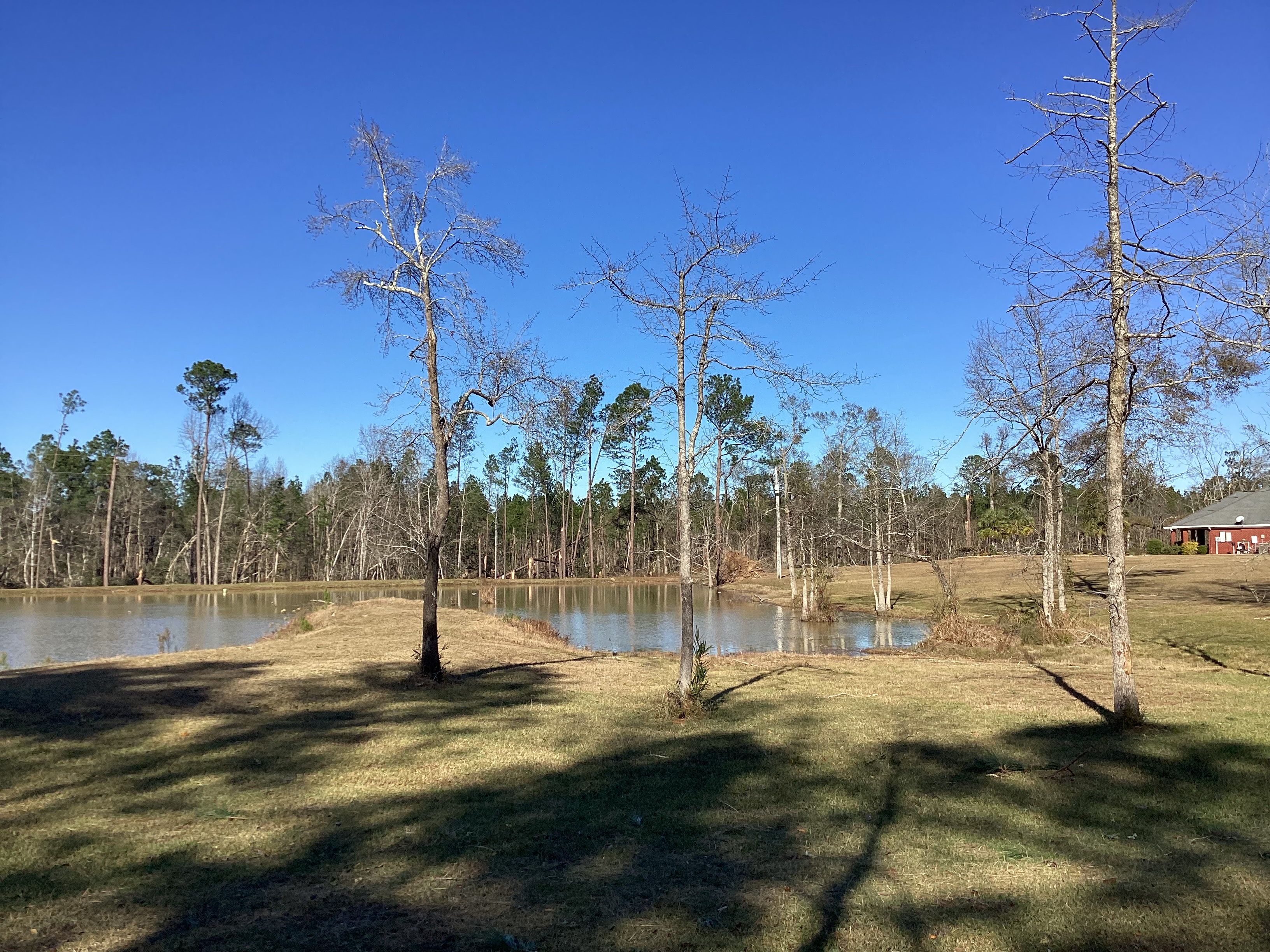
Low-end EF3 tree damage west of Tibble, Alabama.
Summary
[edit].jpg&action=edit§ion=1)
| Description |
English: Low-end EF3 tree damage west of Tibble, Alabama.
"large swaths of softwoods destroyed, overall a 500 yard swath of major tree damage to hardwoods and softwood" |
| Date | |
| Source | https://services.dat.noaa.gov/arcgis/rest/services/nws_damageassessmenttoolkit/DamageViewer/FeatureServer/0/3263241/attachments/1996408 |
| Author | National Weather Service Mobile AL |
| Camera location | | View this and other nearby images on: OpenStreetMap |
|---|
.jpg¶ms=031.360000_N_-088.310000_E_globe:Earth_type:camera__&language=en)
Licensing
[edit].jpg&action=edit§ion=2)
This file is in the public domain in the United States because it was solely created by employees of the National Weather Service or National Severe Storms Laboratory using the Damage Assessment Toolkit (DAT), an interactive map and database.
|
File history
Click on a date/time to view the file as it appeared at that time.
| Date/Time | Thumbnail | Dimensions | User | Comment | |
|---|---|---|---|---|---|
| current | 06:57, 2 July 2024 | | 3,264 × 2,448 (2.36 MB) | ChessEric (talk | contribs) | Uploaded a work by National Weather Service Mobile AL from https://services.dat.noaa.gov/arcgis/rest/services/nws_damageassessmenttoolkit/DamageViewer/FeatureServer/0/3263241/attachments/1996408 with UploadWizard |
You cannot overwrite this file.
File usage on Commons
There are no pages that use this file.
File usage on other wikis
The following other wikis use this file:
- Usage on en.wikipedia.org
.jpg&oldid=923591292)