File:EF3 damage in the Ocean Ridge Plantation community 2021.jpg
Jump to navigation
Jump to search
Size of this preview: 800 × 600 pixels. Other resolutions: 320 × 240 pixels | 640 × 480 pixels | 1,024 × 768 pixels | 1,280 × 960 pixels | 2,560 × 1,920 pixels | 4,032 × 3,024 pixels.
Original file (4,032 × 3,024 pixels, file size: 3.72 MB, MIME type: image/jpeg)
Captions
Captions
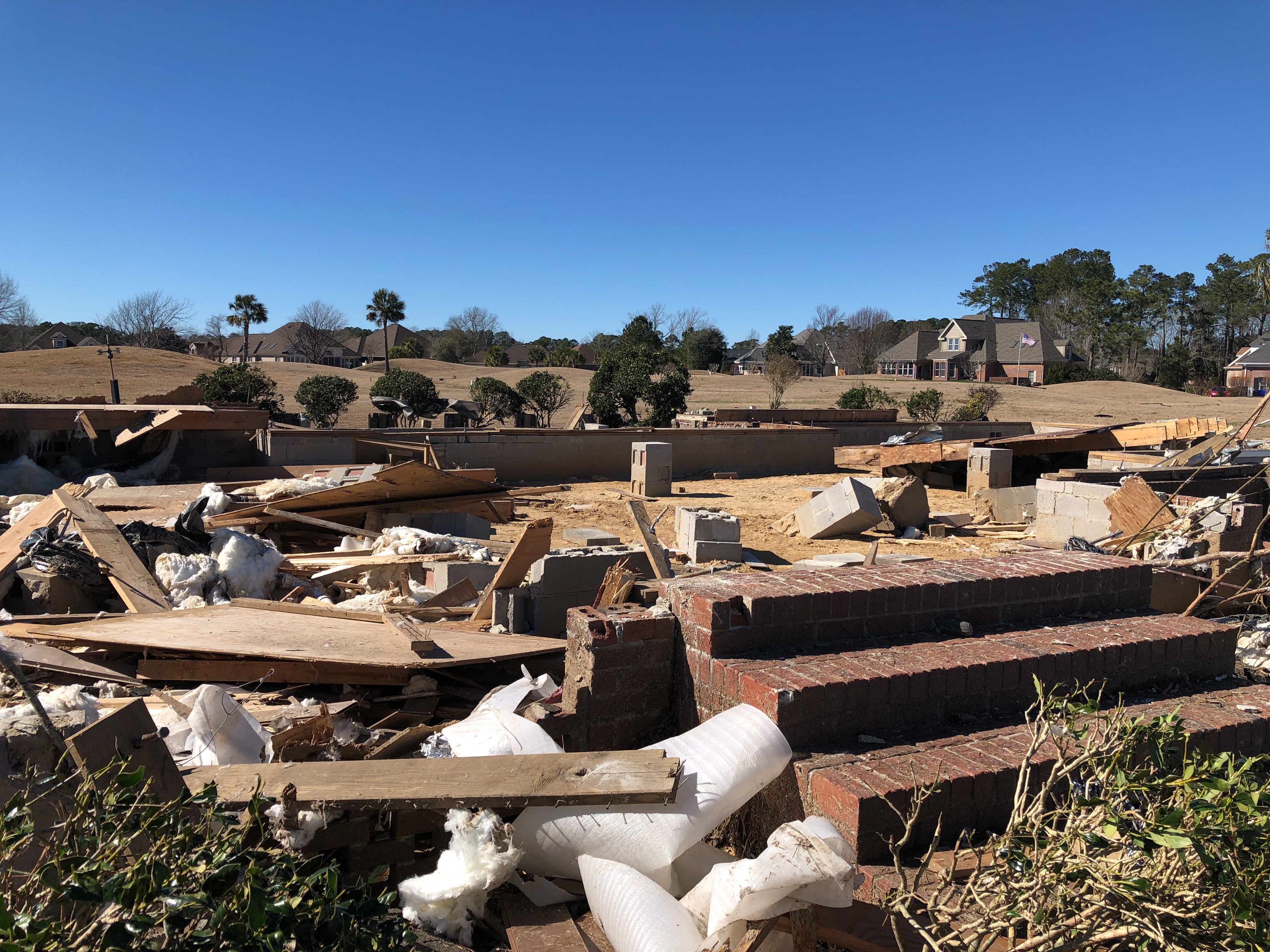
High-end EF3 damage to a home where two fatalities took place north of Sunset Beach, North Carolina.
Summary
[edit]
| Description |
English: A home that was swept off its crawl space by the high-end EF3 tornado north of Sunset Beach, North Carolina. Two fatalities occurred at this location. |
| Date | |
| Source | https://services.dat.noaa.gov/arcgis/rest/services/nws_damageassessmenttoolkit/DamageViewer/FeatureServer/0/2243808/attachments/1400019 |
| Author | NWS Wilmington |
| Camera location | | View this and other nearby images on: OpenStreetMap |
|---|
Licensing
[edit]
This image is in the public domain because it contains materials that originally came from the U.S. National Oceanic and Atmospheric Administration, taken or made as part of an employee's official duties.
|
File history
Click on a date/time to view the file as it appeared at that time.
| Date/Time | Thumbnail | Dimensions | User | Comment | |
|---|---|---|---|---|---|
| current | 23:26, 17 February 2021 | | 4,032 × 3,024 (3.72 MB) | ChessEric (talk | contribs) | Uploaded a work by NWS Wilmington from https://services.dat.noaa.gov/arcgis/rest/services/nws_damageassessmenttoolkit/DamageViewer/FeatureServer/0/2243808/attachments/1400019 with UploadWizard |
You cannot overwrite this file.
File usage on Commons
The following page uses this file:
- File:Damage Points SDE image-20210216-190107.jpg (file redirect)
File usage on other wikis
The following other wikis use this file:
- Usage on en.wikipedia.org
- Usage on ru.wikipedia.org