File:ECOWAS map.png
Jump to navigation
Jump to search
No higher resolution available.
ECOWAS_map.png (360 × 392 pixels, file size: 10 KB, MIME type: image/png)
Captions
Captions
Add a one-line explanation of what this file represents
| Description |
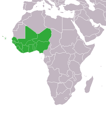
English: Map of African, with African Union member states in dark green and states with suspended membership in light green |
| Date | (UTC) |
| Source | |
| Author |
The original uploader was Theunixgeek at English Wikipedia.
|

|
File:ECOWAS members.svg is a vector version of this file. It should be used in place of this PNG file when not inferior.
File:ECOWAS map.png → File:ECOWAS members.svg
For more information, see Help:SVG. |
 |
I, the copyright holder of this work, hereby publish it under the following license:
This file is licensed under the Creative Commons Attribution-Share Alike 3.0 Unported license.
- You are free:
- to share – to copy, distribute and transmit the work
- to remix – to adapt the work
- Under the following conditions:
- attribution – You must give appropriate credit, provide a link to the license, and indicate if changes were made. You may do so in any reasonable manner, but not in any way that suggests the licensor endorses you or your use.
- share alike – If you remix, transform, or build upon the material, you must distribute your contributions under the same or compatible license as the original.
Original upload log
[edit]
This image is a derivative work of the following images:
- File:Map_of_the_African_Union_with_Suspended_States.svg licensed with Cc-by-sa-3.0
- 2010-03-29T19:33:05Z Roxanna 1000x1000 (128410 Bytes) Reverted to version as of 07:36, 19 February 2010
- 2010-03-29T19:25:59Z Roxanna 500x500 (50468 Bytes) ... but I think Mauritania is still suspended
- 2010-03-29T19:21:17Z Roxanna 500x500 (64647 Bytes) Officially Eritrea seems not yet to be outside of the AU...
- 2010-02-19T07:36:33Z Tomeasy 1000x1000 (128410 Bytes) Changed status of Eritrea from "suspended" to outside of the African Union due to withdrawal of this country.
- 2009-11-21T14:09:51Z Rotsee 1000x1000 (203340 Bytes) {{Information |Description={{en|Map of the African Union with Suspended States in Light Green}} |Source=Transferred from [http://en.wikipedia.org en.wikipedia] (Original text : ''Based on information in the [[:en:African Unio
Uploaded with derivativeFX
File history
Click on a date/time to view the file as it appeared at that time.
| Date/Time | Thumbnail | Dimensions | User | Comment | |
|---|---|---|---|---|---|
| current | 02:40, 23 March 2020 | | 360 × 392 (10 KB) | Uglemat (talk | contribs) | Morocco not a member |
| 16:56, 22 October 2017 |  | 360 × 392 (8 KB) | Casabus (talk | contribs) | + Morocco | |
| 02:21, 27 October 2012 |  | 360 × 392 (10 KB) | GeoMauri (talk | contribs) | Update | |
| 15:28, 9 July 2011 |  | 360 × 392 (14 KB) | Maphobbyist (talk | contribs) | Check | |
| 15:22, 9 July 2011 |  | 360 × 392 (15 KB) | Maphobbyist (talk | contribs) | South Sudan has become independent on July 9, 2011. Sudan and South Sudan are shown with the new international border between them. | |
| 02:55, 31 January 2011 |  | 360 × 392 (15 KB) | Scottbp (talk | contribs) | Guinea readmitted. | |
| 23:30, 13 December 2010 |  | 360 × 392 (10 KB) | Helmandsare (talk | contribs) | Removed Mauritania. | |
| 06:49, 9 December 2010 |  | 360 × 392 (10 KB) | Helmandsare (talk | contribs) | Reclassified Côte d'Ivoire as a suspended member. | |
| 22:58, 15 October 2010 |  | 360 × 392 (10 KB) | Helmandsare (talk | contribs) | {{Information |Description={{en|Map of African, with African Union member states in dark green and states with suspended membership in light green}} |Source=*File:Map_of_the_African_Union_with_Suspended_States.svg |Date=2010-10-15 22:57 (UTC) |Autho |
You cannot overwrite this file.
File usage on Commons
There are no pages that use this file.
File usage on other wikis
The following other wikis use this file:
- Usage on de.wikipedia.org