File:EB 1911 Map Fig 6.png
Jump to navigation
Jump to search
Size of this preview: 800 × 543 pixels. Other resolutions: 320 × 217 pixels | 640 × 435 pixels | 1,024 × 695 pixels | 1,280 × 869 pixels | 2,350 × 1,596 pixels.
Original file (2,350 × 1,596 pixels, file size: 2.25 MB, MIME type: image/png)
Captions
Captions
Add a one-line explanation of what this file represents
Summary
[edit]| Description |
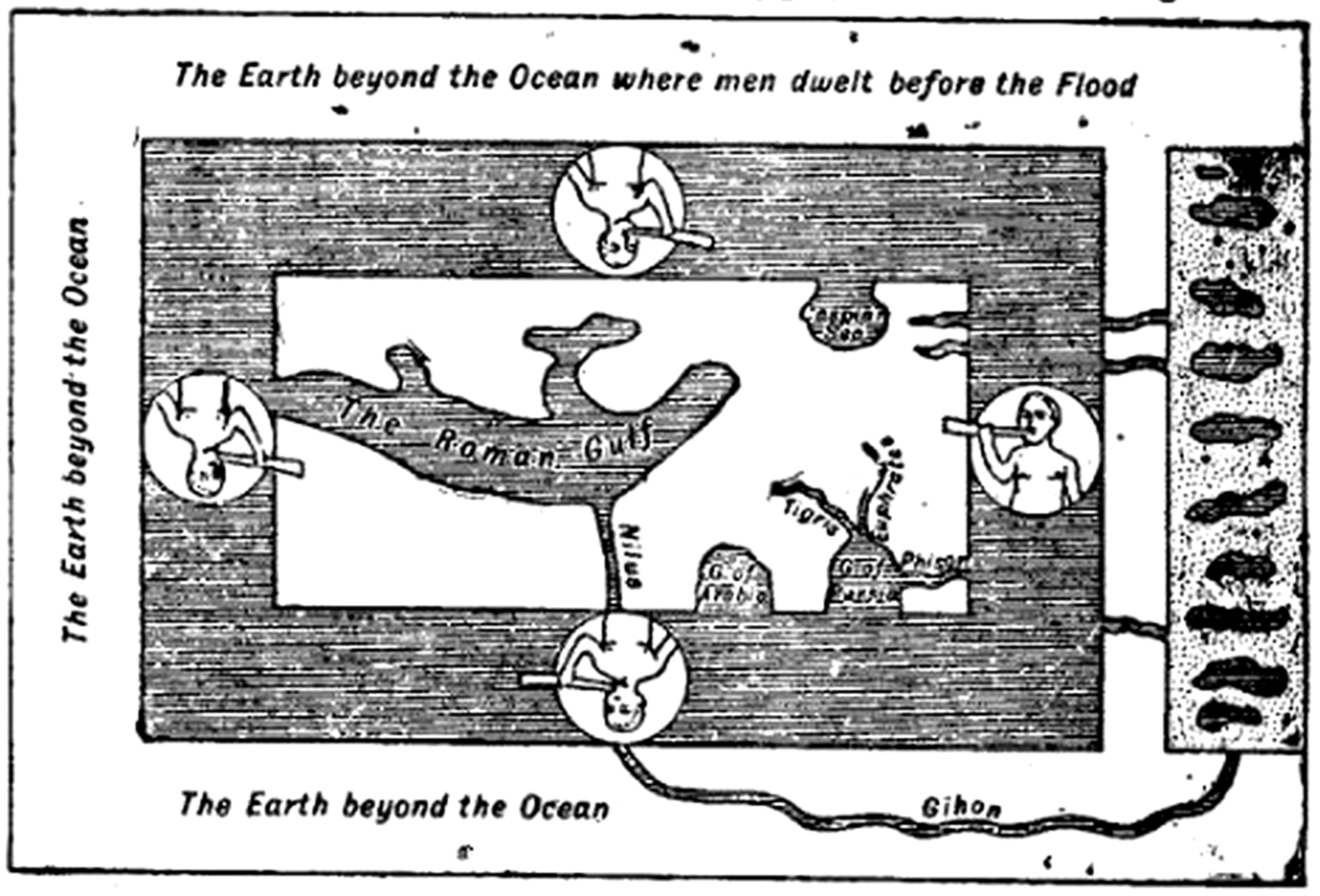
English: Caption: "Fig. 6.—The World according to Cosmas Indicopleustes (535)." Cosmas gave the surface of the Earth as a flat rectangle holding up the vault of the sky, the whole making the shape of the Israelite Tabernacle [not shown]. The World Ocean does not encircle all land, but only the currently inhabited world (i.e., Afroeurasia). The outer shore comprises "The Earth beyond the Ocean where men dwelt before the Flood" (N), "The Earth beyond the Ocean" (W & S), and the [here unlabeled] Garden of Eden from which flow four rivers including the "Gihon"/"Nilus" and "Phisor". The rivers were considered to run through the World Ocean as a current and then to have reëntered the land in Transoxiana, Persia, and Ethiopia. |
| Date | circa 1911 (archetype written sometime after ad 535) |
| Source | "Map" in the Encyclopaedia Britannica, 11th ed., Vol. XVII, p. 637. After Cosmas's Christian Topography. |
| Author | Anonymous (presumably Emery Walker), reconstructing the map of Cosmas Indicopleustes. |
| Permission (Reusing this file) |
PD-US; PD-Britannica |
| Other versions |
|


Licensing
[edit]
This media file is in the public domain in the United States. This applies to U.S. works where the copyright has expired, often because its first publication occurred prior to January 1, 1929, and if not then due to lack of notice or renewal. See this page for further explanation.
|
 | |
 |
| This image comes from the 13th edition of the Encyclopædia Britannica or earlier. The copyrights for that book have expired in the United States because the book was first published in the US with the publication occurring before January 1, 1929. As such, this image is in the public domain in the United States. |  |
| Annotations | This image is annotated: View the annotations at Commons |
File history
Click on a date/time to view the file as it appeared at that time.
| Date/Time | Thumbnail | Dimensions | User | Comment | |
|---|---|---|---|---|---|
| current | 23:23, 30 March 2015 | | 2,350 × 1,596 (2.25 MB) | LlywelynII (talk | contribs) | User created page with UploadWizard |
You cannot overwrite this file.
File usage on Commons
The following page uses this file:
File usage on other wikis
The following other wikis use this file:
- Usage on en.wikisource.org