File:EB1 Plate LXXXVII.png
Jump to navigation
Jump to search

Size of this preview: 497 × 599 pixels. Other resolutions: 199 × 240 pixels | 398 × 480 pixels | 637 × 768 pixels | 849 × 1,024 pixels | 1,699 × 2,048 pixels | 2,768 × 3,337 pixels.
Original file (2,768 × 3,337 pixels, file size: 5.38 MB, MIME type: image/png)
Captions
Captions
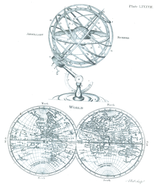
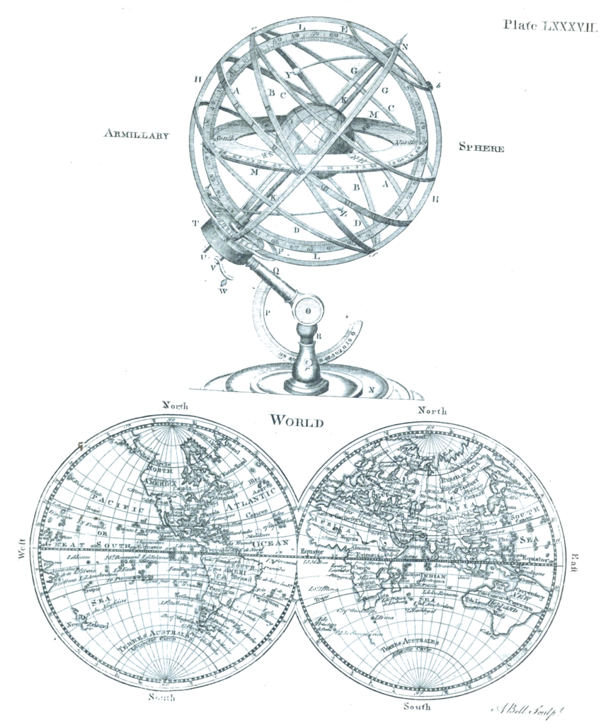
Armillary Sphere and Map of the World c. 1763
Summary
[edit]| Description |
English: Plate LXXXVII from the Encyclopaedia Britannica, 1st ed. A diagram of an armillary sphere and map of the world as two equatorial orthographic projections of the western and eastern hemispheres as known c. 1771. |
| Date | |
| Source | Encyclopaedia Britannica, 1st ed., Vol. II, p. 680 ff. |
| Author | Credited to Andrew Bell, engraver. The map was actually drawn by Andrew Dury and engraved by Thomas Kitchin in 1761 and then edited and reprinted in 1763 and 1764. |
| Other versions |
|


Licensing
[edit]
|
This work is in the public domain in its country of origin and other countries and areas where the copyright term is the author's life plus 70 years or fewer. This work is in the public domain in the United States because it was published (or registered with the U.S. Copyright Office) before January 1, 1929. | |
| This file has been identified as being free of known restrictions under copyright law, including all related and neighboring rights. | |
File history
Click on a date/time to view the file as it appeared at that time.
| Date/Time | Thumbnail | Dimensions | User | Comment | |
|---|---|---|---|---|---|
| current | 20:15, 15 January 2023 | | 2,768 × 3,337 (5.38 MB) | LlywelynII (talk | contribs) | Uploaded a work by Andrew Bell, engraver. from ''Encyclopaedia Britannica'', 1st ed., Vol. II, [https://archive.org/details/1771EncyclopediaBritannicaNLS/First%20edition%2C%201771%20-%20Encyclopaedia%20Britannica%3B%20or%2C%20A%20dictionary%20of%20arts%20and%20sciences%2C%20compiled%20upon%20a%20new%20plan%20%E2%80%A6%2C%20Volume%202%2C%20C-L/page/n649/mode/2up p. 680 ff.] with UploadWizard |
You cannot overwrite this file.
File usage on Commons
The following 3 pages use this file: