File:Dzwola (gmina) location map.png

Original file (1,349 × 1,325 pixels, file size: 450 KB, MIME type: image/png)
Captions
Captions
Summary
[edit]_location_map.png&action=edit§ion=1)
| Description |
English: Location map |
| Date | |
| Source | Own work |
| Author | Smat |
| Description |
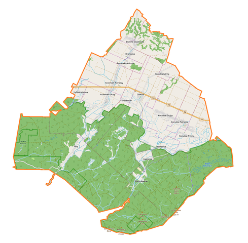
Polski: Mapa gminy Dzwola, Polska
English: Map of Dzwola (gmina), Poland |
|||||||||
| Date | ||||||||||
| Source | You may find a page on the OpenStreetMap wiki page for Dzwola (gmina) | |||||||||
| Creator |
OpenStreetMap contributors OpenStreetMap contributors |
|||||||||
| Permission (Reusing this file) |
OpenStreetMap data is available under the Open Database License (details). Map tiles are licensed under the Creative Commons Attribution-ShareAlike 2.0 license (CC-BY-SA 2.0).
This file is licensed under the Creative Commons Attribution-Share Alike 2.0 Generic license.
|
|||||||||
| Geotemporal data | ||||||||||
| Bounding box |
|
|||||||||
| Georeferencing | If inappropriate please set warp_status = skip to hide. | |||||||||
Licensing
[edit]_location_map.png&action=edit§ion=2)
| This work contains information from OpenStreetMap, which is made available under the Open Database License (ODbL).
The ODbL does not require any particular license for maps produced from ODbL data. Prior to 1 August 2020, map tiles produced by the OpenStreetMap Foundation were licensed under the CC-BY-SA-2.0 license. Maps produced by other people may be subject to other licences. |
File history
Click on a date/time to view the file as it appeared at that time.
| Date/Time | Thumbnail | Dimensions | User | Comment | |
|---|---|---|---|---|---|
| current | 11:24, 8 September 2017 | | 1,349 × 1,325 (450 KB) | Smat (talk | contribs) | User created page with UploadWizard |
You cannot overwrite this file.
File usage on Commons
There are no pages that use this file.
File usage on other wikis
The following other wikis use this file:
- Usage on pl.wikipedia.org
- Rezerwat przyrody Kacze Błota
- Dzwola (gmina)
- Branew
- Branewka
- Branewka-Kolonia
- Dzwola
- Flisy (wieś)
- Krzemień Drugi
- Krzemień Pierwszy
- Kapronie
- Kocudza Druga
- Kocudza Górna
- Kocudza Trzecia
- Kocudza Pierwsza
- Zdzisławice (wieś w województwie lubelskim)
- Zofianka Dolna
- Konstantów (województwo lubelskie)
- Władysławów (powiat janowski)
- Parafia Matki Boskiej Częstochowskiej w Dzwoli
- Parafia św. Anny w Branwi
- Parafia św. Józefa Robotnika w Kocudzy
- Parafia św. Maksymiliana Kolbego w Krzemieniu
- Flisy (osada leśna)
- Zdzisławice (osada leśna w województwie lubelskim)
- Branew Ordynacka
- Branew Szlachecka
- Moduł:Mapa/dane/Dzwola (gmina)
- Sapy (Branew Szlachecka)
- Kolonia Kocudza
- Usage on pl.wikibooks.org
_location_map.png&oldid=708053658)