File:Dust storm at the Slims River inflow to Kluane Lake.jpg
Jump to navigation
Jump to search
Size of this preview: 800 × 410 pixels. Other resolutions: 320 × 164 pixels | 640 × 328 pixels | 1,024 × 525 pixels | 1,280 × 657 pixels | 3,828 × 1,964 pixels.
Original file (3,828 × 1,964 pixels, file size: 794 KB, MIME type: image/jpeg)
Captions
Captions
August 2018
Summary
[edit]
| Description |
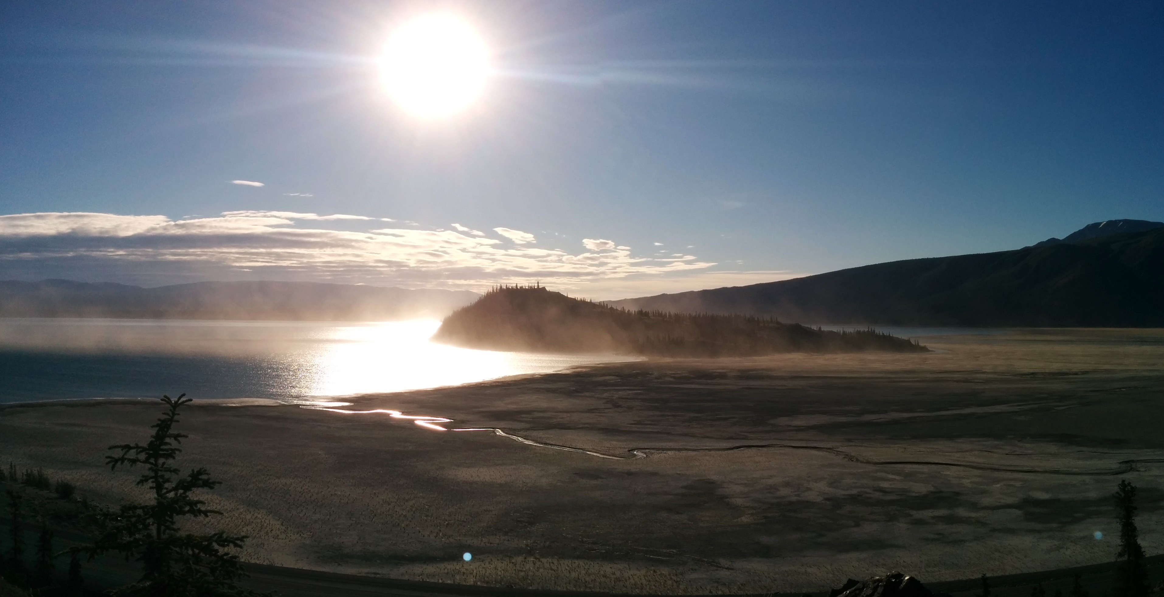
English: The waters that fed the Slims River were diverted in 2016 by a receding glacier in Kluane National Park, Yukon, exposing the bottom sediments of the former delta.
English: Kluane national Park, Yukon, Canada |
||||
| Date | |||||
| Source | Own work | ||||
| Author | Gertrudius |
| Camera location | | View this and other nearby images on: OpenStreetMap |
|---|
Licensing
[edit]
I, the copyright holder of this work, hereby publish it under the following license:
This file is licensed under the Creative Commons Attribution-Share Alike 4.0 International license.
- You are free:
- to share – to copy, distribute and transmit the work
- to remix – to adapt the work
- Under the following conditions:
- attribution – You must give appropriate credit, provide a link to the license, and indicate if changes were made. You may do so in any reasonable manner, but not in any way that suggests the licensor endorses you or your use.
- share alike – If you remix, transform, or build upon the material, you must distribute your contributions under the same or compatible license as the original.
This image was uploaded as part of Wiki Loves Earth 2019.
|
 |
File history
Click on a date/time to view the file as it appeared at that time.
| Date/Time | Thumbnail | Dimensions | User | Comment | |
|---|---|---|---|---|---|
| current | 17:01, 26 June 2019 | | 3,828 × 1,964 (794 KB) | Gertrudius (talk | contribs) | User created page with UploadWizard |
You cannot overwrite this file.
File usage on Commons
There are no pages that use this file.