File:Dunmore Head - geograph.org.uk - 259337.jpg
Jump to navigation
Jump to search
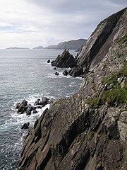
Size of this preview: 450 × 600 pixels. Other resolutions: 180 × 240 pixels | 480 × 640 pixels.
Original file (480 × 640 pixels, file size: 105 KB, MIME type: image/jpeg)
Captions
Captions
Add a one-line explanation of what this file represents
Summary
[edit]
| Description |
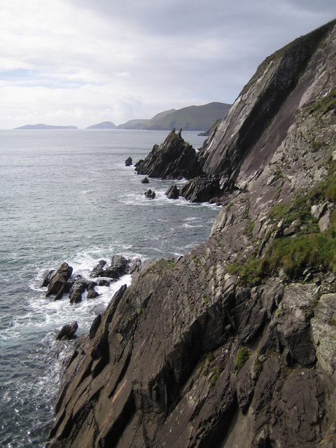
English: Dunmore Head The very southernmost side of the headland of Dunmore Head, along these steeply tilted cliffs, just falls in this grid square. The rest of the grid square is sea (Coumeenoole Bay). Great Blasket Island is visible in the distance with Inishvickillane beyond and to the left on the horizon. |
| Date | |
| Source | From geograph.org.uk |
| Author | Nigel Cox |
| Attribution (required by the license) | Nigel Cox / Dunmore Head / |
| Camera location | | View this and other nearby images on: OpenStreetMap |
|---|
_heading:247.00&language=en)
| Object location | | View this and other nearby images on: OpenStreetMap |
|---|
_heading:247.00&language=en)
Licensing
[edit]

|
This image was taken from the Geograph project collection. See this photograph's page on the Geograph website for the photographer's contact details. The copyright on this image is owned by Nigel Cox and is licensed for reuse under the Creative Commons Attribution-ShareAlike 2.0 license.
|
This file is licensed under the Creative Commons Attribution-Share Alike 2.0 Generic license.
Attribution: Nigel Cox
- You are free:
- to share – to copy, distribute and transmit the work
- to remix – to adapt the work
- Under the following conditions:
- attribution – You must give appropriate credit, provide a link to the license, and indicate if changes were made. You may do so in any reasonable manner, but not in any way that suggests the licensor endorses you or your use.
- share alike – If you remix, transform, or build upon the material, you must distribute your contributions under the same or compatible license as the original.
- Remove redundant categories and try to put this image in the most specific category/categories
- Remove this template
- The location categories are based on information from this geonames tool and this OpenStreetMap tool combined with a database. You can also have a look at this tool from mysociety.
- The topic category from Geograph was Cliffs (find similar images at Geograph)
File history
Click on a date/time to view the file as it appeared at that time.
| Date/Time | Thumbnail | Dimensions | User | Comment | |
|---|---|---|---|---|---|
| current | 16:53, 25 August 2010 | | 480 × 640 (105 KB) | GeographBot (talk | contribs) | == {{int:filedesc}} == {{Information |description={{en|1=Dunmore Head The very southernmost side of the headland of Dunmore Head, along these steeply tilted cliffs, just falls in this grid square. The rest of the grid square is sea (Coumeenoole Bay). Grea |
You cannot overwrite this file.
File usage on Commons
There are no pages that use this file.