File:Duisburg location map.png
Jump to navigation
Jump to search

Size of this preview: 331 × 599 pixels. Other resolutions: 132 × 240 pixels | 365 × 661 pixels.
Original file (365 × 661 pixels, file size: 355 KB, MIME type: image/png)
Captions
Captions
Add a one-line explanation of what this file represents
Summary
[edit]
| Description |
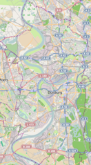
English: Locator map of Duisburg, Germany;
|
| Date | |
| Source | OpenStreetMap |
| Author | OpenStreetMap contributors |
Licensing
[edit]
This file is licensed under the Creative Commons Attribution-Share Alike 2.0 Generic license.
- You are free:
- to share – to copy, distribute and transmit the work
- to remix – to adapt the work
- Under the following conditions:
- attribution – You must give appropriate credit, provide a link to the license, and indicate if changes were made. You may do so in any reasonable manner, but not in any way that suggests the licensor endorses you or your use.
- share alike – If you remix, transform, or build upon the material, you must distribute your contributions under the same or compatible license as the original.
File history
Click on a date/time to view the file as it appeared at that time.
| Date/Time | Thumbnail | Dimensions | User | Comment | |
|---|---|---|---|---|---|
| current | 19:27, 23 May 2012 | | 365 × 661 (355 KB) | Powerek38 (talk | contribs) |
You cannot overwrite this file.
File usage on Commons
There are no pages that use this file.
File usage on other wikis
The following other wikis use this file:
- Usage on fr.wikipedia.org
- Usage on pl.wikipedia.org
- Schauinsland-Reisen-Arena
- Duisburg Hauptbahnhof
- Nowa Synagoga w Duisburgu
- Stara Synagoga w Duisburgu
- Duisburg-Rahm (przystanek kolejowy)
- Duisburg Schlenk
- Duisburg-Buchholz (przystanek kolejowy)
- Duisburg-Großenbaum (stacja kolejowa)
- Duisburg-Wedau (stacja kolejowa)
- Kościół Zbawiciela w Duisburgu
- Panika na Love Parade w Duisburgu
- Moduł:Mapa/dane/Duisburg
- Usage on pl.wikibooks.org