File:Duddon estuary at Borwick Rails - geograph.org.uk - 784771.jpg
Jump to navigation
Jump to search
Size of this preview: 622 × 600 pixels. Other resolutions: 249 × 240 pixels | 498 × 480 pixels | 640 × 617 pixels.
Original file (640 × 617 pixels, file size: 84 KB, MIME type: image/jpeg)
Captions
Captions
Add a one-line explanation of what this file represents
Summary
[edit]
| Description |
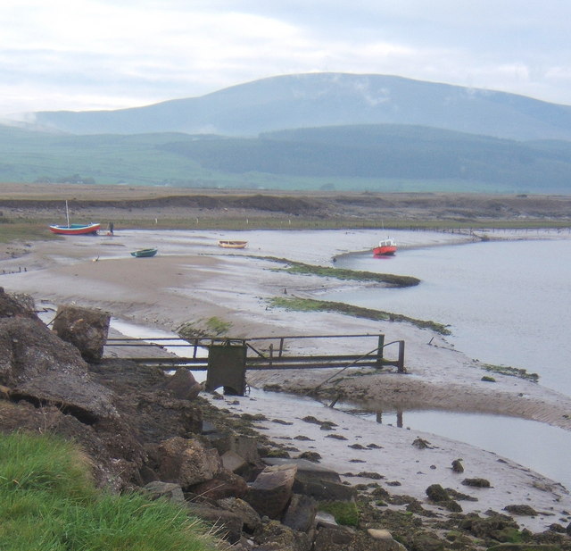
English: Duddon estuary at Borwick Rails Millom was formerly an active port, but the dangerous channels meant a pilot service was required. These days there is little activity on the water. The nearby iron works and all the rail services closed down in the 1960s. |
| Date | |
| Source | From geograph.org.uk |
| Author | Andrew Hill |
| Attribution (required by the license) | Andrew Hill / Duddon estuary at Borwick Rails / |
| Camera location | | View this and other nearby images on: OpenStreetMap |
|---|
_heading:292.00&language=en)
| Object location | | View this and other nearby images on: OpenStreetMap |
|---|
_heading:292.00&language=en)
Licensing
[edit]

|
This image was taken from the Geograph project collection. See this photograph's page on the Geograph website for the photographer's contact details. The copyright on this image is owned by Andrew Hill and is licensed for reuse under the Creative Commons Attribution-ShareAlike 2.0 license.
|
This file is licensed under the Creative Commons Attribution-Share Alike 2.0 Generic license.
Attribution: Andrew Hill
- You are free:
- to share – to copy, distribute and transmit the work
- to remix – to adapt the work
- Under the following conditions:
- attribution – You must give appropriate credit, provide a link to the license, and indicate if changes were made. You may do so in any reasonable manner, but not in any way that suggests the licensor endorses you or your use.
- share alike – If you remix, transform, or build upon the material, you must distribute your contributions under the same or compatible license as the original.
File history
Click on a date/time to view the file as it appeared at that time.
| Date/Time | Thumbnail | Dimensions | User | Comment | |
|---|---|---|---|---|---|
| current | 01:07, 20 February 2011 | | 640 × 617 (84 KB) | GeographBot (talk | contribs) | == {{int:filedesc}} == {{Information |description={{en|1=Duddon estuary at Borwick Rails Millom was formerly an active port, but the dangerous channels meant a pilot service was required. These days there is little activity on the water. The nearby iron |
You cannot overwrite this file.
File usage on Commons
There are no pages that use this file.