File:Dudding Hill Junction and signal box, Willesden - geograph.org.uk - 62130.jpg
Jump to navigation
Jump to search
No higher resolution available.
Dudding_Hill_Junction_and_signal_box,_Willesden_-_geograph.org.uk_-_62130.jpg (640 × 480 pixels, file size: 141 KB, MIME type: image/jpeg)
Captions
Captions
Add a one-line explanation of what this file represents
Summary
[edit]
| Description |
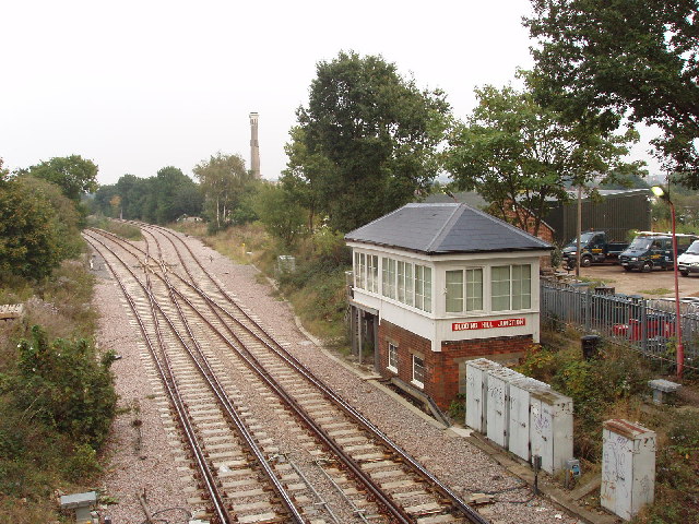
English: Dudding Hill Junction and signal box, Willesden. Taken looking East from the footbridge in Gladstone Park at the bottom of Parkside. The rails diverge North to Hendon and South to Cricklewood. For an account of the railways that criss-cross Willesden, see http://www.british-history.ac.uk/report.asp?compid=22600 , Willesden Communications in the Victoria County History for Middlesex. |
| Date | |
| Source | From geograph.org.uk |
| Author | David Hawgood |
| Attribution (required by the license) | David Hawgood / Dudding Hill Junction and signal box, Willesden / |
| Object location | | View this and other nearby images on: OpenStreetMap |
|---|
_&language=en)
Licensing
[edit]

|
This image was taken from the Geograph project collection. See this photograph's page on the Geograph website for the photographer's contact details. The copyright on this image is owned by David Hawgood and is licensed for reuse under the Creative Commons Attribution-ShareAlike 2.0 license.
|
This file is licensed under the Creative Commons Attribution-Share Alike 2.0 Generic license.
Attribution: David Hawgood
- You are free:
- to share – to copy, distribute and transmit the work
- to remix – to adapt the work
- Under the following conditions:
- attribution – You must give appropriate credit, provide a link to the license, and indicate if changes were made. You may do so in any reasonable manner, but not in any way that suggests the licensor endorses you or your use.
- share alike – If you remix, transform, or build upon the material, you must distribute your contributions under the same or compatible license as the original.
File history
Click on a date/time to view the file as it appeared at that time.
| Date/Time | Thumbnail | Dimensions | User | Comment | |
|---|---|---|---|---|---|
| current | 14:46, 30 January 2010 | | 640 × 480 (141 KB) | GeographBot (talk | contribs) | == {{int:filedesc}} == {{Information |description={{en|1=Dudding Hill Junction and signal box, Willesden. Taken looking East from the footbridge in Gladstone Park at the bottom of Parkside. The rails diverge North to Hendon and South to Cricklewood. For a |
You cannot overwrite this file.
File usage on Commons
There are no pages that use this file.