File:Drought in Madagascar.jpg

Original file (3,521 × 2,540 pixels, file size: 4.54 MB, MIME type: image/jpeg)
Captions
Captions
Summary
[edit]
| Description |
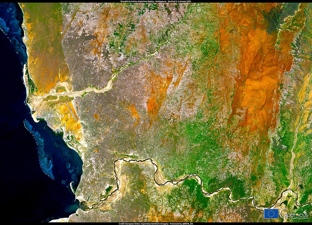
English: In the southern region of Madagascar, recurrent drought has had a devastating impact, wiping out harvests and hampering people's access to food. According to the World Food Programme, three consecutive years of drought coupled with a sharp recession triggered by the COVID-19 pandemic will leave a third of the population in Southern Madagascar without enough food and more than 135,000 children will suffer from acute malnutrition. This image, acquired by one of the Copernicus Sentinel-2 satellites on 3 January 2021, shows the Atsimo Andrefana Region, one of the most affected areas by the drought of recent years. With a revisit time of five days on average at the equator, the Copernicus Sentinel-2 satellites deliver free and open data that can be used to monitor droughts and their impact. The Copernicus Emergency Management Service also runs a European and a Global Drought Observatory. |
| Date | Taken on 3 January 2021 |
| Source | Drought in Madagascar |
| Author | European Union , Copernicus Sentinel-2 imagery |
Licensing
[edit]

|
This image contains data from a satellite in the Copernicus Programme, such as Sentinel-1, Sentinel-2 or Sentinel-3. Attribution is required when using this image.
Attribution: Contains modified Copernicus Sentinel data 2021
The use of Copernicus Sentinel Data is regulated under EU law (Commission Delegated Regulation (EU) No 1159/2013 and Regulation (EU) No 377/2014). Relevant excerpts:
Free access shall be given to GMES dedicated data [...] made available through GMES dissemination platforms [...].
Access to GMES dedicated data [...] shall be given for the purpose of the following use in so far as it is lawful:
GMES dedicated data [...] may be used worldwide without limitations in time.
GMES dedicated data and GMES service information are provided to users without any express or implied warranty, including as regards quality and suitability for any purpose. |
File history
Click on a date/time to view the file as it appeared at that time.
| Date/Time | Thumbnail | Dimensions | User | Comment | |
|---|---|---|---|---|---|
| current | 11:23, 25 August 2023 | | 3,521 × 2,540 (4.54 MB) | OptimusPrimeBot (talk | contribs) | #Spacemedia - Upload of https://www.copernicus.eu/system/files/2021-01/image_day/DroughtMadagascar.jpg via Commons:Spacemedia |
You cannot overwrite this file.
File usage on Commons
There are no pages that use this file.