File:Drottningholm karta 1700-talet DEL.jpg
Jump to navigation
Jump to search
No higher resolution available.
Drottningholm_karta_1700-talet_DEL.jpg (794 × 380 pixels, file size: 132 KB, MIME type: image/jpeg)
Captions
Captions
Add a one-line explanation of what this file represents
Summary
[edit]
| Description |
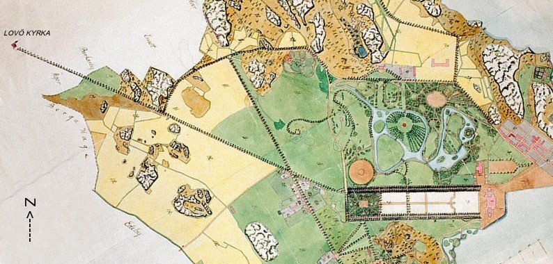
Svenska: Karta över Drottningholms slottsområde, slutet av 1700-talet. Del av karta med nuvarande Lovö kyrkallé. Kartan uträttad med norr uppåt. |
| Source | Kungliga biblioteket |
| Author | Ingen uppgift |
Licensing
[edit]
|
This work is in the public domain in its country of origin and other countries and areas where the copyright term is the author's life plus 70 years or fewer. | |
| This file has been identified as being free of known restrictions under copyright law, including all related and neighboring rights. | |
File history
Click on a date/time to view the file as it appeared at that time.
| Date/Time | Thumbnail | Dimensions | User | Comment | |
|---|---|---|---|---|---|
| current | 11:22, 26 November 2011 | | 794 × 380 (132 KB) | Holger.Ellgaard (talk | contribs) | {{Information |Description ={{sv|1=Karta över Drottningholms slottsområde, slutet av 1700-talet. Del av karta med nuvarande Lovö kyrkallé. Kartan uträttad med norr uppåt.}} |Source =Kungliga biblioteket |Author =Ingen uppgift |Dat |
You cannot overwrite this file.
File usage on Commons
There are no pages that use this file.
File usage on other wikis
The following other wikis use this file:
- Usage on no.wikipedia.org
- Usage on sv.wikipedia.org