File:Dronketurm-09-Aussicht Steineberg.jpg
From Wikimedia Commons, the free media repository
Jump to navigation
Jump to search
![File:Dronketurm-09-Aussicht Steineberg.jpg](https://upload.wikimedia.org/wikipedia/commons/thumb/3/31/Dronketurm-09-Aussicht_Steineberg.jpg/800px-Dronketurm-09-Aussicht_Steineberg.jpg?20201201135450)
Size of this preview: 800 × 600 pixels. Other resolutions: 320 × 240 pixels | 640 × 480 pixels | 1,024 × 768 pixels | 1,280 × 960 pixels | 2,560 × 1,920 pixels | 4,320 × 3,240 pixels.
Original file (4,320 × 3,240 pixels, file size: 6.04 MB, MIME type: image/jpeg)
File information
Structured data
Captions
Captions
Add a one-line explanation of what this file represents
Summary
[edit]DescriptionDronketurm-09-Aussicht Steineberg.jpg |
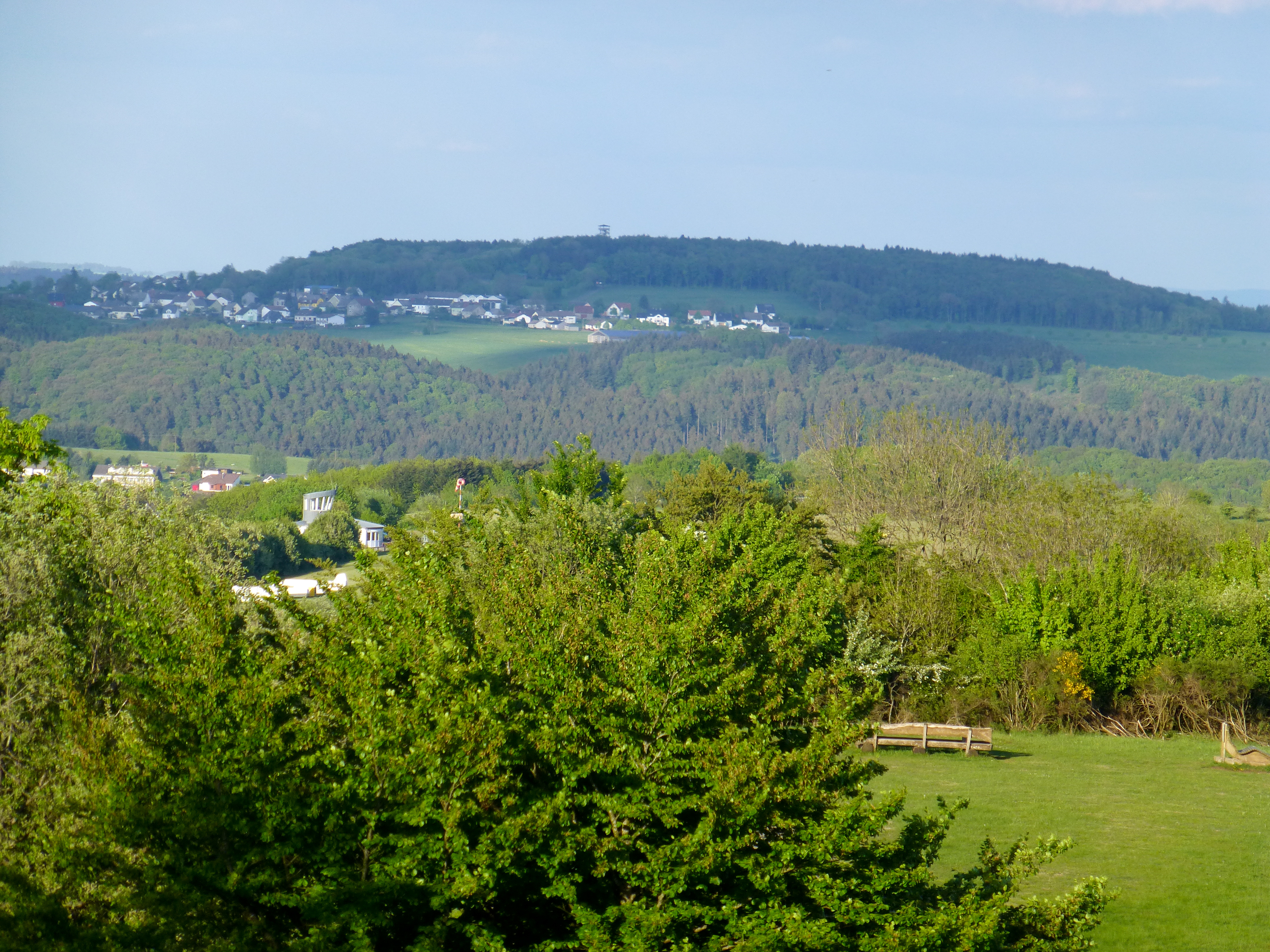
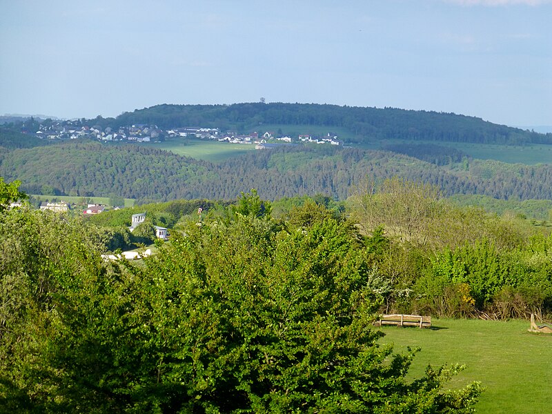
Deutsch: Blick vom Dronketurm nach Osten in Richtung Steineberg mit der Steineberger Ley und der Vulcano Infoplattform; in der Bildmitte halblinks das Segelfluggelände Daun-Senheld |
Date | |
Source | Own work |
Author | Muck |
Camera location | 50° 10′ 32.13″ N, 6° 50′ 31.54″ E ![]() ![]() | View this and other nearby images on: OpenStreetMap | ![]() |
---|
Licensing
[edit]I, the copyright holder of this work, hereby publish it under the following license:
![w:en:Creative Commons](https://upload.wikimedia.org/wikipedia/commons/thumb/7/79/CC_some_rights_reserved.svg/90px-CC_some_rights_reserved.svg.png)
![attribution](https://upload.wikimedia.org/wikipedia/commons/thumb/1/11/Cc-by_new_white.svg/24px-Cc-by_new_white.svg.png)
![share alike](https://upload.wikimedia.org/wikipedia/commons/thumb/d/df/Cc-sa_white.svg/24px-Cc-sa_white.svg.png)
This file is licensed under the Creative Commons Attribution-Share Alike 4.0 International license.
- You are free:
- to share – to copy, distribute and transmit the work
- to remix – to adapt the work
- Under the following conditions:
- attribution – You must give appropriate credit, provide a link to the license, and indicate if changes were made. You may do so in any reasonable manner, but not in any way that suggests the licensor endorses you or your use.
- share alike – If you remix, transform, or build upon the material, you must distribute your contributions under the same or compatible license as the original.
Annotations InfoField | This image is annotated: View the annotations at Commons |
702
1593
940
545
4320
3240
Segelfluggelände Daun-Senheld
232
961
2484
200
4320
3240
Steineberg
2009
702
97
211
4320
3240
Vulcano Infoplattform
File history
Click on a date/time to view the file as it appeared at that time.
Date/Time | Thumbnail | Dimensions | User | Comment | |
---|---|---|---|---|---|
current | 13:54, 1 December 2020 | ![]() | 4,320 × 3,240 (6.04 MB) | Muck50 (talk | contribs) | Uploaded own work with UploadWizard |
You cannot overwrite this file.
File usage on Commons
There are no pages that use this file.
Metadata
This file contains additional information such as Exif metadata which may have been added by the digital camera, scanner, or software program used to create or digitize it. If the file has been modified from its original state, some details such as the timestamp may not fully reflect those of the original file. The timestamp is only as accurate as the clock in the camera, and it may be completely wrong.
Camera manufacturer | Panasonic |
---|---|
Camera model | DMC-TZ31 |
Exposure time | 1/250 sec (0.004) |
F-number | f/5.6 |
ISO speed rating | 100 |
Date and time of data generation | 19:48, 19 May 2016 |
Lens focal length | 38.2 mm |
Latitude | 50° 10′ 32.13″ N |
Longitude | 6° 50′ 31.54″ E |
Horizontal resolution | 240 dpi |
Vertical resolution | 240 dpi |
Software used | Adobe Photoshop Lightroom 3.6 (Windows) |
File change date and time | 14:40, 1 December 2020 |
Exposure Program | Landscape mode (for landscape photos with the background in focus) |
Exif version | 2.3 |
Date and time of digitizing | 19:48, 19 May 2016 |
APEX shutter speed | 7.965784 |
APEX aperture | 4.970854 |
APEX exposure bias | 0 |
Maximum land aperture | 4.96875 APEX (f/5.6) |
Metering mode | Pattern |
Light source | Unknown |
Flash | Flash did not fire, compulsory flash suppression |
Sensing method | One-chip color area sensor |
File source | Digital still camera |
Scene type | A directly photographed image |
Custom image processing | Normal process |
Exposure mode | Auto exposure |
White balance | Auto white balance |
Digital zoom ratio | 0 |
Focal length in 35 mm film | 214 mm |
Scene capture type | Standard |
Scene control | None |
Contrast | Normal |
Saturation | Normal |
Sharpness | Normal |
GPS time (atomic clock) | 17:46 |
Receiver status | Measurement in progress |
Measurement mode | 2-dimensional measurement |
Measurement precision | Poor (3) |
Geodetic survey data used | WGS-84 |
Name of GPS area | Vulkaneifelkreis |
GPS date | 19 May 2016 |
GPS tag version | 0.0.3.2 |
Date metadata was last modified | 15:40, 1 December 2020 |
Unique ID of original document | 3450BB8643012E8795CDDB0A3FAFEA0B |
IIM version | 4 |