File:Downtown Saint Paul Riverfront (695165531).jpg
Jump to navigation
Jump to search

Size of this preview: 800 × 480 pixels. Other resolutions: 320 × 192 pixels | 1,024 × 614 pixels | 1,280 × 768 pixels | 2,800 × 1,680 pixels.
Original file (2,800 × 1,680 pixels, file size: 1.13 MB, MIME type: image/jpeg)
Captions
Captions
Add a one-line explanation of what this file represents
Summary
[edit].jpg&action=edit§ion=1)
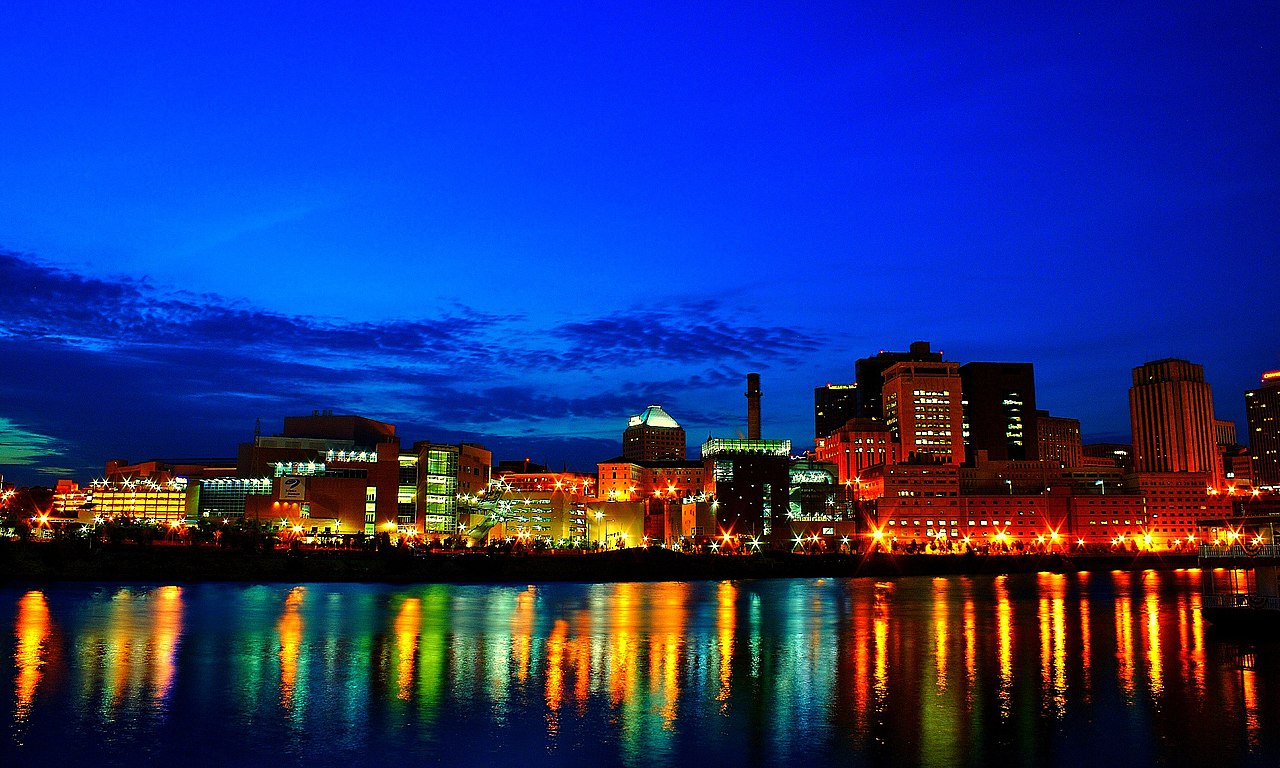
| Description | Downtown Saint Paul at dusk along the Mississippi River during the Taste of Minnesota from Harriet Island. This was also my first experience carrying the Sony GPS-CS1 and automatically tagging the EXIF data -- so simple and so awesome! |
| Date | Taken on 1 July 2007, 21:51 |
| Source | Downtown Saint Paul Riverfront |
| Author | Tony Webster from Portland, Oregon, United States |
| Camera location | | View this and other nearby images on: OpenStreetMap |
|---|
.jpg¶ms=044.939000_N_-093.096666_E_globe:Earth_type:camera_source:Flickr_&language=en)
Licensing
[edit].jpg&action=edit§ion=2)
This file is licensed under the Creative Commons Attribution 2.0 Generic license.
- You are free:
- to share – to copy, distribute and transmit the work
- to remix – to adapt the work
- Under the following conditions:
- attribution – You must give appropriate credit, provide a link to the license, and indicate if changes were made. You may do so in any reasonable manner, but not in any way that suggests the licensor endorses you or your use.
| This image was originally posted to Flickr by Tony Webster at https://www.flickr.com/photos/87296837@N00/695165531. It was reviewed on 30 April 2015 by FlickreviewR and was confirmed to be licensed under the terms of the cc-by-2.0. |
File history
Click on a date/time to view the file as it appeared at that time.
| Date/Time | Thumbnail | Dimensions | User | Comment | |
|---|---|---|---|---|---|
| current | 19:15, 30 April 2015 | | 2,800 × 1,680 (1.13 MB) | Hiku2 (talk | contribs) | Transferred from Flickr via Flickr2Commons |
You cannot overwrite this file.
File usage on Commons
The following page uses this file:
File usage on other wikis
The following other wikis use this file:
- Usage on eml.wikipedia.org
- Usage on www.wikidata.org
.jpg&oldid=889047738)