File:Dove at Hartington 340428 b17fdd30.jpg
Jump to navigation
Jump to search
No higher resolution available.
Dove_at_Hartington_340428_b17fdd30.jpg (640 × 480 pixels, file size: 119 KB, MIME type: image/jpeg)
Captions
Captions
Add a one-line explanation of what this file represents
Summary
[edit]
| Description |
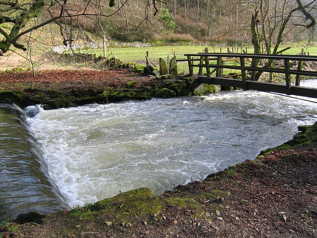
English: Footbridge over the River Dove, Beresford Dale There are several weirs along this stretch of the River Dove through Beresford Dale. The River Dove marks the Staffordshire/Derbyshire border, so each time you cross the river you also cross the county border. The footpath, over the footbridge, enters the flat pasture through a squeeze stile and continues on to Wolfscote Dale. |
| Date | |
| Source | From geograph.org.uk |
| Author | Nikki Mahadevan |
| Camera location | | View this and other nearby images on: OpenStreetMap |
|---|
Licensing
[edit]

|
This image was taken from the Geograph project collection. See this photograph's page on the Geograph website for the photographer's contact details. The copyright on this image is owned by Nikki Mahadevan and is licensed for reuse under the Creative Commons Attribution-ShareAlike 2.0 license.
|
This file is licensed under the Creative Commons Attribution-Share Alike 2.0 Generic license.
Attribution: Nikki Mahadevan
- You are free:
- to share – to copy, distribute and transmit the work
- to remix – to adapt the work
- Under the following conditions:
- attribution – You must give appropriate credit, provide a link to the license, and indicate if changes were made. You may do so in any reasonable manner, but not in any way that suggests the licensor endorses you or your use.
- share alike – If you remix, transform, or build upon the material, you must distribute your contributions under the same or compatible license as the original.
File history
Click on a date/time to view the file as it appeared at that time.
| Date/Time | Thumbnail | Dimensions | User | Comment | |
|---|---|---|---|---|---|
| current | 18:01, 7 April 2008 | | 640 × 480 (119 KB) | Victuallers (talk | contribs) | {{Information |Description=Footbridge over the River Dove, Beresford Dale There are several weirs along this stretch of the River Dove through Beresford Dale. The River Dove marks the Staffordshire/Derbyshire border, so each t |
You cannot overwrite this file.
File usage on Commons
There are no pages that use this file.