File:Dourges - Terrils n° 116 et 117, 10 d'Oignies (64).JPG
From Wikimedia Commons, the free media repository
Jump to navigation
Jump to search
Size of this preview: 800 × 400 pixels. Other resolutions: 320 × 160 pixels | 640 × 320 pixels | 1,024 × 512 pixels | 1,280 × 640 pixels | 2,560 × 1,280 pixels | 4,896 × 2,448 pixels.
Original file (4,896 × 2,448 pixels, file size: 2.41 MB, MIME type: image/jpeg)
File information
Structured data
Captions
Summary
[edit]DescriptionDourges - Terrils n° 116 et 117, 10 d'Oignies (64).JPG |
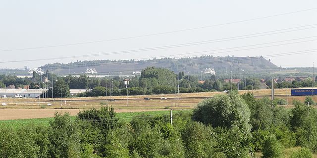
Français : Terrils nos 116 et 117 dits 10 d'Oignies, fosse n° 10 du Groupe d'Oignies dans le bassin minier du Nord-Pas-de-Calais, Dourges, Pas-de-Calais, Nord-Pas-de-Calais, France. Les terrils nos 116 et 117 sont inscrits sur la liste du patrimoine mondial de l'Unesco le 30 juin 2012 et y constituent en partie le site no 42. |
|||||||||||||||||||||||
Date | ||||||||||||||||||||||||
Source | Own work | |||||||||||||||||||||||
Author |
creator QS:P170,Q58229383 |
|||||||||||||||||||||||
Permission (Reusing this file) |
| |||||||||||||||||||||||
Attribution (required by the license) InfoField | Jérémy-Günther-Heinz Jähnick / Dourges - Terrils n° 116 et 117, 10 d'Oignies (64) / Wikimedia Commons / | |||||||||||||||||||||||
InfoField | Jérémy-Günther-Heinz Jähnick / Dourges - Terrils n° 116 et 117, 10 d'Oignies (64) / Wikimedia Commons |
Camera location | 50° 25′ 27″ N, 2° 58′ 18.82″ E | View this and other nearby images on: OpenStreetMap | 50.424166; 2.971895 |
---|
File history
Click on a date/time to view the file as it appeared at that time.
Date/Time | Thumbnail | Dimensions | User | Comment | |
---|---|---|---|---|---|
current | 14:46, 12 August 2013 | 4,896 × 2,448 (2.41 MB) | Jérémy-Günther-Heinz Jähnick (talk | contribs) |
You cannot overwrite this file.
File usage on Commons
The following page uses this file:
File usage on other wikis
The following other wikis use this file:
- Usage on fr.wikipedia.org
Metadata
This file contains additional information such as Exif metadata which may have been added by the digital camera, scanner, or software program used to create or digitize it. If the file has been modified from its original state, some details such as the timestamp may not fully reflect those of the original file. The timestamp is only as accurate as the clock in the camera, and it may be completely wrong.
Camera manufacturer | SONY |
---|---|
Camera model | DSC-HX20V |
Exposure time | 1/320 sec (0.003125) |
F-number | f/4.5 |
ISO speed rating | 100 |
Date and time of data generation | 10:26, 19 July 2013 |
Lens focal length | 20.02 mm |
Latitude | 50° 25′ 27″ N |
Longitude | 2° 58′ 18.82″ E |
Altitude | 37.4 meters above sea level |
Orientation | Normal |
Horizontal resolution | 350 dpi |
Vertical resolution | 350 dpi |
Software used | Microsoft Windows Photo Gallery 6.0.6001.18000 |
File change date and time | 18:49, 19 July 2013 |
Y and C positioning | Co-sited |
Exposure Program | Landscape mode (for landscape photos with the background in focus) |
Exif version | 2.3 |
Date and time of digitizing | 10:26, 19 July 2013 |
Meaning of each component |
|
Image compression mode | 3 |
APEX brightness | 9.34140625 |
APEX exposure bias | 0 |
Maximum land aperture | 4.3359375 APEX (f/4.49) |
Metering mode | Pattern |
Light source | Unknown |
Flash | Flash did not fire, auto mode |
Supported Flashpix version | 1 |
File source | Digital still camera |
Scene type | A directly photographed image |
Custom image processing | Normal process |
Exposure mode | Auto exposure |
White balance | Auto white balance |
Digital zoom ratio | 1 |
Scene capture type | Landscape |
Contrast | Normal |
Saturation | Normal |
Sharpness | Normal |
Unique image ID | 4C65CAABF3A84D128684E62F5A118901 |
GPS time (atomic clock) | 08:26:46.846 |
Receiver status | Measurement in progress |
Measurement mode | 3-dimensional measurement |
Measurement precision | Poor (1.39) |
Speed unit | Kilometers per hour |
Speed of GPS receiver | 3.204 |
Reference for direction of movement | True direction |
Direction of movement | 0 |
Reference for direction of image | Magnetic direction |
Direction of image | 357.25 |
Geodetic survey data used | WGS-84 |
GPS date | 19 July 2013 |
GPS differential correction | 0 |
GPS tag version | 2.3.0.0 |