File:Donetsk province physical map.svg
Jump to navigation
Jump to search

Size of this PNG preview of this SVG file: 439 × 599 pixels. Other resolutions: 176 × 240 pixels | 352 × 480 pixels | 563 × 768 pixels | 751 × 1,024 pixels | 1,501 × 2,048 pixels | 533 × 727 pixels.
Original file (SVG file, nominally 533 × 727 pixels, file size: 581 KB)
Captions
Captions
Add a one-line explanation of what this file represents
Summary
[edit]
| Description |
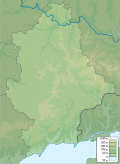
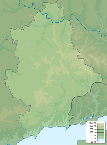
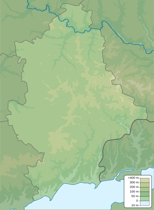
English: Physical map of Donetsk province, Ukraine
Русский: Физическая карта Донецкой области, Украина |
| Date | |
| Source | Own work |
| Author | Urutseg |
Licensing
[edit]
| I, the copyright holder of this work, release this work into the public domain. This applies worldwide. In some countries this may not be legally possible; if so: I grant anyone the right to use this work for any purpose, without any conditions, unless such conditions are required by law. |
File history
Click on a date/time to view the file as it appeared at that time.
| Date/Time | Thumbnail | Dimensions | User | Comment | |
|---|---|---|---|---|---|
| current | 21:17, 10 December 2010 | | 533 × 727 (581 KB) | Urutseg (talk | contribs) | == {{int:filedesc}} == {{Information |Description={{en|1=Physical map of Donetsk province, Ukraine}} {{ru|1=Физическая карта Донецкой области, Украина}} |Source={{own}} |Author=Urutseg |Date=2010-12-10 |
You cannot overwrite this file.
File usage on Commons
There are no pages that use this file.
File usage on other wikis
The following other wikis use this file:
- Usage on ar.wikipedia.org
- Usage on az.wikipedia.org
- Usage on be.wikipedia.org
- Usage on bg.wikipedia.org
- Usage on bn.wikipedia.org
- Usage on bs.wikipedia.org
- Usage on ca.wikipedia.org
- Usage on ce.wikipedia.org
- Usage on cs.wikipedia.org
- Usage on da.wikipedia.org
- Usage on de.wikipedia.org
- Usage on en.wikipedia.org
View more global usage of this file.