File:Donaukreis.png
Jump to navigation
Jump to search
Size of this preview: 460 × 599 pixels. Other resolutions: 184 × 240 pixels | 368 × 480 pixels | 660 × 860 pixels.
Original file (660 × 860 pixels, file size: 25 KB, MIME type: image/png)
Captions
Captions
Add a one-line explanation of what this file represents
| Description |
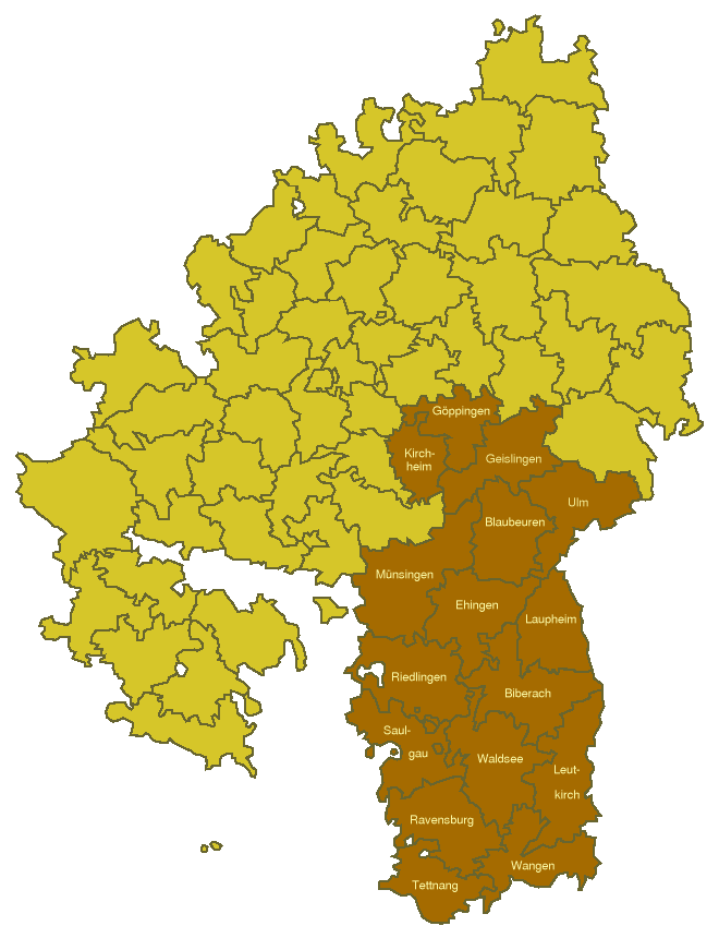
Deutsch: Karte des Donaukreises mit den dazugehörigen Oberämtern in Württemberg, Stand 1835.
English: Map of the Donaukreis (one of four districts of Württemberg) with its administrative subdivisions (Oberämter) as of 1835. |
||||||||
| Date | |||||||||
| Source | drawn by myself, generated from Image:Oberaemter1835-Template.png | ||||||||
| Author | Ssch | ||||||||
| Permission (Reusing this file) |
|

File history
Click on a date/time to view the file as it appeared at that time.
| Date/Time | Thumbnail | Dimensions | User | Comment | |
|---|---|---|---|---|---|
| current | 10:43, 3 March 2007 | | 660 × 860 (25 KB) | Ssch~commonswiki (talk | contribs) | {{Information| |Description = *de: Karte des Donaukreises mit den dazugehörigen Oberämtern in Württemberg, Stand 1835.<br/> *en: Map of the Donaukreis (one of four districts of Württemberg) with its administrative subdivisions (Oberämter) as of 1835. |
You cannot overwrite this file.
File usage on Commons
There are no pages that use this file.
File usage on other wikis
The following other wikis use this file:
- Usage on de.wikipedia.org
- Usage on fr.wikipedia.org
- Usage on no.wikipedia.org