File:Don and Rother Valley panorama - geograph.org.uk - 799118.jpg
Jump to navigation
Jump to search
Size of this preview: 800 × 116 pixels. Other resolutions: 320 × 46 pixels | 2,000 × 289 pixels.
Original file (2,000 × 289 pixels, file size: 404 KB, MIME type: image/jpeg)
Captions
Captions
Add a one-line explanation of what this file represents
Summary
[edit]
| Description |
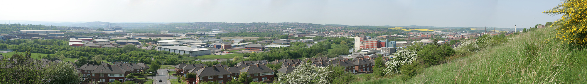
English: Don and Rother Valley panorama. This area used to be dominated by the steel making and associated industries, but has been redeveloped with modern industrial estates. Many of the details are difficult to make out at this scale, so the following constituent pictures have been loaded too as a key. 799123 799126 799127 799129 |
| Date | |
| Source | From geograph.org.uk |
| Author | Alan Murray-Rust |
| Attribution (required by the license) | Alan Murray-Rust / Don and Rother Valley panorama / |
_-_geograph.org.uk_-_799123.jpg)
_-_geograph.org.uk_-_799126.jpg)
_-_geograph.org.uk_-_799127.jpg)
_-_geograph.org.uk_-_799129.jpg)
| Camera location | | View this and other nearby images on: OpenStreetMap |
|---|
_heading:315.00&language=en)
Licensing
[edit]

|
This image was taken from the Geograph project collection. See this photograph's page on the Geograph website for the photographer's contact details. The copyright on this image is owned by Alan Murray-Rust and is licensed for reuse under the Creative Commons Attribution-ShareAlike 2.0 license.
|
This file is licensed under the Creative Commons Attribution-Share Alike 2.0 Generic license.
Attribution: Alan Murray-Rust
- You are free:
- to share – to copy, distribute and transmit the work
- to remix – to adapt the work
- Under the following conditions:
- attribution – You must give appropriate credit, provide a link to the license, and indicate if changes were made. You may do so in any reasonable manner, but not in any way that suggests the licensor endorses you or your use.
- share alike – If you remix, transform, or build upon the material, you must distribute your contributions under the same or compatible license as the original.
File history
Click on a date/time to view the file as it appeared at that time.
| Date/Time | Thumbnail | Dimensions | User | Comment | |
|---|---|---|---|---|---|
| current | 19:07, 31 August 2017 | 2,000 × 289 (404 KB) | Geograph Update Bot (talk | contribs) | Higher-resolution version from Geograph. | |
| 04:36, 20 February 2011 | 640 × 92 (24 KB) | GeographBot (talk | contribs) | == {{int:filedesc}} == {{Information |description={{en|1=Don and Rother Valley panorama This area used to be dominated by the steel making and associated industries, but has been redeveloped with modern industrial estates. Many of the details are difficul |
You cannot overwrite this file.
File usage on Commons
There are no pages that use this file.
File usage on other wikis
The following other wikis use this file: